Caramut, Victoria
Caramut /ˈkærəmət/ is a town in the Western District of Victoria, Australia on the Hamilton Highway. It is in the Shire of Moyne local government area and the federal Division of Wannon.
| Caramut Victoria | |
|---|---|
 Caramut | |
| Coordinates | 37°57′S 142°31′E |
| Population | 246 (2016 census)[1] |
| Postcode(s) | 3274 |
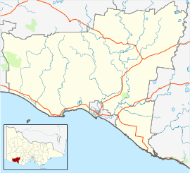
| Location |
|
| LGA(s) | Shire of Moyne |
| State electorate(s) | Polwarth |
| Federal Division(s) | Wannon |
The name 'Caramut' is believed to be derived from the aboriginal word 'cooramook' thought to mean 'plenty of possums'.[2]
At the 2006 census, Caramut and the surrounding area had a population of 392.[1] At the 2016 census, Caramut and the surrounding area had a population of 246.[3]
History
There is evidence that indigenous people had established a village of domed huts near Caramut before white settlement. The Protector of Aborigines George Augustus Robinson produced drawings[4] of structures in the area circa 1840.
In 1839 the Caramut area was first settled by John Muston as a pastoral run.
In 1842, the Lubra Creek massacre of five Dhauwurd wurrung aboriginals took place on the Caramut run, leased by Thomas Osbrey and Sidney Smith at the time.[5][6][7]
The Post Office opened on 1 March 1848 as Muston's Creek and was renamed Caramut in 1854.[8]
Traditional ownership
The formally recognised traditional owners for the area in which Caramut sits are the Eastern Maar People[9] who are represented by the Eastern Maar Aboriginal Corporation.[10]
Community
The town has an Australian Rules football team competing in the Mininera & District Football League.
References
- Australian Bureau of Statistics (25 October 2007). "Caramut (State Suburb)". 2006 Census QuickStats. Retrieved 28 August 2007.
- Lee, Jeremy (18 March 2010). "A-Z of the South West number five – Caramut". Australian Broadcasting Corporation. Retrieved 4 January 2019.
- "2016 Census QuickStats: Caramut".
- Memmott, Paul (2007). images reproduced in Gunyah, Goondie and Wurley : the Aboriginal architecture of Australia. University of Queensland Press. ISBN 9780702232459.
- "Caramut | Victorian Places". www.victorianplaces.com.au. Retrieved 4 January 2019.
- Ian., Clark (1995). Scars in the landscape : a register of massacre sites in western victoria, 1803–1859. [Place of publication not identified]: Aboriginal Studies Press. ISBN 0855755954. OCLC 171556239.
- Williams, E., 1984. Documentation and Archaeological Investigation of an Aboriginal'Village'Site in South Western Victoria. Aboriginal History, pp.177.
- Premier Postal History, Post Office List, retrieved 11 April 2008
- "Map of formally recognised traditional owners". Aboriginal Victoria. Retrieved 2 June 2020.
- "Eastern Maar Aboriginal Corporation". Eastern Maar Aboriginal Corporation. Retrieved 2 June 2020.