Cape Turnagain
Cape Turnagain is a prominent headland on the east coast of New Zealand's North Island, part way between Hawke Bay and Cook Strait, between the mouths of the Porangahau and Akitio Rivers.[1]


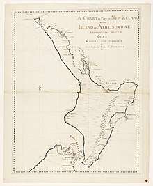
The cape was named by Captain James Cook in 1769. On his journey of discovery, he sailed south to this point where he was met with atrocious conditions, typical of the area. Being unable to safely proceed, he decided to turn and head north [2] and sailed anticlockwise around the North Island of New Zealand and upon reaching the same place turned again southwards & named the point as a result of his decision.
The Māori name for the cape is Te Aho a Maui, which means ‘Maui’s fishing line’, in reference to the well-known story of Maui and his brothers fishing up the land mass now known as the North Island.[3]
Cape Turnagain is 650 kilometres (400 mi) north-west of Chatham Island, making it the nearest point of mainland New Zealand to Chatham Island.
References
- "Place name detail: Cape Turnagain". New Zealand Gazetteer. Land Information New Zealand. Retrieved 25 March 2010.
- "Route of Cook around New Zealand - Voyage 1"
- Rangitāne o Wairarapa and Rangitāne o Tamaki nui-ā-Rua Statutory Acknowledgements. Retrieved 8 January 2020, from https://www.horizons.govt.nz/HRC/media/Media/Iwi%20and%20Hapu/Statutory-Acknowledgements-FINAL.pdf