Cape Sorell
Cape Sorell is a headland located in the Southern Ocean outside Macquarie Harbour on the West Coast of Tasmania, Australia. The cape and the Cape Sorell Lighthouse, located above the headland, are important orientation points for all vessels entering the Macquarie Heads and then through Hells Gates at the entrance to the harbour.
| Cape Sorrell | |
|---|---|
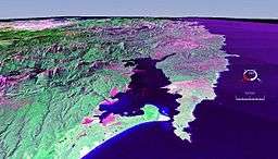 False colour Landsat image showing Macquarie Harbour with Cape Sorell in the centre right area of the picture. | |
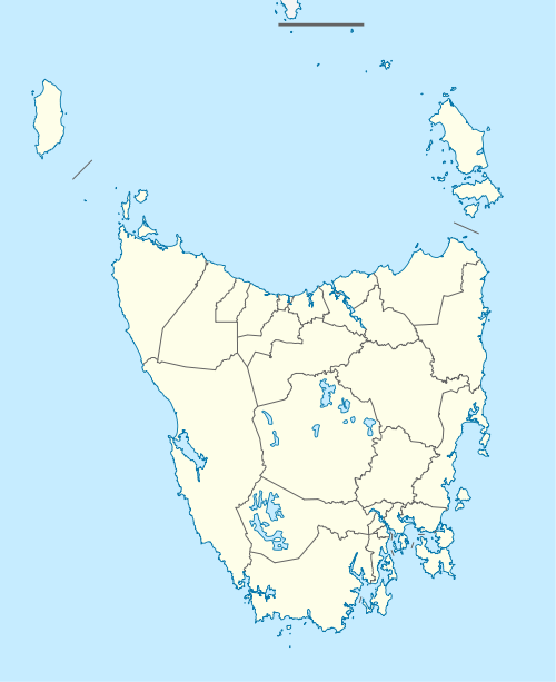 Location in Tasmania | |
| Location | West Coast, Tasmania, Australia |
| Coordinates | 42°11′24″S 145°09′36″E |
Cape Sorrell is named in honour of William Sorell, Lieutenant-Governor of Tasmania from 1817 to 1824.
It is a regularly cited feature of the west coast of Tasmania - for many systems as an indicator the northern most point of the region South West Tasmania.[1][2]
Lighthouse
Constructed in 1899 during the rise of the West Coast mining boom, the Cape Sorell Lighthouse is a heritage-listed lighthouse located on Cape Sorell. i The lighthouse is located approximately 12 kilometres (7.5 mi) southwest of Strahan.
Macquarie Heads breakwater railway
Between 1900 and 1946 a horse drawn wooden rail tramline was used to provide access between the Cape Sorell headland and the Cape Sorell Lighthouse and the jetty and wharf locations. It was used to move rock from quarries for the construction and maintenance of the Macquarie Heads breakwater.
Waverider Buoy
- See also Cape Sorell Waverider Buoy
The Cape Sorell Waverider Buoy, also known as Captain Fathom as named by the listeners of ABC Radio, Tasmania during the May 2015 to mark the centenary of the Bureau of Meteorology,[3] is a swell-measuring buoy located west of Cape Sorell some 10 kilometres (6.2 mi) west of Ocean Beach (42°12′S 145°03′E).[3][4]
See also
- Geography of Tasmania
References
- Hills, Loftus; Tasmania. Department of Mines (1914), Geological reconnaissance of the country between Cape Sorell and Point Hibbs, Dept. of Mines, retrieved 13 February 2018
- Prince, Brian; Tasmania. Dept. of Parks, Wildlife and Heritage; Australian Heritage Commission (1992), Aboriginal archaeological sites on the West Coast of Tasmania : port Davey to Cape Sorell : a report to the Tasmanian Department of Parks, Wildlife and Heritage, Dept. of Parks, Wildlife and Heritage, retrieved 13 February 2018
- "Cape Sorell Waverider Buoy Observations". Bureau of Meteorology. Australian Government. Retrieved 28 June 2015.
- "Cape Sorell Waverider Buoy Observations" (Chart). Bureau of Meteorology. Australian Government. Retrieved 28 June 2015.