Canova, South Dakota
Canova is a town in Miner County, South Dakota, United States. The population was 105 at the 2010 census.
Canova, South Dakota | |
|---|---|
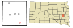 Location in Miner County and the state of South Dakota | |
| Coordinates: 43°52′50″N 97°30′7″W | |
| Country | United States |
| State | South Dakota |
| County | Miner |
| Incorporated | 1898[1] |
| Area | |
| • Total | 0.31 sq mi (0.81 km2) |
| • Land | 0.31 sq mi (0.81 km2) |
| • Water | 0.00 sq mi (0.00 km2) |
| Elevation | 1,522 ft (464 m) |
| Population | |
| • Total | 105 |
| • Estimate (2018)[4] | 99 |
| • Density | 315.29/sq mi (121.62/km2) |
| Time zone | UTC-6 (Central (CST)) |
| • Summer (DST) | UTC-5 (CDT) |
| ZIP code | 57321 |
| Area code(s) | 605 |
| FIPS code | 46-09420[5] |
| GNIS feature ID | 1265623[6] |
The town celebrated its 125th anniversary in 2008.[7]
History
Canova was platted in 1883.[8] The town is named after Italian sculptor Antonio Canova.[9]
Ted and Dorothy Hustead lived in Canova just before moving to Wall, South Dakota, and establishing the Wall Drug Store.[10]
Geography
Canova is located at 43°52′50″N 97°30′07″W.[11]
According to the United States Census Bureau, the town has a total area of 0.31 square miles (0.80 km2), all of it land.[12]
Canova has been assigned the ZIP code 57321 and the FIPS place code 09420.
Demographics
| Historical population | |||
|---|---|---|---|
| Census | Pop. | %± | |
| 1900 | 169 | — | |
| 1910 | 311 | 84.0% | |
| 1920 | 338 | 8.7% | |
| 1930 | 364 | 7.7% | |
| 1940 | 333 | −8.5% | |
| 1950 | 340 | 2.1% | |
| 1960 | 247 | −27.4% | |
| 1970 | 204 | −17.4% | |
| 1980 | 194 | −4.9% | |
| 1990 | 172 | −11.3% | |
| 2000 | 140 | −18.6% | |
| 2010 | 105 | −25.0% | |
| Est. 2018 | 99 | [4] | −5.7% |
| U.S. Decennial Census[13] | |||
2010 census
As of the census[3] of 2010, there were 105 people, 47 households, and 24 families residing in the town. The population density was 338.7 inhabitants per square mile (130.8/km2). There were 59 housing units at an average density of 190.3 per square mile (73.5/km2). The racial makeup of the town was 98.1% White and 1.9% African American. Hispanic or Latino of any race were 7.6% of the population.
There were 47 households, of which 21.3% had children under the age of 18 living with them, 42.6% were married couples living together, 2.1% had a female householder with no husband present, 6.4% had a male householder with no wife present, and 48.9% were non-families. 44.7% of all households were made up of individuals, and 25.5% had someone living alone who was 65 years of age or older. The average household size was 2.23 and the average family size was 3.17.
The median age in the town was 44.3 years. 21% of residents were under the age of 18; 9.6% were between the ages of 18 and 24; 21% were from 25 to 44; 27.7% were from 45 to 64; and 21% were 65 years of age or older. The gender makeup of the town was 47.6% male and 52.4% female.
2000 census
As of the census[5] of 2000, there were 140 people, 62 households, and 38 families residing in the town. The population density was 443.9 people per square mile (168.9/km2). There were 72 housing units at an average density of 228.3 per square mile (86.9/km2). The racial makeup of the town was 100.00% White.
There were 62 households, out of which 21.0% had children under the age of 18 living with them, 53.2% were married couples living together, 6.5% had a female householder with no husband present, and 38.7% were non-families. 33.9% of all households were made up of individuals, and 9.7% had someone living alone who was 65 years of age or older. The average household size was 2.26 and the average family size was 2.87.
In the town, the population was spread out, with 24.3% under the age of 18, 5.0% from 18 to 24, 28.6% from 25 to 44, 19.3% from 45 to 64, and 22.9% who were 65 years of age or older. The median age was 40 years. For every 100 females, there were 109.0 males. For every 100 females age 18 and over, there were 100.0 males.
The median income for a household in the town was $24,500, and the median income for a family was $33,750. Males had a median income of $33,438 versus $15,417 for females. The per capita income for the town was $14,624. There were 7.1% of families and 12.7% of the population living below the poverty line, including 32.3% of under eighteens and 8.1% of those over 64.
References
- "SD Towns" (PDF). South Dakota State Historical Society. Archived from the original (PDF) on 2010-02-10. Retrieved 2010-02-11.
- "2018 U.S. Gazetteer Files". United States Census Bureau. Retrieved February 22, 2020.
- "U.S. Census website". United States Census Bureau. Retrieved 2012-06-21.
- "Population and Housing Unit Estimates". United States Census Bureau. June 27, 2019. Retrieved June 4, 2019.
- "U.S. Census website". United States Census Bureau. Retrieved 2008-01-31.
- "US Board on Geographic Names". United States Geological Survey. 2007-10-25. Retrieved 2008-01-31.
- "Congressional Record: 110th Congress (2007-2008)". Library of Congress. 25 June 2008. Retrieved 19 July 2014.
- Chicago and North Western Railway Company (1908). A History of the Origin of the Place Names Connected with the Chicago & North Western and Chicago, St. Paul, Minneapolis & Omaha Railways. p. 51.
- Federal Writers' Project (1940). South Dakota place-names, v.1-3. University of South Dakota. p. 29.
- "History of Wall Drug in Wall SD". 1982. Retrieved 19 July 2014.
- "US Gazetteer files: 2010, 2000, and 1990". United States Census Bureau. 2011-02-12. Retrieved 2011-04-23.
- "US Gazetteer files 2010". United States Census Bureau. Archived from the original on 2012-07-02. Retrieved 2012-06-21.
- "Census of Population and Housing". Census.gov. Retrieved June 4, 2015.
External links
Municipalities and communities of Miner County, South Dakota, United States | ||
|---|---|---|
| Cities | 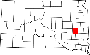 | |
| Towns | ||
| Township | ||
| CDP | ||
| Ghost town |
| |
| Authority control |
|
|---|