Camp Sherman, Oregon
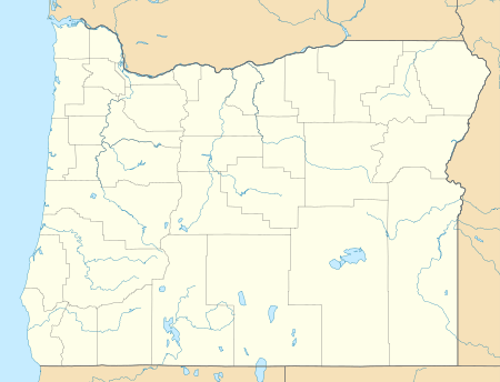
Camp Sherman is an unincorporated community and census-designated place (CDP) in Jefferson County, Oregon, United States. It is located on the Metolius River. The year-round population as of the 2010 census was 233,[3] with that number tripling or more during the summer. The community includes an elementary school, Black Butte School, a general store and a post office (ZIP code 97730). The community also has a volunteer fire department. Camp Sherman was founded by vacationers from Sherman County in the latter part of the 19th century.
Camp Sherman, Oregon | |
|---|---|
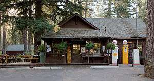 Camp Sherman store | |
 Camp Sherman  Camp Sherman | |
| Coordinates: 44°27′37″N 121°38′28″W | |
| Country | United States |
| State | Oregon |
| County | Jefferson |
| Named for | Sherman County, home of many families who spent their summer vacations here[1] |
| Area | |
| • Total | 3.15 sq mi (8.16 km2) |
| • Land | 3.15 sq mi (8.16 km2) |
| • Water | 0.0 sq mi (0.0 km2) |
| Elevation | 2,963 ft (903 m) |
| Population (2010) | |
| • Total | 233 |
| Time zone | UTC-8 (PST) |
| • Summer (DST) | UTC-7 (PDT) |
| ZIP code | 97730 |
| Area code(s) | 541 |
| FIPS code | 41-10550 |
| GNIS feature ID | 1139266 |
| Coordinates and elevation from United States Geological Survey[2] | |
Notable features
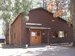
In 1949, Luther Metke was a key builder of the Camp Sherman Community Hall, the center of social activity in the community. In February 2003 it was listed as a National Register of Historic Places due to its rustic architecture highlighting late 19th & early 20th century American movements: Bungalow/Craftsman and Western Stick architecture.[4]
Climate
This region experiences warm (but not hot) and dry summers, with no average monthly temperatures above 71.6 °F. According to the Köppen Climate Classification system, Camp Sherman has a warm-summer Mediterranean climate, abbreviated "Csb" on climate maps.[5]
References
- McArthur, Lewis A.; Lewis L. McArthur (2003) [1928]. Oregon Geographic Names (7th ed.). Portland, Oregon: Oregon Historical Society Press. p. 151. ISBN 0-87595-277-1.
- "Camp Sherman". Geographic Names Information System. United States Geological Survey. November 28, 1980. Retrieved August 6, 2011.
- "Geographic Identifiers: 2010 Census Summary File 1 (G001): Camp Sherman CDP, Oregon". American Factfinder. U.S. Census Bureau. Archived from the original on February 13, 2020. Retrieved October 30, 2018.
- "National Register of Historic Places". United States Department of the Interior, National Park Service. United States Department of the Interior. February 28, 2003. Retrieved October 13, 2014.
- "Camp Sherman Oregon". Weatherbase.com. CantyMedia. Retrieved October 13, 2014.
External links
![]()
Municipalities and communities of Jefferson County, Oregon, United States | ||
|---|---|---|
| Cities | 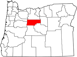 Jefferson County map | |
| CDPs | ||
| Other unincorporated communities | ||
| Indian reservation | ||
| Ghost towns | ||
| Footnotes | ‡This populated place also has portions in an adjacent county or counties | |