Camembert, Orne
Camembert (French pronunciation: [kamɑ̃bɛʁ] (![]()
Camembert | |
|---|---|
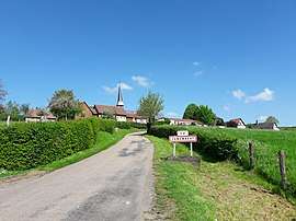 The road into Camembert | |
Location of Camembert 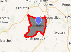
| |
 Camembert  Camembert | |
| Coordinates: 48°53′38″N 0°10′42″E | |
| Country | France |
| Region | Normandy |
| Department | Orne |
| Arrondissement | Mortagne-au-Perche |
| Canton | Vimoutiers |
| Intercommunality | Pays de Camembert |
| Area 1 | 10.3 km2 (4.0 sq mi) |
| Population (2017-01-01)[1] | 187 |
| • Density | 18/km2 (47/sq mi) |
| Time zone | UTC+01:00 (CET) |
| • Summer (DST) | UTC+02:00 (CEST) |
| INSEE/Postal code | 61071 /61120 |
| Elevation | 111–237 m (364–778 ft) (avg. 137 m or 449 ft) |
| 1 French Land Register data, which excludes lakes, ponds, glaciers > 1 km2 (0.386 sq mi or 247 acres) and river estuaries. | |
It is the place where camembert cheese originated.
Camembert has been called "The largest small village in France." This is because the area of the commune itself is out of proportion to the center of the village which consists of the Cheese Museum (in the shape of a Camembert cheese), the Town Hall (Mairie), the Church of St Anne, the Ferme Président (a museum), Beamoncel (the house where Marie Harel, the creator of camembert cheese lived) and 3 other small houses. The rest of the commune is scattered over 10 km2 (2,500 acres).
History
The village is most noted for the early development of camembert cheese by Marie Harel in 1791.
Population
| Historical population | ||
|---|---|---|
| Year | Pop. | ±% |
| 1999 | 197 | — |
| 2012 | 196 | −0.5% |
See also
References
External links
| Wikimedia Commons has media related to Camembert. |
| Authority control |
|
|---|
- "Populations légales 2017". INSEE. Retrieved 6 January 2020.
This article is issued from Wikipedia. The text is licensed under Creative Commons - Attribution - Sharealike. Additional terms may apply for the media files.