Calhoun Township, Cheyenne County, Kansas
Calhoun Township is a township in Cheyenne County, Kansas, USA. As of the 2000 census, its population was 57.
Calhoun Township | |
|---|---|
 Location in Cheyenne County | |
| Coordinates: 39°56′25″N 101°41′2″W | |
| Country | United States |
| State | Kansas |
| County | Cheyenne |
| Area | |
| • Total | 89.87 sq mi (232.77 km2) |
| • Land | 89.25 sq mi (231.15 km2) |
| • Water | 0.63 sq mi (1.62 km2) 0.7% |
| Elevation | 3,156 ft (962 m) |
| Population (2000) | |
| • Total | 57 |
| • Density | 0.6/sq mi (0.2/km2) |
| GNIS feature ID | 0470879 |
Geography
Calhoun Township covers an area of 89.87 square miles (232.8 km2) and contains no incorporated settlements. According to the USGS, it contains one cemetery, Barley.
Beaumaster Pond (historical) is within this township. The streams of Bluff Creek, Cleveland Run, Delay Creek, Hackberry Creek, Jones Canyon Creek, Nesbit Creek and Plum Creek run through this township.
External links
Municipalities and communities of Cheyenne County, Kansas, United States | ||
|---|---|---|
| Cities | 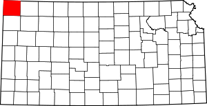 Map of Kansas highlighting Cheyenne County | |
| Unincorporated communities | ||
| Ghost towns | ||
| Townships | ||
This article is issued from Wikipedia. The text is licensed under Creative Commons - Attribution - Sharealike. Additional terms may apply for the media files.