Cairo, Georgia
Cairo (/ˈkeɪroʊ/) is a city in Grady County, Georgia, United States. As of the 2010 census, the city had a population of 9,607.[5] The city is the county seat of Grady County.[6]
Cairo, Georgia | |
|---|---|
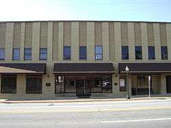 Cairo City Hall | |
| Nicknames: "Georgia's Hospitality City", and "The Syrup City" | |
 Location in Grady County and the state of Georgia | |
| Coordinates: 30°52′39″N 84°12′5″W | |
| Country | United States |
| State | Georgia |
| County | Grady |
| Government | |
| • Mayor | Booker T. Gainor |
| Area | |
| • Total | 9.91 sq mi (25.68 km2) |
| • Land | 9.78 sq mi (25.33 km2) |
| • Water | 0.14 sq mi (0.35 km2) |
| Elevation | 243 ft (74 m) |
| Population (2010) | |
| • Total | 9,607 |
| • Estimate (2018)[2] | 9,410 |
| • Density | 962.27/sq mi (371.54/km2) |
| Time zone | UTC-5 (Eastern (EST)) |
| • Summer (DST) | UTC-4 (EDT) |
| ZIP codes | 31728, 39827, 39828 |
| Area code(s) | 229 |
| FIPS code | 13-12400[3] |
| GNIS feature ID | 0354934[4] |
| Website | www |
History
Cairo was founded in 1835. It was incorporated as a town in 1870 and as a city in 1906. In 1905, Cairo was designated seat of the newly formed Grady County.[7] The city was named after Cairo, the capital of Egypt.[8]
Recreation and entertainment
The local industrial base continues to grow with manufacturing, service, and healthcare companies anchoring a strong economy.
The area is home to several local festivals, including Calvary's Mule Day,[9] Whigham's Rattlesnake Roundup,[10] Cairo's own Antique Car Rally,[11] and several competitive recreational programs. The Antique Car Rally features a wide range of cars, and includes many activities: a poker run, a parade, and even a street dance. It usually takes place on the second weekend of May. Sponsored by Mr. Chick, it is an annual event that attracts many people to the southwest corner of Georgia.
Education
Grady County Schools serves the city. Cairo High School, located in Cairo serves as a central high school for all of Grady County. Elementary schools serving students in the city include Eastside Elementary, Northside Elementary and Southside Elementary. Washington Middle School serves Cairo residents.[12]
A campus of the Southern Regional Technical College is located in Cairo.
Health
Grady General Hospital serves the city. A 60-bed acute care facility, it has been affiliated with John D. Archbold Memorial Hospital in Thomasville since 1985.[13]
Geography
Cairo is located in central Grady County at 30°52′39″N 84°12′5″W (30.8774, -84.2013).[4] U.S. Route 84 (38th Boulevard) passes through the northern part of the city, leading east 14 miles (23 km) to Thomasville and west 24 miles (39 km) to Bainbridge. Valdosta is 59 miles (95 km) to the east, and Dothan, Alabama, is 79 miles (127 km) to the west on US 84. Georgia State Route 93 passes through the center of Cairo as Broad Street and Fifth Street; it leads north 19 miles (31 km) to Pelham and south 12 miles (19 km) to U.S. Route 319 north of the Florida border. Tallahassee, Florida, is 33 miles (53 km) to the south.
According to the United States Census Bureau, Cairo has a total area of 9.8 square miles (25.4 km2), of which 9.7 square miles (25.1 km2) is land and 0.1 square miles (0.3 km2), or 1.38%, is water.[14]
Climate
The climate in this area is characterized by relatively high temperatures and evenly distributed precipitation throughout the year. According to the Köppen Climate Classification system, Cairo has a humid subtropical climate, abbreviated "Cfa" on climate maps.[15]
| Climate data for Cairo, Georgia | |||||||||||||
|---|---|---|---|---|---|---|---|---|---|---|---|---|---|
| Month | Jan | Feb | Mar | Apr | May | Jun | Jul | Aug | Sep | Oct | Nov | Dec | Year |
| Average high °F (°C) | 64 (18) |
66 (19) |
73 (23) |
80 (27) |
86 (30) |
90 (32) |
91 (33) |
91 (33) |
87 (31) |
81 (27) |
71 (22) |
65 (18) |
79 (26) |
| Average low °F (°C) | 42 (6) |
42 (6) |
48 (9) |
55 (13) |
62 (17) |
68 (20) |
70 (21) |
70 (21) |
67 (19) |
57 (14) |
46 (8) |
42 (6) |
56 (13) |
| Average precipitation inches (mm) | 3.9 (99) |
4.1 (100) |
5.3 (130) |
3.9 (99) |
3.4 (86) |
5.5 (140) |
6.4 (160) |
5.6 (140) |
4.4 (110) |
2.5 (64) |
2.6 (66) |
3.5 (89) |
51.2 (1,300) |
| Source: Weatherbase [16] | |||||||||||||
Demographics
| Historical population | |||
|---|---|---|---|
| Census | Pop. | %± | |
| 1880 | 275 | — | |
| 1890 | 521 | 89.5% | |
| 1900 | 690 | 32.4% | |
| 1910 | 1,505 | 118.1% | |
| 1920 | 1,908 | 26.8% | |
| 1930 | 3,169 | 66.1% | |
| 1940 | 4,653 | 46.8% | |
| 1950 | 5,577 | 19.9% | |
| 1960 | 7,427 | 33.2% | |
| 1970 | 8,061 | 8.5% | |
| 1980 | 8,777 | 8.9% | |
| 1990 | 9,035 | 2.9% | |
| 2000 | 9,239 | 2.3% | |
| 2010 | 9,607 | 4.0% | |
| Est. 2018 | 9,410 | [2] | −2.1% |
| U.S. Decennial Census[17] | |||
As of the census[3] of 2000, there were 9,239 people, 3,465 households, and 2,456 families residing in the city. The population density was 992.0 people per square mile (383.2/km2). There were 3,898 housing units at an average density of 418.5 per square mile (161.7/km2). The racial makeup of the city was 51.30% African American, 43.99% White, 0.42% Native American, 0.57% Asian, 0.02% Pacific Islander, 2.80% from other races, and 0.89% from two or more races. Hispanic or Latino of any race were 5.05% of the population.
There were 3,465 households, out of which 34.0% had children under the age of 18 living with them, 41.4% were married couples living together, 24.7% had a female householder with no husband present, and 29.1% were non-families. 25.4% of all households were made up of individuals, and 13.5% had someone living alone who was 65 years of age or older. The average household size was 2.64 and the average family size was 3.14.
In the city, the population was spread out, with 29.1% under the age of 18, 9.4% from 18 to 24, 27.4% from 25 to 44, 20.7% from 45 to 64, and 13.5% who were 65 years of age or older. The median age was 34 years. For every 100 females, there were 83.4 males. For every 100 females age 18 and over, there were 77.6 males.
The median income for a household in the city was $23,054, and the median income for a family was $30,352. Males had a median income of $29,063 versus $20,542 for females. The per capita income for the city was $13,759. About 24.4% of families and 30.0% of the population were below the poverty line, including 41.2% of those under age 18 and 23.4% of those age 65 or over.
Notable people
- Notable Cairo people include:

 Jackie Robinson,
born 1919,
American professional baseball second baseman who became the first African American to play in Major League Baseball (MLB) in the modern era.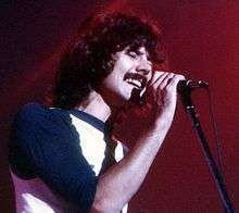 Mickey Thomas,
born 1949,
American rock singer, best known as one of the lead vocalists of Jefferson Starship and Starship.
- Jake Bundrick, drummer for the pop/rock band Mayday Parade
- Teresa Edwards, former professional basketball player and an Olympic gold medalist
- Willie Harris, outfielder and second baseman in Major League Baseball from 2001 through 2012, member of the 2005 World Champion Chicago White Sox
- Bryan Johnson, former professional motocross racer.
- John Monds, 2010 Libertarian gubernatorial candidate for the state of Georgia
- David Ponder, former defensive tackle for the Dallas Cowboys
- Ernest Riles, shortstop and third baseman in Major League Baseball
- Jackie Robinson, Baseball Hall of Famer; first person to break the color barrier in Major League Baseball; born in Cairo
- Matthew "Mack" Robinson, Olympic silver medalist, older brother of Jackie Robinson
- Daryle Singletary, country music singer
- George Thornewell Smith, Georgia politician
- Bill Stanfill, former All-Pro National Football League defensive end
- Mickey Thomas, lead singer of Jefferson Starship
- Bobby Walden, former punter for the Pittsburgh Steelers and Minnesota Vikings
- J. J. Wilcox, safety for the New York Jets
- Arthur L. Williams Jr., founder of Primerica Financial Services
- Curley Williams, country music singer and songwriter; born near Cairo in Grady County
- Emerson Hancock, pitcher for University of Georgia and top prospect for 2020 MLB Draft
References
- "2018 U.S. Gazetteer Files". United States Census Bureau. Retrieved Feb 12, 2020.
- "Population and Housing Unit Estimates". Retrieved June 4, 2019.
- "U.S. Census website". United States Census Bureau. Retrieved 2008-01-31.
- "Cairo, Georgia". Geographic Names Information System. United States Geological Survey.
- "Archived copy". Archived from the original on 2011-11-04. Retrieved 2011-11-18.CS1 maint: archived copy as title (link)
- "Find a County". National Association of Counties. Archived from the original on 2011-05-31. Retrieved 2011-06-07.
- Hellmann, Paul T. (May 13, 2013). Historical Gazetteer of the United States. Routledge. p. 222. ISBN 978-1135948597. Retrieved 30 November 2013.
- Logue, Victoria; Logue, Frank (1997). Touring the Backroads of North and South Georgia. John F. Blair, Publisher. p. 412. ISBN 978-0-89587-171-8.
- "Calvary Mule Day". Cairo Ga Chamber. Archived from the original on 2017-05-01. Retrieved April 28, 2017.
- "Whigham Rattlesnake Roundup". Cairo Ga Chamber. Archived from the original on 2017-05-25. Retrieved April 28, 2017.
- "Great Southern Antique Car Show and Rally". Cairo Ga Chamber. Archived from the original on 2017-05-01. Retrieved April 28, 2017.
- "Schools." Grady County Schools. Retrieved on April 9, 2009.
- "Grady General Hospital". Archbold Medical Center. Retrieved 2017-03-30.
- "Geographic Identifiers: 2010 Demographic Profile Data (G001): Cairo city, Georgia". American Factfinder. U.S. Census Bureau. Retrieved November 23, 2016.
- Climate Summary for Cairo, Georgia
- "Weatherbase.com". Weatherbase. 2013. Retrieved on September 28, 2013.
- "Census of Population and Housing". Census.gov. Retrieved June 4, 2015.
External links
Municipalities and communities of Grady County, Georgia, United States | ||
|---|---|---|
| Cities |  Map of Georgia highlighting Grady County | |
| CDP | ||
| Unincorporated communities | ||
| Indian reservation | ||
| Authority control |
|
|---|