Burgh by Sands
Burgh by Sands (/ˈbrʌf/ (![]()
| Burgh by Sands | |
|---|---|
 St. Michael's Church, Burgh by Sands | |
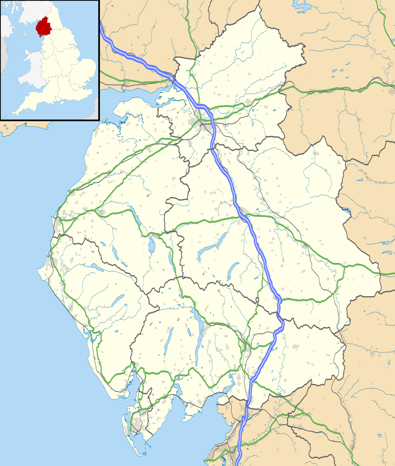 Burgh by Sands Location within Cumbria | |
| Population | 1,176 (2011) |
| OS grid reference | NY326592 |
| Civil parish |
|
| District | |
| Shire county | |
| Region | |
| Country | England |
| Sovereign state | United Kingdom |
| Post town | CARLISLE |
| Postcode district | CA5 |
| Dialling code | 01228 |
| Police | Cumbria |
| Fire | Cumbria |
| Ambulance | North West |
| UK Parliament | |
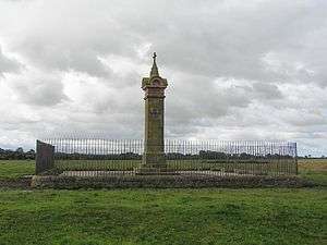
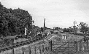
According to the 2011 census the parish had a population of 1,176.[2] The village is about seven miles (11 km) west of Carlisle city centre. The village has a primary school, a pub and a post office. It also has a statue of Edward I at some distance to the north. Burgh was on the Carlisle Navigation canal from 1823 to 1853,[3] after which it was served by the Port Carlisle railway, which was built on the bed of the canal, until its closure in 1932. From 1856 to 1964, railway trains operating on the Carlisle to Silloth line once again stopped at Burgh-by-sands station.[4]
Etymology
Burgh is "doubtless so named from the 'burh' or fort on Hadrian's Wall which ended here." [5] ('Burh' is Old English for 'fortified place', 'town' or 'manor house').
History
Hadrian's Wall runs through the village, and the site once was that of a Roman fort, Aballava. It is also the death-place of Edward I of England [1]
In the 12th century, the castle and lands of Burgh by Sands belonged to members of the Feudal barony of Burgh by Sands, among them Ada de Engaine. Her granddaughter's second marriage founded a younger branch of the de Multon family, a branch of which held this castle in the 13th century. In the 14th century the Dacre family inherited it by marriage to the heiress.
King Edward I, while on his way to war against the Scots, died on the marshes near Burgh, and his corpse lay at the village's 12th-century church until its eventual removal to Westminster Abbey. There is an impressive monument on the marshes erected in 1685 to mark the place where he died. It is 11⁄4 miles NNW of the village, is signposted and can be reached on foot.
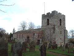
St Michael's Church
The Church of St Michael[6] is a fortified church built with stone from the Roman wall on the site of a Norman church. It has a broad west tower with a base dating from the mid 14th century, and apart from the 19th-century north aisle windows, the rest is Early English. The tower, which can only be accessed from within the church, is designed for defence and the ground floor is tunnel-vaulted. The top of the tower is probably 18th century. The internal door to the tower is a yett, a fortified iron door to repel invaders. The church is remarkable for having had two defensive towers, one at each end, a measure of the perceived threat from Scottish raiders. The east tower is now used as the vestry, but to this day the church has no east window. More recently the east tower has been lowered to match the roof of the church, so from outside it is not immediately recognisable as a tower.
Governance
The Parish falls in the electoral ward of Burgh. This wards stretches beyond the boundaries of Burgh by Sands with a total population taken at the 2011 Census of 2,117.[7]
Transport
Public transport currently consists of a bus service from Carlisle. As of September 2018 it is run four times daily by Stagecoach.[8]
See also
References
- Prestwich, Michael (1997), Edward I (updated ed.), New Haven: Yale University Press, pp. 556–557, ISBN 0-300-07209-0
- "Parish population 2011". Retrieved 23 June 2011.
- David Ramshaw The Carlisle Navigation Canal P3 publications 1997 ISBN 0-9522098-5-3
- "Carlisle & Silloth Bay Railway - History". Retrieved 14 April 2017.
- Armstrong, A. M.; Mawer, A.; Stenton, F. M.; Dickens, B. (1950). The place-names of Cumberland. English Place-Name Society, vol.xx. Part 1. Cambridge: Cambridge University Press. p. 127.
- Pevsner N, Buildings of England; Cumberland and Westmorland ISBN 0-14-071033-7
- "Ward population 2011". Retrieved 23 June 2015.
- September 2018 bus timetable
External links
| Wikimedia Commons has media related to Burgh by Sands. |
- Cumbria County History Trust: Burgh-by-Sands (nb: provisional research only - see Talk page)
- Burgh by Sands Parish Council
| Authority control |
|
|---|