Bulalacao
Bulalacao, officially the Municipality of Bulalacao, (Tagalog: Bayan ng Bulalacao), is a 3rd class municipality in the province of Oriental Mindoro, Philippines. According to the 2015 census, it has a population of 39,107 people.[3]
Bulalacao | |
|---|---|
| Municipality of Bulalacao | |
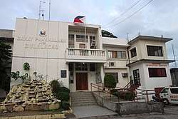 Bulalacao Town Hall | |
 Seal | |
| Etymology: meteorite, shooting star | |
 Map of Oriental Mindoro with Bulalacao highlighted | |
OpenStreetMap 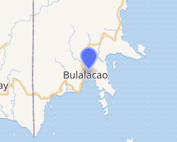
| |
.svg.png) Bulalacao Location within the Philippines | |
| Coordinates: 12°20′N 121°21′E | |
| Country | |
| Region | Mimaropa (Region IV-B) |
| Province | Oriental Mindoro |
| District | 2nd District |
| Barangays | 15 (see Barangays) |
| Government | |
| • Type | Sangguniang Bayan |
| • Mayor | Ernilo C. Villas |
| • Vice Mayor | Ramon G. Magbanua |
| • Congressman | Alfonso V. Umali Jr. |
| • Electorate | 22,568 voters (2019) |
| Area | |
| • Total | 321.86 km2 (124.27 sq mi) |
| Elevation | 15.8 m (51.8 ft) |
| Population (2015 census)[3] | |
| • Total | 39,107 |
| • Density | 120/km2 (310/sq mi) |
| • Households | 8,485 |
| Economy | |
| • Income class | 3rd municipal income class |
| • Poverty incidence | 40.97% (2015)[4] |
| • Revenue (₱) | 114,743,679.73 (2016) |
| Time zone | UTC+8 (PST) |
| ZIP code | 5214 |
| PSGC | |
| IDD : area code | +63 (0)43 |
| Climate type | tropical climate |
| Native languages | Ratagnon Romblomanon Tagalog |
| Website | www |
It is formerly known as San Pedro.[5]
History
Don Gabriel Contreras – Gobernadorcillo and Capitan Municipal. One of the rulers of Bulalacao under the Spanish Imperial Crown [6] The territory of Bulalacao was formerly raided by Datu (Prince) Calido of Panay. The Contreras family administered over Bulalacao as Punong Datu before the conquest of Spain. Since the founding of the First Republic, Bulalacao has predominantly been administered by descendants of Don Gabriel Contreras. The lands composing the present Municipality of Bulalacao was previously the hacienda of the Contreras family.[7] Their collateral familial lines (Sejera, Templanza, Fajardo, etc.) also once held vast haciendas throughout the island of Mindoro.
Bulalacao, with a natural harbor, is one of the places theorized by anthropologists and archaeologists to be the location of the ancient wangdom of Ma-i. In the late 1970s, several jade Chinese porcelain vases were found in Bulalacao, further corroborating the theory.
Geography
Bulalacao is located at the southernmost tip of the province and is 176 kilometres (109 mi) from Calapan.
Climate
| Climate data for Bulalacao, Oriental Mindoro | |||||||||||||
|---|---|---|---|---|---|---|---|---|---|---|---|---|---|
| Month | Jan | Feb | Mar | Apr | May | Jun | Jul | Aug | Sep | Oct | Nov | Dec | Year |
| Average high °C (°F) | 29 (84) |
30 (86) |
30 (86) |
31 (88) |
31 (88) |
30 (86) |
29 (84) |
30 (86) |
29 (84) |
29 (84) |
29 (84) |
29 (84) |
30 (85) |
| Average low °C (°F) | 23 (73) |
23 (73) |
23 (73) |
23 (73) |
24 (75) |
25 (77) |
25 (77) |
24 (75) |
24 (75) |
24 (75) |
24 (75) |
24 (75) |
24 (75) |
| Average precipitation mm (inches) | 45 (1.8) |
34 (1.3) |
62 (2.4) |
64 (2.5) |
127 (5.0) |
159 (6.3) |
172 (6.8) |
147 (5.8) |
167 (6.6) |
182 (7.2) |
172 (6.8) |
88 (3.5) |
1,419 (56) |
| Average rainy days | 12.1 | 9.4 | 13.0 | 14.3 | 22.7 | 26.9 | 28.0 | 26.4 | 27.0 | 27.0 | 22.7 | 17.8 | 247.3 |
| Source: Meteoblue [8] | |||||||||||||
Barangays
Bulalacao is politically subdivided into 15 barangays.
| Barangay | Population (2016) |
|---|---|
| Bagong Sikat | 830 |
| Balatasan | 2,167 |
| Benli (Mangyan Settlement) | 4,527 |
| Cabugao | 995 |
| Cambunang (Poblacion) | 2,399 |
| Campaasan (Poblacion) | 3,149 |
| Maasin | 912 |
| Maujao | 3,118 |
| Milagrosa (Guiob) | 2,117 |
| Nasukob (Poblacion) | 4,419 |
| Poblacion | 3,634 |
| San Francisco (Alimawan) | 778 |
| San Isidro | 563 |
| San Juan | 3,455 |
| San Roque (Buyayao) | 6,044 |
| Total | 39,107 |
Demographics
| Population census of Bulalacao | ||
|---|---|---|
| Year | Pop. | ±% p.a. |
| 1903 | 3,754 | — |
| 1918 | 6,224 | +3.43% |
| 1939 | 3,497 | −2.71% |
| 1948 | 3,597 | +0.31% |
| 1960 | 5,414 | +3.47% |
| 1970 | 10,857 | +7.20% |
| 1975 | 14,038 | +5.29% |
| 1980 | 16,926 | +3.81% |
| 1990 | 21,316 | +2.33% |
| 1995 | 24,047 | +2.28% |
| 2000 | 27,698 | +3.08% |
| 2007 | 30,188 | +1.19% |
| 2010 | 33,754 | +4.15% |
| 2015 | 39,107 | +2.84% |
| Source: Philippine Statistics Authority[3][9][10][11] | ||
See also
- List of renamed cities and municipalities in the Philippines
- List of political families in the Philippines
References
- "Municipality". Quezon City, Philippines: Department of the Interior and Local Government. Retrieved 31 May 2013.
- "Province: Oriental Mindoro". PSGC Interactive. Quezon City, Philippines: Philippine Statistics Authority. Retrieved 12 November 2016.
- Census of Population (2015). "Region IV-B (Mimaropa)". Total Population by Province, City, Municipality and Barangay. PSA. Retrieved 20 June 2016.
- "PSA releases the 2015 Municipal and City Level Poverty Estimates". Quezon City, Philippines. Retrieved 12 October 2019.
- Republic Act No. 5646 Archived 2012-06-01 at the Wayback Machine, PhilippineLaw.info, retrieved 2012
- https://www.wheninmanila.com/recently-discovered-datu-heritage/
- https://www.wheninmanila.com/recently-discovered-datu-heritage/
- "Bulalacao: Average Temperatures and Rainfall". Meteoblue. Retrieved 27 April 2020.
- Census of Population and Housing (2010). "Region IV-B (Mimaropa)". Total Population by Province, City, Municipality and Barangay. NSO. Retrieved 29 June 2016.
- Censuses of Population (1903–2007). "Region IV-B (Mimaropa)". Table 1. Population Enumerated in Various Censuses by Province/Highly Urbanized City: 1903 to 2007. NSO.
- "Province of Oriental Mindoro". Municipality Population Data. Local Water Utilities Administration Research Division. Retrieved 17 December 2016.
External links
| Wikimedia Commons has media related to Bulalacao. |
- Bulalacao Profile at PhilAtlas.com
- Bulalacao, Oriental Mindoro official website
- Philippine Standard Geographic Code
- Philippine Census Information
- Local Governance Performance Management System
Places adjacent to Bulalacao | ||||||||||
|---|---|---|---|---|---|---|---|---|---|---|
| ||||||||||
Calapan (capital) | |
| Municipalities | |
| Component city | |