Bucaná
Bucaná is one of the 31 barrios of the municipality of Ponce, Puerto Rico. Together with Canas, Playa, Vayas, and Capitanejo, Bucaná is one of the municipality's five coastal barrios. The name of this barrio is of native Indian origin.[1] It was founded in 1831.[2]
Barrio Bucaná | |
|---|---|
_alimenta_al_R%C3%ADo_Bucan%C3%A1_(der.)%2C_tomada_mirando_al_norte_desde_la_Carr._PR-52%2C_Bo._Bucan%C3%A1%2C_Ponce%2C_PR_(DSC05627).jpg) Río Portugués (L) feeds into Río Bucaná (R), just north of PR-52 in Barrio Bucaná | |
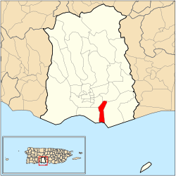 Location of barrio Bucaná within the municipality of Ponce shown in red | |
| Commonwealth | |
| Municipality | |
| Area | |
| • Total | 2.16 sq mi (5.6 km2) |
| • Land | 1.34 sq mi (3.5 km2) |
| • Water | 0.81 sq mi (2.1 km2) |
| Population (2000) | |
| • Total | 3,963 |
| • Density | 2,958/sq mi (1,142/km2) |
| Source: 2000 Census | |
History
Prior to being established as a barrio of Ponce, around 1597, the bay of Ponce had a small place populated by Christian European settlers that was called Bucaná.[3] In 1800, Bucaná was known as Coto Bucaná,[4] a type of grant of land suitable for farming to a resident by the Spanish king in recognition for some service provided by the resident to the King.[5]
Location
Bucaná is an urban barrio located in the southern section of the municipality, within the Ponce city limits, and southeast of the traditional center of the city, Plaza Las Delicias. The toponomy, or origin of the name, alludes to the river that makes its way through it, Río Bucaná.[6]
Boundaries
.jpg)
It is bounded on the North by Marginal Street/PR-578 (one block north of PR-1), on the South by the Caribbean Sea, on the West by Rio Bucana, PR-2 (roughly), Rio Portugues, and the Portugues-Bucana Rivers Channel, and on the East by Bucara Street/Los Caobos Avenue, PR-52 (roughly), and the Costa Caribe Country Club East Access Road.[7]
In terms of barrio-to-barrio boundaries, Bucaná is bounded in the North by Sabanetas, in the South by the Caribbean Sea, in the West by San Anton and Playa, and in the East by Vayas.[8]
Demographics
Bucaná has 1.34 square miles (3.5 km2) of land area and 0.81 square miles (2.1 km2) of water area. In 2000, the population of Bucaná was 3,963 persons, with a density of 2,958 persons per square mile.[9][10] It has the shortest coastline of all five of Ponce's coastal barrios.
The communities of Los Caobos and Camino del Sur are found in Bucana.[11]
Major roads in barrio Bucana are PR-1, PR-578 and PR-52.[12]
Landmarks
Barrio Bucaná is home to the Julio Enrique Monagas Family Park.
See also
References
- Sunny A. Cabrera Salcedo. Hacia un Estudio Integral de la Toponimia del Municipio de Ponce, Puerto Rico. Ph. D. dissertation. May 1999. University of Massachusetts Amherst. Graduate School. Department of Spanish and Portuguese. Page 54.
- Barrios de Ponce. Archived 30 September 2015 at the Wayback Machine Antepasados Esclavos.(From: Pedro Tomás de Córdoba. Memorias geográficas, históricas, económicas y estadísticas de la Isla de Puerto Rico.) Retrieved 28 November 2014.
- Ponce: Notas para su Historia (second Edition). Archived 7 February 2017 at the Wayback Machine Mariano Vidal Armstrong. Oficina Estatal de Conservacion Historica. San Juan, Puerto Rico. 1989. page 14. Accessed 19 February 2018.
- Verdadera Y Auténtica Historia de la Ciudad de Ponce. Eduardo Neuman Gandia. Instituto de Cultura Puertorriqueña. 1913. Page 66. Accessed 17 June 2018.
- Verdadera Y Auténtica Historia de la Ciudad de Ponce. Eduardo Neuman Gandia. Instituto de Cultura Puertorriqueña. 1913. Page 67. Accessed 17 June 2018.
- Government of the Municipality of Ponce. Periodico "El Señorial". Special issue: Carnaval Ponceño 2013. February 2013. Page 17. Ponce, Puerto Rico.
- General Purpose Population Data, Census 2000. Unidad de Sistemas de Información Geográfica, Área de Tecnología de Información Gubernamental, Oficina de Gerencia y Presupuesto. Gobierno de Puerto Rico. Archived 2010-08-12 at the Wayback Machine Retrieved February 20, 2010.
- Mapa de Localizacion Limite de Barrios de Ponce. Oficina de Ordenacion Territorial. Municipio Autonomo de Ponce. Ponce, Puerto Rico. Archived 2011-05-14 at the Wayback Machine Retrieved July 31, 2010.
- BoricuaOnline. Source: US Census Bureau. Retrieved February 20, 2010
- Ponce Municipio, Puerto Rico -- County Subdivision and Place: GCT-PH1. Population, Housing Units, Area, and Density: 2000 (Data Set: Census 2000 Summary File 1 (SF 1) 100-Percent Data) Archived 12 February 2020 at Archive.today Retrieved March 10, 2010.
- Mapa de Localizacion Limite de Barrios de Ponce. Oficina de Ordenacion Territorial. Municipio Autonomo de Ponce. Ponce, Puerto Rico. Archived 2011-05-14 at the Wayback Machine Retrieved July 31, 2010.
- General Purpose Population Data, Census 2000. Unidad de Sistemas de Información Geográfica, Área de Tecnología de Información Gubernamental, Oficina de Gerencia y Presupuesto. Gobierno de Puerto Rico. Archived 2010-08-12 at the Wayback Machine Retrieved 14 November 2011.
- U.S. Geological Survey Geographic Names Information System: Bucaná Barrio
External links
- Management Plan for La Esperanza Nature Preserve in Ponce, Puerto Rico. Matthew Bourque, Drew Digeser, Stephen Partridge, Hussein Yatim. Worcester Polytechnic Institute. Worcester, Massachusttes. 2 May 2012. Retrieved 4 August 2013.