Bronkhorstspruit
Bronkhorstspruit is a town 50 km east of Pretoria, Gauteng, South Africa along the N4 highway towards Witbank. It lies on the border between the Gauteng and Mpumalanga provinces. It also consists of three townships called Zithobeni, Rethabiseng and Ekangala.
Bronkhorstspruit | |
|---|---|
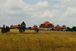 The Nan Hua Temple Complex in Bronkhorstspruit | |
 Bronkhorstspruit  Bronkhorstspruit | |
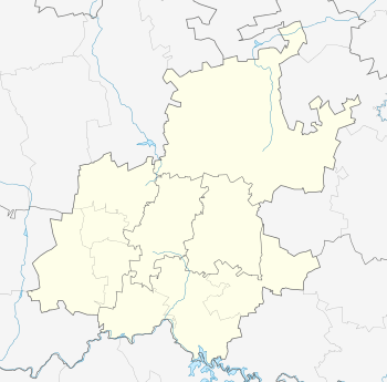
| Coordinates: 25°48′18″S 28°44′47″E | |
| Country | South Africa |
| Province | Gauteng |
| Municipality | City of Tshwane |
| Area | |
| • Total | 3.11 km2 (1.20 sq mi) |
| Elevation | 1,375 m (4,511 ft) |
| Population (2011)[1] | |
| • Total | 3,720 |
| • Density | 1,200/km2 (3,100/sq mi) |
| Time zone | UTC+2 (SAST) |
| Postal code (street) | 1020 |
| PO box | 1020 |
| Area code | 013 |
On 18 May 2011 Tshwane Metropolitan Municipality took over the municipal administration from the abolished Kungwini Local Municipality.
History
In 1858, a group of Voortrekkers settled in the Bronkhorstspruit creek, which was originally called Kalkoenkransrivier ('Turkey Cliff River'). The town was laid out on land of the farm Hondsrivier in 1904 owned by C.J.G. Erasmus and was initially named after him.[2][3]:8 It adopted the name Bronkhorstspruit in 1935.[4]:296
On 20 December 1880 it was the scene of the Battle of Bronkhorstspruit, an important event in the early days of the First Boer War when a Boer Commando ambushed a British army column, 94th Regiment of Foot, near the present town en route from Lydenburg to Pretoria.[4]:296
There is disagreement about where the town got its name from. Some believe it was named after the farmer JG Bronkhorst, while others say that it was named after the plant, bronkors (Afrikaans for watercress), that grew in the region of the creek.[4]:296
Parks and greenspace
Ten kilometers to the south of the town lies the Bronkhorstspruit Dam.[4]:296
Suburbs
- Erasmus
- Masada
- Riamar Park
- Bester Park
- Cultura Park
- Bronkhorstbaai
Economy
Agriculture
Being an agricultural area, maize, sorghum, groundnuts, sunflower seeds, sheep and cattle are grown and raised.[4]:296
Places of interest
Cultura Park, a suburb of Bronkhorstspruit, hosts the largest Buddhist temple in the Southern Hemisphere. Nan Hua Temple houses the South African headquarters of the Humanistic Buddhist order.
References
- "Sub Place Bronkhorstspruit". Census 2011.
- Dictionary of Southern African Place Names
- van Schalkwyk, J (June 2011). "HERITAGE IMPACT ASSESSMENT FOR THE PROPOSED UPGRADE OF ROAD R104, SILVERTON TO BRONKHORSTSPRUIT, GAUTENG PROVINCE" (PDF). South African Heritage Resources Agency. Retrieved 1 January 2019.
- Erasmus, B.P.J. (2014). On Route in South Africa: Explore South Africa region by region. Jonathan Ball Publishers. p. 401. ISBN 9781920289805.
External links
.svg.png)