Bromley, New Zealand
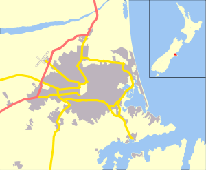
Bromley is a suburb of the city of Christchurch, New Zealand. It lies to the east of the city centre, mostly between Pages Road and the Avon river estuary.[1]
Bromley | |
|---|---|
 Bromley | |
| Coordinates: 43°33′00″S 172°42′00″E | |
| Area | |
| • Total | 2.8345 km2 (1.0944 sq mi) |
| Population (2013) | |
| • Total | 4,290 |
| • Density | 1,500/km2 (3,900/sq mi) |
History
.jpg)
Bromley was named after the town in north-west Kent in England.[2]
In 1883, a sewage farm was established next to the Avon estuary. This was later developed when sewage works were built between 1958 and 1962.[3] As of 2018, the area includes oxidation ponds and a wildlife reserve.[4]
From 1913, Christchurch City Council looked for additional cemetery space and one of the options under consideration was a reserve that the city owned in Bromley, which at the time was located in Heathcote County. In 1915, the designation of the land was changed, preparatory work happened in 1917, and in July the Bromley Cemetery opened for burials. This was just prior to the 1918 flu pandemic and the new cemetery became the main burial ground for flu victims from the eastern part of the city. The cemetery was extended in size in 1940.[5] Ruru Lawn Cemetery opened in 1941 and is the burial ground for the victims of the 1947 Ballantyne's fire.[6] Memorial Park Cemetery has been in use since 1956 and, like Ruru Lawn Cemetery, is operational.[7]
The various parks and cemeteries in Bromley form a buffer between the residential area in the west, and the industrial area and sewage treatment plant in the east. The exception is Maces Road, where the north side is industrial and the south side is residential. Like other suburbs in the east of Christchurch, and in proximity to the Avon River or the Avon Heathcote Estuary, Bromley suffered great damage in the 2011 Christchurch earthquake.[4] None of the land in the suburb was red zoned, though.[8]
References
- "Community profile, Bromley – Census area" (PDF). Christchurch City Council. November 2014. Retrieved 15 March 2018.
- Harper, Margaret. "Christchurch Place Names: A–M" (PDF). Christchurch City Libraries. p. 46. Retrieved 8 April 2020.
- "Sewage treatment works at Bromley, near Christchurch". Te Ara: The Encyclopedia of New Zealand. 1966. Retrieved 21 March 2018.
- Wilson, John. "Canterbury places – East Christchurch". Te Ara: The Encyclopedia of New Zealand. Retrieved 8 April 2020.
- "Bromley Cemetery". Christchurch City Libraries. Retrieved 8 April 2020.
- "Ruru Lawn Cemetery". Christchurch City Libraries. Retrieved 8 April 2020.
- "Operational cemeteries". Christchurch City Council. Retrieved 8 April 2020.
- Wilson, John. "Canterbury places – East Christchurch". Te Ara: The Encyclopedia of New Zealand. Retrieved 8 April 2020.
- "Bromley School". Retrieved 20 March 2018.