Breznik Heights
Breznik Heights (Breznishki Vazvisheniya \'brez-nish-ki v&-zvi-'she-ni-ya\) rises to over 600 m in the southeast part of Greenwich Island in Antarctica. They extend 12 km between Santa Cruz Point in the northeast and the base of the moraine spit of Provadiya Hook at the mouth of Yankee Harbour in the southwest. The heights are ice-covered except for limited precipitous areas such as those at Oborishte Ridge, Ephraim Bluff, Viskyar Ridge and Bogdan Ridge.
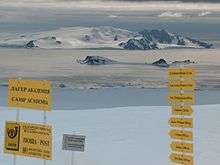
Location of Greenwich Island in the South Shetland Islands from Camp Academia, Livingston Island.
Breznik Heights
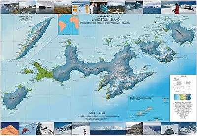
Topographic map of Livingston Island, Greenwich, Robert, Snow and Smith Islands.
The heights are named after the town of Breznik in Western Bulgaria.
Location
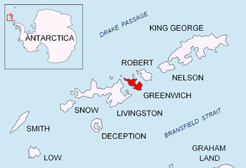
Breznik Heights are centred at 62°31′30″S 59°39′50″W.
Maps
- L.L. Ivanov et al. Antarctica: Livingston Island and Greenwich Island, South Shetland Islands. Scale 1:100000 topographic map. Sofia: Antarctic Place-names Commission of Bulgaria, 2005.
- L.L. Ivanov. Antarctica: Livingston Island and Greenwich, Robert, Snow and Smith Islands. Scale 1:120000 topographic map. Troyan: Manfred Wörner Foundation, 2009. ISBN 978-954-92032-6-4
References
- Breznik Heights. SCAR Composite Gazetteer of Antarctica
- Bulgarian Antarctic Gazetteer. Antarctic Place-names Commission. (details in Bulgarian, basic data in English)
External links
Breznik Heights. Copernix satellite image
This article includes information from the Antarctic Place-names Commission of Bulgaria which is used with permission.
This article is issued from Wikipedia. The text is licensed under Creative Commons - Attribution - Sharealike. Additional terms may apply for the media files.