Brandywine Township, Hancock County, Indiana
Brandywine Township is one of nine townships in Hancock County, Indiana, United States. As of the 2010 census, its population was 2,392 and it contained 892 housing units.[1]
Brandywine Township | |
|---|---|
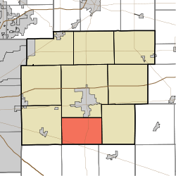 Location in Hancock County | |
| Coordinates: 39°43′34″N 85°46′30″W | |
| Country | United States |
| State | Indiana |
| County | Hancock |
| Government | |
| • Type | Indiana township |
| Area | |
| • Total | 24.24 sq mi (62.8 km2) |
| • Land | 24.23 sq mi (62.8 km2) |
| • Water | 0.01 sq mi (0.03 km2) 0.04% |
| Elevation | 860 ft (262 m) |
| Population (2010) | |
| • Total | 2,392 |
| • Density | 98.7/sq mi (38.1/km2) |
| GNIS feature ID | 0453133 |
Geography
According to the 2010 census, the township has a total area of 24.24 square miles (62.8 km2), of which 24.23 square miles (62.8 km2) (or 99.96%) is land and 0.01 square miles (0.026 km2) (or 0.04%) is water.[1] The streams of Maxwell Ditch and Wilson Ditch run through this township.
Cities and towns
- Greenfield (south edge)
Unincorporated towns
- Carrollton
- Reedville Station
(This list is based on USGS data and may include former settlements.)
Adjacent townships
- Center Township (north)
- Blue River Township (east)
- Hanover Township, Shelby County (southeast)
- Van Buren Township, Shelby County (south)
- Sugar Creek Township (west)
Cemeteries
The township contains one cemetery, Little Sugar Creek.
Major highways
Airports and landing strips
- Osgood Field
References
- "Brandywine Township, Hancock County, Indiana". Geographic Names Information System. United States Geological Survey. Retrieved 2009-09-24.
- United States Census Bureau cartographic boundary files
- "Population, Housing Units, Area, and Density: 2010 - County -- County Subdivision and Place -- 2010 Census Summary File 1". United States Census. Archived from the original on 2020-02-12. Retrieved 2013-05-10.
- Richman, George J. (1916). History of Hancock County, Indiana: Its People, Industries and Institutions. Wm. Mitchell Printing Company. pp. 513.
- Binford, John H. (1882). History of Hancock County, Indiana: From Its Earliest Settlement by the "pale Face," in 1818, Down to 1882. King & Binford. pp. 77.
External links
Municipalities and communities of Hancock County, Indiana, United States | ||
|---|---|---|
| City | Map of Indiana highlighting Hancock County | |
| Towns | ||
| Townships | ||
| Unincorporated communities | ||
| Footnotes | ‡This populated place also has portions in an adjacent county or counties | |
This article is issued from Wikipedia. The text is licensed under Creative Commons - Attribution - Sharealike. Additional terms may apply for the media files.