Bolivar, Tennessee
Bolivar is a city in Hardeman County, Tennessee, United States. As of the 2010 census, the city population was 5,417.[5] It is the county seat of Hardeman County.[6] The town was named for South American revolutionary leader Simón Bolívar.[7]
Bolivar, Tennessee | |
|---|---|
 Bolivar Town Square | |
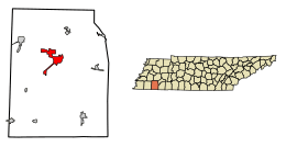 Location of Bolivar in Hardeman County, Tennessee. | |
| Coordinates: 35°16′N 89°0′W | |
| Country | United States |
| State | Tennessee |
| County | Hardeman |
| Area | |
| • Total | 8.12 sq mi (21.04 km2) |
| • Land | 8.11 sq mi (21.01 km2) |
| • Water | 0.01 sq mi (0.03 km2) |
| Elevation | 446 ft (136 m) |
| Population (2010) | |
| • Total | 5,417 |
| • Estimate (2018)[2] | 4,937 |
| • Density | 608.45/sq mi (234.93/km2) |
| Time zone | UTC-6 (Central (CST)) |
| • Summer (DST) | UTC-5 (CDT) |
| ZIP codes | 38008, 38074 |
| Area code(s) | 731 |
| FIPS code | 47-07180[3] |
| GNIS feature ID | 1269372[4] |
| Website | www |
Bolivar is served by William L. Whitehurst Field.
Geography
According to the United States Census Bureau, the city has a total area of 8.5 square miles (22 km2), of which 8.5 square miles (22 km2) is land and 0.12% is water.
Sights
The area is home to several historic properties and historic districts among the National Register of Historic Places listings in Hardeman County, Tennessee including Bolivar Court Square Historic District, Western State Hospital Historic District, North Main Street Historic District, and the Bills-McNeal Historic District.
Demographics
| Historical population | |||
|---|---|---|---|
| Census | Pop. | %± | |
| 1850 | 626 | — | |
| 1860 | 1,213 | 93.8% | |
| 1870 | 889 | −26.7% | |
| 1880 | 1,043 | 17.3% | |
| 1890 | 1,100 | 5.5% | |
| 1900 | 1,035 | −5.9% | |
| 1910 | 1,076 | 4.0% | |
| 1920 | 1,031 | −4.2% | |
| 1930 | 1,217 | 18.0% | |
| 1940 | 1,314 | 8.0% | |
| 1950 | 2,429 | 84.9% | |
| 1960 | 3,338 | 37.4% | |
| 1970 | 6,674 | 99.9% | |
| 1980 | 6,597 | −1.2% | |
| 1990 | 5,969 | −9.5% | |
| 2000 | 5,802 | −2.8% | |
| 2010 | 5,417 | −6.6% | |
| Est. 2018 | 4,937 | [2] | −8.9% |
| Sources:[8][9] | |||
As of the census[3] of 2000, there were 5,802 people, 2,161 households, and 1,462 families residing in the city. The population density was 684.4 people per square mile (264.2/km2). There were 2,352 housing units at an average density of 277.4 per square mile (107.1/km2). The racial makeup of the city was 42.33% White, 56.39% African American, 0.07% Native American, 0.50% Asian, 0.02% Pacific Islander, 0.07% from other races, and 0.62% from two or more races. Hispanic or Latino of any race were 0.60% of the population.

There were 2,161 households, out of which 31.4% had children under the age of 18 living with them, 39.0% were married couples living together, 24.9% had a female householder with no husband present, and 32.3% were non-families. 30.0% of all households were made up of individuals, and 14.5% had someone living alone who was 65 years of age or older. The average household size was 2.45 and the average family size was 3.03.
In the city, the population was spread out, with 26.7% under the age of 18, 9.0% from 18 to 24, 25.6% from 25 to 44, 21.5% from 45 to 64, and 17.3% who were 65 years of age or older. The median age was 37 years. For every 100 females, there were 83.0 males. For every 100 females age 18 and over, there were 75.1 males.
The median income for a household in the city was $28,651, and the median income for a family was $35,298. Males had a median income of $30,442 versus $21,544 for females. The per capita income for the city was $14,973. About 19.5% of families and 23.2% of the population were below the poverty line, including 28.7% of those under age 18 and 28.6% of those age 65 or over.
Notable people
- Wayne Chism, former basketball player for the University of Tennessee Volunteers, lived in Bolivar and played high school basketball at Bolivar Central High School.
- John Dodge, baseball player
- Willie Kemp, former basketball player for the University of Memphis, lived in Bolivar and played high school basketball at Bolivar Central High School.
- Wayne Farris, known as Pro Wrestler The Honky Tonk Man, lived in Bolivar.
- Wayne Reid, known as Pistol 'Pete' Maravich's Manager, lived in Bolivar and played baseball at the Mississippi State University.
Climate
The climate in this area is characterized by relatively high temperatures and evenly distributed precipitation throughout the year. According to the Köppen Climate Classification system, Bolivar has a Humid subtropical climate, abbreviated "Cfa" on climate maps.[10]
| Climate data for Bolivar, Tennessee | |||||||||||||
|---|---|---|---|---|---|---|---|---|---|---|---|---|---|
| Month | Jan | Feb | Mar | Apr | May | Jun | Jul | Aug | Sep | Oct | Nov | Dec | Year |
| Average high °C (°F) | 9 (49) |
12 (53) |
17 (62) |
22 (72) |
27 (80) |
31 (88) |
32 (90) |
32 (90) |
29 (84) |
23 (74) |
16 (61) |
11 (51) |
22 (71) |
| Average low °C (°F) | −2 (29) |
−1 (31) |
4 (40) |
9 (48) |
14 (57) |
18 (65) |
20 (68) |
19 (67) |
16 (60) |
8 (47) |
3 (38) |
−1 (31) |
9 (48) |
| Average precipitation mm (inches) | 120 (4.8) |
110 (4.5) |
130 (5.3) |
120 (4.9) |
120 (4.7) |
94 (3.7) |
100 (4) |
86 (3.4) |
89 (3.5) |
81 (3.2) |
110 (4.5) |
130 (5.2) |
1,320 (51.9) |
| Source: Weatherbase [11] | |||||||||||||
References
- "2018 U.S. Gazetteer Files". United States Census Bureau. Retrieved February 23, 2020.
- "Population and Housing Unit Estimates". United States Census Bureau. June 27, 2019. Retrieved June 4, 2019.
- "U.S. Census website". United States Census Bureau. Retrieved 2008-01-31.
- "US Board on Geographic Names". United States Geological Survey. 2007-10-25. Retrieved 2008-01-31.
- Tennessee Department of Economic and Community Development, Certified Population of Tennessee Incorporated Municipalities and Counties Archived 2014-06-30 at the Wayback Machine, State of Tennessee official website, 14 July 2011. Retrieved: 6 December 2013.
- "Find a County". National Association of Counties. Archived from the original on 2011-05-31. Retrieved 2011-06-07.
- Kenny, Hamill (1945). West Virginia Place Names: Their Origin and Meaning, Including the Nomenclature of the Streams and Mountains. Piedmont, WV: The Place Name Press. p. 123.
- "Census of Population and Housing: Decennial Censuses". United States Census Bureau. Retrieved 2012-03-04.
- "Incorporated Places and Minor Civil Divisions Datasets: Subcounty Resident Population Estimates: April 1, 2010 to July 1, 2012". Population Estimates. U.S. Census Bureau. Archived from the original on 17 June 2013. Retrieved 11 December 2013.
- Climate Summary for Bolivar, Tennessee
- "Weatherbase.com". Weatherbase. 2013. Retrieved on September 20, 2013.
External links
| Wikimedia Commons has media related to Bolivar, Tennessee. |
Municipalities and communities of Hardeman County, Tennessee, United States | ||
|---|---|---|
| Cities | Hardeman County map | |
| Towns | ||
| Unincorporated communities | ||
| Footnotes | ‡This populated place also has portions in an adjacent county or counties | |
| Authority control |
|
|---|