Bogoria, Poland
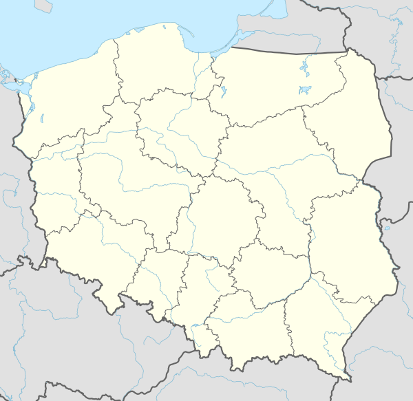
Bogoria[2][3][4] [bɔˈɡɔrja] is a village in Staszów County, Świętokrzyskie Voivodeship, in south-central Poland. It is the seat of the gmina (administrative district) called Gmina Bogoria. It lies approximately 12 kilometres (7 mi) north-east of Staszów and 53 km (33 mi) south-east of the regional capital Kielce.[5] Bogoria has a population of ![]()
Bogoria | |
|---|---|
Village | |
 Coat of arms | |
 Bogoria | |
| Coordinates: 50°38′59″N 21°15′40″E | |
| Country | |
| Voivodeship | Świętokrzyskie |
| County | Staszów |
| Gmina | Bogoria |
| Sołectwo | Bogoria |
| Elevation | 253 m (830 ft) |
| Population (31 December 2009 at Census)[1] | |
| • Total | |
| Time zone | UTC+1 (CET) |
| • Summer (DST) | UTC+2 (CEST) |
| Postal code | 28-210 |
| Area code(s) | +48 15 |
| Car plates | TSZ |
| Website | http://www.bogoria.pl/ |
The name of the village comes from the Bogoria family, which resided in the nearby village of Skotniki. In 1578, Bogoria was a small settlement, and a local nobleman named Krzysztof Bogoria Podlecki decided to found here a town. In 1616, King Zygmunt III Waza granted it Magdeburg rights, and Bogoria quickly developed, with its own town hall, artisans and eight fairs every year. The town belonged to Lesser Poland’s Sandomierz Voivodeship, and like other locations, it was completely destroyed by Swedish soldiers in the Deluge (1655 - 1660). In 1662, it had only 300 inhabitants, and by 1676, the population shrank to 100. In the 18th century, the situation improved, with merchants and cloth makers opening their shops here. In 1770, however, Bogoria burned, together with the town hall. By 1827, when after the Partitions of Poland, the town belonged to the Russian-controlled Congress Poland, it had the population of 425, with 73 houses. Bogoria lost its town charter after the November Uprising (1869), together with a number of other towns of northern Lesser Poland. During World War II, Bogoria was one of centers of the Home Army. The Germans destroyed 80% of the village.
Demography
According to the 2002 Poland census, there were 1,038 people residing in Bogoria village, of whom 47.6% were male and 52.4% were female. In the village, the population was spread out with 26.6% under the age of 18, 37.6% from 18 to 44, 17.2% from 45 to 64, and 18.6% who were 65 years of age or older.[1]
Table 1. Population level of village in 2002 — by age group[1] SPECIFICATION Measure
unitPOPULATION
(by age group in 2002)TOTAL 0-9 10-19 20-29 30-39 40-49 50-59 60-69 70-79 80 + I. TOTAL person 1,038 140 174 140 125 158 91 99 83 28 — of which in % 100 13.5 16.8 13.5 12 15.2 8.8 9.5 8 2.7 1. BY SEX A. Males person 494 73 84 70 66 80 47 39 31 4 — of which in % 47.6 7 8.1 6.7 6.4 7.7 4.5 3.8 3 0.4 B. Females person 544 67 90 70 59 78 44 60 52 24 — of which in % 52.4 6.5 8.7 6.7 5.7 7.5 4.2 5.8 5 2.3
Figure 1. Population pyramid of village in 2002 — by age group and sex[1]
Table 2. Population level of village in 2002 — by sex[1] SPECIFICATION Measure
unitPOPULATION
(by sex in 2002)TOTAL Males Females I. TOTAL person 1,038 494 544 — of which in % 100 47.6 52.4 1. BY AGE GROUP A. At pre-working age person 276 136 140 — of which in % 26.6 13.1 13.5 B. At working age. grand total person 569 301 268 — of which in % 54.8 29 25.8 a. at mobile working age person 390 201 189 — of which in % 37.6 19.4 18.2 b. at non-mobile working age person 179 100 79 — of which in % 17.2 9.6 7.6 C. At post-working age person 193 57 136 — of which in % 18.6 5.5 13.1

References
- "Local Data Bank (Bank Danych Lokalnych) – Layout by NTS nomenclature (Układ wg klasyfikacji NTS)". demografia.stat.gov.pl: GUS. 10 March 2011.
- Bielec, Jan (ed.); Szwałek, Stanisława (1980). Wykaz urzędowych nazw miejscowości w Polsce. T. I: A – J [List of official names of localities in Poland, Vol. I: A – J] (in Polish). Ministry of Administration, Spatial Economy and Environmental Protection (1st ed.). Warsaw, Poland: Central Statistical Office.CS1 maint: extra text: authors list (link)
- Sitek, Janusz (1991). Nazwy geograficzne Rzeczypospolitej Polskiej [Geographical names of the Republic of Poland] (in Polish). Ministry of Physical Planning and Construction, Surveyor General of Poland, Council of Ministers' Office, Commission for Establishing Names of Localities and Physiographical Objects (1st ed.). Warsaw, Poland: Eugeniusz Romer State Cartographical Publishing House. ISBN 83-7000-071-1.
- "Bogoria, wieś, gmina Bogoria, powiat staszowski, województwo świętokrzyskie" [Bogoria, village, Bogoria Commune, Staszów County, Świętokrzyskie Province, Poland]. Topographical map prepared in 1:10,000 scale. Aerial and satellite orthophotomap (in Polish). Head Office of Geodesy and Cartography, Poland, Warsaw. 2011. geoportal.gov.pl. Archived from the original on 21 December 2012. Retrieved 27 April 2011.
- "Central Statistical Office (GUS) - TERYT (National Register of Territorial Land Apportionment Journal)" (in Polish). 2008-06-01.
| Seat | | |
|---|---|---|
| Other villages |
| |
| Parts of village |
| |
| Colony of village |
| |
| Hamlets of village |
| |
| Colonies |
| |
| Hamlet |
| |