Blandford-Blenheim
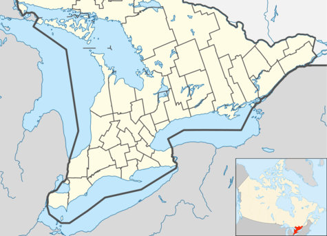
Blandford-Blenheim is a township in the Canadian province of Ontario, located in Oxford County. The township had a population of 7,359 in the Canada 2011 Census.
Blandford-Blenheim | |
|---|---|
| Township of Blandford-Blenheim | |
| Motto(s): Working Together | |
 Blandford-Blenheim | |
| Coordinates: 43°14′N 80°36′W | |
| Country | |
| Province | |
| County | Oxford |
| Formed | 1975 |
| Government | |
| • Mayor | Mark Peterson |
| • Federal riding | Oxford |
| • Prov. riding | Oxford |
| Area | |
| • Land | 382.33 km2 (147.62 sq mi) |
| Population (2016)[1] | |
| • Total | 7,399 |
| • Density | 19.4/km2 (50/sq mi) |
| Time zone | UTC-5 (Eastern Standard Time (EST)) |
| • Summer (DST) | UTC-4 (Eastern Daylight Time (EDT)) |
| Postal Code | N0J |
| Area code(s) | 519 and 226 |
| Website | www.twp.bla-ble.on.ca |
Its government consists of a mayor and four councillors. There are no geographic ward divisions for municipal elections; candidates for councillor campaign in the entire township and the four candidates who receive the most votes are declared elected.[2]
The township was amalgamated in 1975 from two historic county townships, Blandford and Blenheim.[3]
Communities
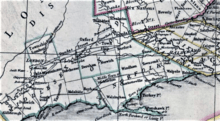
The town of Blandford-Blenheim comprises a number of villages and hamlets, including the following communities such as Blandford, Blandford Station, Blink Bonnie, Bond's Corners, Bright, Canning, Chesterfield, Creditville, Drumbo, Eastwood, Etonia, Forest Estates, Gobles, Maple Lake Park, Park Haven, Perry's Corners, Plattsville, Princeton, Ratho, Richwood, Showers Corners, Washington, Windfall and Wolverton.
Demographics
Population trend:[4]
- Population in 2016: 7399
- Population in 2011: 7359
- Population in 2006: 7149
- Population in 2001: 7630 (or 7442 when adjusted to 2006 boundaries)
- Population in 1996: 7455 (or 7409 when adjusted to 2001 boundaries)
- Population in 1991: 7266
Private dwellings occupied by usual residents: 2616 (total dwellings: 2716)
Attractions and cultural resources
Drumbo Public Library
On June 10, 2005 the Oxford County Library Board closed the Drumbo branch. When letters of appeal and a public meeting organized by Carl McLean failed to reverse this decision, the Access Committee Group – Robbie Savage, Valerie Johnston and Paul Jacobson – was formed to maintain a community library with internet access. A new entity, the Drumbo Opportunity Centre, was born.
This group applied for charitable status, approached the County of Oxford for use of the library building and applied to the Community Access Program. Charitable status was granted in June 2006 and a lease with the County (for rent and connectivity) was signed in May 2006. DOC ceased operations at the end of December 2013 and returned the building to the control of the county.
Plattsville Public Library
c/o Plattsville Public School, 112 Mill St. E, Plattsville.
Princeton Museum and Library
35 Main St S, Princeton. A branch of the Oxford County Library. Plaque - built in 1998 from stone from local farms, the Princeton War Memorial commemorates local war veterans who died in World War I and II.
Richwood Community Centre
767415 Twp Rd 5, Blenheim. Originally a two-room schoolhouse, the former S.S. No 14 was operated as a school from 1857 to 1963. The building is now owned by the Municipality of Blandford-Blenheim and is used as a community centre.
Attractions
Blenheim Springs Trout Farm, Walter's Dinner Theatre.
Natural areas and parks
Chesney Wilderness
Con 9 lot 5 Blandford. This 40.5 ha (100 acres) of land was the first reforestation plot in the county in 1944. Similar tracts were established in Drumbo, Centreville, Innerkip, Embro and Lakeside.
Plattsville Memorial Community Arena and Park
68 Mill St E, Plattsville. Park offers 1 ball diamond with field lights, arena. There is also a pavilion. The "To Our Heroes" Memorial Gate was set up in August 1921 in honour of the men and women who served in World War I. Plattsville Cenotaph is located on the property.
Princeton Memorial Park
35 Main St. S, Princeton. A cairn and flagpole in honour of Mac McAnsh, a gentleman who operated the hardware in Princeton for many years, is located in front of the Centennial Building.
History
The geographical area which is now Blandford-Blenheim was populated with Neutral/Attawandaron longhouse villages for many centuries but was abandoned to First Nations nomadic peoples by the 1650s as a result of warfare with Iroquois and epidemics resulting from European contact. A century later the area was being used for hunting grounds primarily by the Mississaugas First Nation, and it was from them that the land was acquired by the Crown through two treaties, the first signed in 1784, and the second in 1792. [5]
The names of Blandford and Blenheim were given in the 1790s as part of Gov. Simcoe's program to make the new colony of Upper Canada a "mirror of Britain", using place names familier from England. Upon his arrival in the province in 1792, the first proclamation issued by Gov. Simcoe, while still at Kingston, announced the names and boundaries he had decided upon for county boundaries. For areas lying to the west of Kingston, he decided that the sequence of names for counties along Lake Ontario would be Northumberland, Durham, York and Lincoln, and for counties along Lake Erie, the names became Norfolk, Suffolk, Essex and Kent. (This was the same sequence of county names in place along the eastern seacoast of England, running from the Scottish boundary down to the English Channel.) The proclamation defined the northern boundary of Norfolk County as being the Thames River, but the area which became Blandford and Blenheim was originally designated as being part of the western end of York County for election purposes.[6]
Gov. Simcoe with several other government officers, guided by a party of Six Nations warriors, conducted a wilderness tour on foot down and back up the length of the Thames River in February 1793 and decided to assign additional place names to mirror those they knew along the Thames River in England. Middlesex County was the name to be used for the area around a town site reserved at the "lower forks" in the river, to be called London; Dorchester was the name for a town site at the "middle forks"; and the area around the "upper forks" was to be Oxford - the same sequence of names as found along the Thames in England. Just as in Oxfordshire in England, Blandford and Blenheim were names at the northerly end of the county, around Woodstock, adjacent to the towns of Oxford and Burford. When legislation was passed in 1798 in Upper Canada to implement these new divisions by Gov. Simcoe, Norwich and Dereham were separated from Norfolk County and added to the new Oxford County, which included also Burford, Blenheim, Blandford and Oxford townships.[7]
Blenheim Township was opened up to settlement in 1793 when Gov. Simcoe agreed it should be granted to Thomas Watson from New Jersey who promised to bring in settlers and build mills. This was the start of what became the life's work of his nephew Thomas Hornor, who with Watson's son Thomas Jr. and various others were active developing a settlement around Princeton by 1795. Within the course of the next decade, Hornor was appointed a justice of the peace, then as the land registrar for the county, then as the resident commanding officer for the county militia. He carried on as a leading citizen of the county until his death from cholera in 1834.[8]
Blandford Township was held in reserve by the government until a village began to develop along its southern end in the early 1830s, which took the name Woodstock.[9] The official town plot was surveyed in 1834 by the prolific Crown surveyor Charles Rankin.[10]
Historical events
In 1890, a body was found in a Princeton swamp that would lead to the Reginald Birchall murder trial that took place in Woodstock, Ontario. This trial received worldwide media coverage.
Historical landmarks
Drumbo Museum
42 Centre St, Drumbo. Located in the former Wolverton Railway Station which was relocated to the Drumbo Agricultural Fairgrounds.
Wolverton Hall
88 Wolverton St., Wolverton. A fine example of Regency styling, with Gothic flourishes. A plaque marks this brick house built about 1854–55 by Enos Woverton, village founder and first postmaster.
Plaques and monuments
Blandford School
775903 Blandford Rd. Dedicated to all Schools in the former Township of Blandford.
Drumbo Agricultural Society
42 Centre St, Drumbo. There are two plaques on the property commemorating 100 years of the Drumbo Fall Fair and 150 years of the Drumbo Fall Fair, respectively.
Henry Muma, 1822–1902
12 Wilmot St. N, Drumbo. Land agent and founder of Drumbo post office in 1854; he began a brick works here in 1874 and founded the Muma Block on this corner in 1890. His photograph is in the village agricultural hall.
Mudge Hollow
Canning. Located on Township Road 3 east of the Canning Road, Canning was originally known as Mudge Hollow.
Historical cemeteries
Anglican Cemetery
Cemetery located behind the house at 686879 Oxford Road 2, Princeton. A family cemetery in a woodlot just east of the Princeton Cemetery. Access to the cemetery is by an unmarked 12-foot right-of-way to the east of the residential property in front of the cemetery. Owned by the municipality and is considered to be an abandoned (inactive) cemetery according to By-law 971-93.
Blenheim Evangelical 9th Line Cemetery
846515 Township Rd. 9. This cemetery is located south east of Bright, where it services the Mennonite community in the area.
Brethren Cemetery
90742 Twp. Rd. 12, Blenheim. This small Brethren Cemetery is located just south of the Hamlet of Washington. People in the vicinity are generally members of the Brethren Farm Community.
Caledon Cemetery
747409 Twp. Rd. 4, Blenheim. Deeded in 1842 by the Dickson family as a burial ground for the early Scottish settlers. It is located on a hill overlooking a stream.
Canning Cemetery
955207 Canning Rd., Blenheim. The cemetery is located behind the Haack barn south of Canning. The Rickert plot used to be enclosed by an iron fence and an ornate gateway guarded by a large iron dog. Access to this site is by a long and narrow driveway. Owned by the municipality and is considered to be an abandoned (inactive) cemetery according to By-law 971-93.
Chesterfield United Cemetery
816661 Oxford Road 22, Blandford. It surrounds the Chesterfield United Church. It contains a cenotaph erected in 1920 which is inscribed with the names of the 25 people from the community who were killed in World War I and II.
Drumbo Cemetery
806761 Oxford Road 29, Blenheim. Situated on the property of the original Drumbo Baptist Church. A mausoleum was erected and dedicated in 1956. Owned by the municipality and is considered to be an active cemetery.
Mennonite Cemetery
866250 Twp Rd 10, Blandford. The church that was associated with the cemetery was built of logs between 1846–1854 and used by `Old Order Mennonites`. It was sold in 1904 because the building needed repairs. Owned by the municipality and is considered to be an abandoned (inactive) cemetery according to By-law 971-93.
Mennonite Conference Cemetery
967244 Oxford-Waterloo Rd. Created in 1830, it was originally maintained by the Blenheim Mennonite congregation. The associated church has been converted into a retreat centre.
Pioneer Cemetery
687677 Governors Rd. Stones from this abandoned cemetery have been gathered inside protective walls. The oldest burial stone has been dated to 1853. Owned by the municipality it is considered to be an abandoned (inactive) cemetery according to By-law 971-93. On this site stood the Christian Church 1848–1915 and in the surrounding land they laid their dead to rest.
Plattsville Cemetery
Seaton St., Plattsville. Created in 1855, it was once a Lutheran Cemetery but now services the entire community. Owned by the municipality and is considered to be an active cemetery according to By-law 971-93.
Princeton Cemetery
686853 Oxford Road 2, Princeton. The cemetery was started in the early 1800s; fenced in 1930; a mausoleum was erected in 1967; and a portion of ground was blessed for use as a Roman Catholic Cemetery in 1954. Owned by municipality and is considered to be an active cemetery according to By-law 971-93. Plaque - Coloner Thomas Horner, 1767–1834. Honours the pioneer settler of Blenheim Township (1795) who built the first saw and gristmills in what became Oxford County. Plaque-Frederick Benwell, 1865-1890. Commemorates the young victim of Oxford's most infamous murdered, Reginald Birchall.
Ratho Presbyterian Cemetery
905987 Twp Rd 12, Blandford. It surrounds the Ratho Presbyterian Church.
Richwood Cemetery
767413 Twp Rd 5, Blenheim. After a Free Will Baptist Church was organized in Richwood in the 1840s, a rough cast meeting house was built in 1850, in the front part of the Richmond Cemetery. For many years, this was a "free burial ground". Has been expanded to include the former School property. Owned by the municipality and is considered to be an active cemetery according to By-law 971-93. A plaque was erected here in 1998 by descendants of the Kennedy family.
Riverside Cemetery
955569 Lucy Rd. The first 'Regular Baptist Church' in service from 1828 to 1875, was located east of the cemetery. Located on the corner of the Lucy Road and Township Road 5. Owned by the municipality and is considered to be an abandoned (inactive) cemetery according to By-law 971-93.
Washington Cemetery
927196 Oxford Road 8. A small beautiful cemetery on the south side of Oxford Road 8. Owned by the municipality and is considered to be an abandoned (inactive) cemetery according to By-law 971-93. This was an Anglican church Cemetery.
Windfall Cemetery
806484 Oxford Road 29. It is part of the Windfall United Church property. A plaque marks the historic hamlet of Windfall.
Wolverton Cemetery
917709 Wolverton Rd., Wolverton. A long and narrow cemetery situated at the top of a hill overlooking the Hamlet of Wolverton. Owned by the municipality and is considered to be an active cemetery according to By-law 971-93.
Historical churches
Bright United Church
31 John St W, Bright. The original Methodist congregation was established in 1865. There was a need for a new church in 1877, but one was not built until 1892.
Chesterfield United Church
816661 Oxford Road 22, Bright. The original congregation was Presbyterian. Built in 1854. The Chesterfield centotaph is located in the churchyard.
Drumbo Baptist Church
20 Pinkham St., Drumbo. Known originally as Second Blenheim Regular Baptist Church, it was built in 1855at Windfall. In 1859, while moving the building to the centre of Drumbo, the roof caved in and a new white framed building was erected for $1000. The new building was located about 50 yards south of the present church building, which was built in 1876. This present building was the first new building to be erected after the fire that destroyed much of the town.
Plattsville Evangelical Missionary Church
19 Albert St E, Plattsville.
Started in 1956, Plattsville Evangelical Missionary Church began as a Bible study group from the members of Bethel Missionary Church in New Dundee. The congregation was faced with the necessity of expanding their facilities to accommodate their growing congregation.
A group of individuals with a passion for reaching the community of Plattsville approached the local sandpaper factory (now Saint-Gobain). The company had been using a former church building as a storage and warehouse facility. The original building was built in 1885 by a Baptist congregation, but upon their closure in 1937, the building was sold to the sandpaper facility next door.
The church was dedicated as Plattsville United Missionary Church on June 10, 1956. In 1984, an addition was built on, providing additional classrooms, a nursery, and offices. Then in 1996, a new, multi-purpose gymnasium with a full basement was built. The gymnasium is now the main sanctuary for the church.
Plattsville Evangelical Missionary Church is a member of the Evangelical Missionary Church of Canada denomination.
Plattsville United Church
20 Samuel St., Plattsville. It was a Methodist congregation until 1925 when it became United. Built in 1876. Addition built in 1993, which included a new foyer and elevator.
Princeton United Church
24 Elgin St E., Princeton. The original Methodist congregation was established in 1870. The current congregation is a result of a union between the Princeton and Etonia churches in 1925. It was built in 1880.
Ratho Presbyterian Church
905987 Twp Rd 12, Blandford. Built in 1852 by a Scottish community.
Richwood United Church
767417 Rd 5, Blenheim. Richwood United Church was opened on September 15, 1861, as a Wesleyan Methodist Church on the Paris circuit. It is now part of the Drumbo Charge.
Sacred Heart Roman Catholic Church
39 Gissing St W, Princeton. The Princeton church, which was built in 1888, was a mission of St. Mary's until 1941 when it became Sacred Heart.
St. Paul's Anglican Church
4 Elgin St. E., Princeton. Built in 1867.
Mennonite Conference Church
967244 Oxford-Waterloo Rd. Built in 1901. Used only as a retreat centre.
Washington United Church
23 Washington Rd N. The original congregation was Methodist. Built in 1860.
Willis United Church
15 Centre St., Drumbo. Built in 1915. Named after Michael Willis, who was moderator of the Presbyterian Church in 1870.
Windfall United Church
806484 Oxford Road 29. The first church was a frame building and the congregation was of the United Brethren faith. In 1899 the frame building was torn down and the present brick building erected. It is believed that a $100 bill was placed in the corner stone. Regular services ceased in 1991. A memorial service and an anniversary service are held each year.
Historical schools
Drumbo Central Public School
32 Wilmot St. S. Drumbo. The school was built in 1946. Plaque - The Drumbo cenotaph is located on the school property.
Princeton Central Public School
40 Elgin St., Princeton. The school was built in September 1950.
Residents of note
- John English, Canadian historian and Member of Parliament
- Babe Siebert, Hockey Hall of Fame inductee
- Bill Swan, Canadian children's author
- Steven Sanderson, Hockey Hall of Fame inductee
See also
References
- "Blandford-Blenheim census profile". 2016 Census of Population. Statistics Canada. Retrieved 2019-02-26.
- "Archived copy". Archived from the original on 2008-04-12. Retrieved 2008-12-31.CS1 maint: archived copy as title (link)
- Statistics Canada: 1996, 2001, 2006, 2011 census
- known as the Between the Lakes Treaty, it corrected an error in the earlier treaty which failed to properly describe the western boundary intended.
- Proclamation of July 16, 1792
- An act for the better division of this province, S.U.C. 1798, c. 5, s. 37
- http://www.biographi.ca/en/bio/hornor_thomas_6E.html
- Thomas Shenston, Oxford Gazetteer (Hamilton, 1852)
- "Charles Rankin" (PDF). Association of Ontario Land Surveyors. Retrieved 23 January 2020.
External links
Places adjacent to Blandford-Blenheim | ||||||||||
|---|---|---|---|---|---|---|---|---|---|---|
| ||||||||||