Bekaa Kafra
Bekaa Kafra (Arabic: بقاع كفرا) is a Lebanese village located in the Bsharri District in Northern Lebanon. Bekaa Kafra is located in front of the village of Bsharri across the Kadisha Valley. It is the birth town of Saint Charbel. Bekaa Kafra has an altitude ranging from 1500 m to 2000 m at its highest point, making it officially the highest village in Lebanon and Middle-East.
Bekaa Kafra بقاع كفرا | |
|---|---|
Village | |
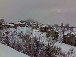 Bekaa Kafra in Winter | |
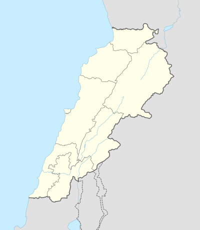 Bekaa Kafra Location within Lebanon | |
| Coordinates: 34°14′25.1″N 36°00′09.6″E | |
| Country | |
| Governorate | North Governorate |
| District | Bsharri District |
| Elevation | 1,650 m (5,410 ft) |
| Highest elevation | 2,780 m (9,120 ft) |
| Lowest elevation | 1,500 m (4,900 ft) |
| Time zone | UTC+2 (EET) |
| • Summer (DST) | UTC+3 (EEST) |
| Dialing code | +961 |
Etymology
The name Bekaa Kafra comes from the Syriac and means "Flat spot" and the village that has a municipal council.
Climate
Bekaa Kafra has a Mediterranean climate with warm, dry summers and cold, snowy winters. It is cold in winter for two reasons: Its location in Northern Lebanon, and its high altitude. Temperatures in winter average around 0 °C and can reach -10 °C to -30 °C. Temperatures in summer average around 18 °C, but they may reach 20 °C to 25 °C in July and August, but can also drop to as low as 6 °C at night. Snow in winter can accumulate up to 6 meters and occasionally more.
Highest Lebanese village
Bekaa Kafra is considered to have the highest village in Lebanon and the Middle East, as it rises 2200m elevation on average. Elevation indicator in Google Earth maps confirms this information.
External links
- Bqaa Kafra, Localiban
Capital: Bsharri | ||
| Towns and villages |
|  |
| Notable landmarks | ||
| Notable people |
| |