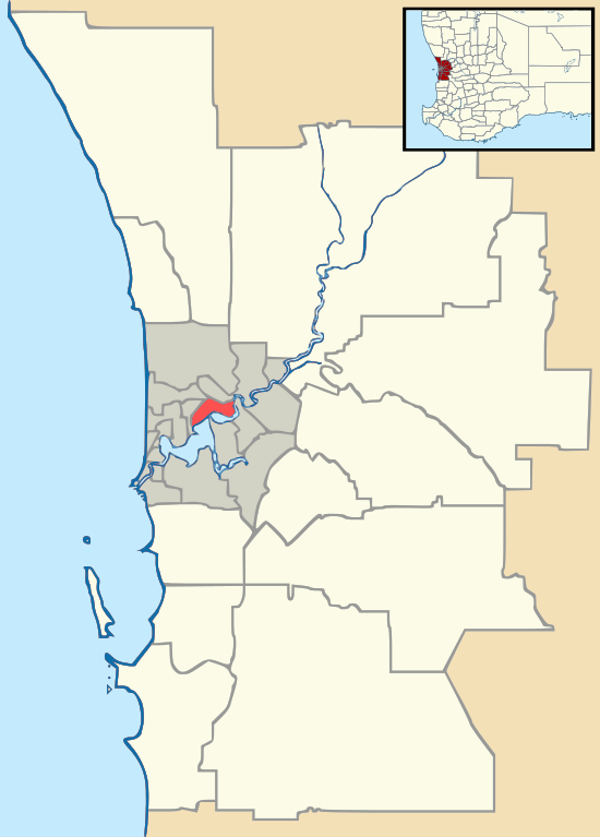
Bibra Lake, Western Australia
Bibra Lake is a suburb of Perth, Western Australia; it takes its name from the extensive freshwater lake within its boundaries. It is located within the City of Cockburn and its postcode is 6163.
| Bibra Lake Perth, Western Australia | |||||||||||||||
|---|---|---|---|---|---|---|---|---|---|---|---|---|---|---|---|
 | |||||||||||||||
 Bibra Lake | |||||||||||||||
| Coordinates | 32.099°S 115.818°E | ||||||||||||||
| Population | 5,954 (2011 census)[1] | ||||||||||||||
| • Density | 472.5/km2 (1,224/sq mi) | ||||||||||||||
| Established | 1967 | ||||||||||||||
| Postcode(s) | 6163 | ||||||||||||||
| Area | 12.6 km2 (4.9 sq mi) | ||||||||||||||
| Location | 20 km (12 mi) from Perth | ||||||||||||||
| LGA(s) | City of Cockburn | ||||||||||||||
| State electorate(s) | |||||||||||||||
| Federal Division(s) | Fremantle | ||||||||||||||
| |||||||||||||||
History
The existence of the lake was first reported by Augustus Gregory during a survey of George Robb's land in May 1842. Gregory recorded the Aboriginal name of the lake as Walubup. During the following year, Benedict von Bibra, surveying his own selection on the southern shores of the lake, recorded the name as Walliabup and the latter version was used exclusively on maps for more than half a century.[2]

In the summer of 1843, Benedict von Bibra (son of Franz Ludwig von Bibra) bought land at the edge of a wide depression to use as a camping place to shorten the trip between his two carpentry businesses in Perth and Fremantle. He apparently assessed from the stringybark trees that the basin would become a lake in winter of a depth of seven to eight feet. He proved correct.[3]
In 1877, it was found the von Bibra's association with Lake Walliabup was apparently still recalled by locals who referred to the feature as Bibra's Lake. This alternative name was added to plans and, in 1967, adopted in place of the Aboriginal name. In 1898 Bibra Lake was reserved for recreation and all applications to lease land were strenuously opposed by the Fremantle District Roads Board, which was given control of the reserve in 1902. Tearooms were erected and the Reserve became a popular venue for picnics and sports gatherings.[4]
AWAS Camp
During World War II, there was a battery attached to the 66 Searchlight stationed at Bibra Lake, along with the regimental headquarters of the 116 Light Anti-Aircraft. This was the base for many women who served in the Australian Women's Army Service, performing important home defence duties to free up more men for front line fighting. The camp was dismantled immediately after the end of the war, and all its buildings and materials sold at auction. The camp was rediscovered in 2015 by members of the community, and is currently threatened by the proposed Roe Highway extension.[5]
Geography
| Bibra Lake | |
|---|---|
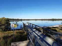 Bibra Lake, seen from the western shore | |
| Location | Perth, Western Australia |
| Coordinates | 32°05′37″S 115°49′33″E |
| Type | Freshwater |
| Basin countries | Australia |
| Designation | Beeliar Regional Park |
It is bounded by the Roe Highway reservation to the north, Stock Road to the west, the Kwinana Freeway to the east and the freight rail line to the south.[6]
Bibra Lake is the fourth lake (going north to south) of a string of lakes which combined comprise the Beeliar Regional Park. Bibra Lake contains two electric insect traps designed to reduce the number of mosquitoes in the area. Around the lake is a cycle way, which provides access to bird hides.
Facilities
The majority of the suburb, which is not part of the Beeliar Regional Park contains a major light industrial area, with businesses such as Amcor.
Bibra Lake is the location for several major private recreation facilities, including Adventure World theme park, a bungee jumping tower, Cockburn Ice Arena, paintball and laser tag operations. Bibra Lake also has a Waldorf primary school and a Montessori primary school.
The manufacturing facilities and headquarters for OKA Australia are in Bibra Lake.
References
- Australian Bureau of Statistics (31 October 2012). "Bibra Lake (State Suburb)". 2011 Census QuickStats. Retrieved 4 January 2015.

- Western Australian Land Information Authority. "History of metropolitan suburb names – B". Retrieved 12 October 2007.
- The Von Bibra Story Lois Nyman and Graeme von Bibra, November 1996, Foot & Playsted Pty Ltd., Launceston ISBN 0-9597188-1-8
- Cockburn: The Making of a Community Michael Berson, 1978, Town of Cockburn, ISBN 0-9596533-0-9
- "Push to save army camp ruins from Perth highway extension". ABC News. Retrieved 27 August 2015.
- Department of Land Information. StreetSmart Perth Street Directory (54th ed.). West Australian Newspapers Ltd. pp. Maps 431-432, 461–462. ISBN 978-0-909439-67-5.