Beroun
Beroun (Czech pronunciation: [ˈbɛroun]; German: Beraun) is a town in the Central Bohemian Region of the Czech Republic. It is the administrative centre of Beroun District.
Beroun | |
|---|---|
Town | |
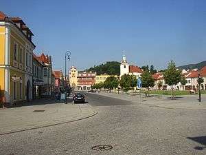
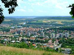 View of Beroun | |
 Flag  Coat of arms | |
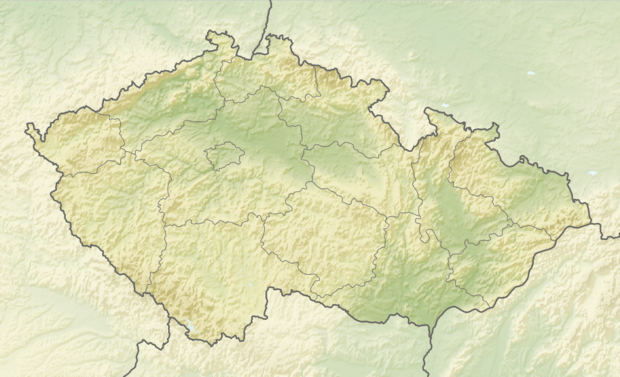 Beroun Location in the Czech Republic | |
| Coordinates: 49°57′51″N 14°4′26″E | |
| Country | |
| Region | Central Bohemian |
| District | Beroun |
| First mentioned | 1265 |
| Government | |
| • Mayor | Soňa Chalupová |
| Area | |
| • Total | 31.31 km2 (12.09 sq mi) |
| Elevation | 235 m (771 ft) |
| Population (2019-01-01[1]) | |
| • Total | 19,510 |
| • Density | 620/km2 (1,600/sq mi) |
| Time zone | UTC+1 (CET) |
| • Summer (DST) | UTC+2 (CEST) |
| Postal code | 266 01 |
| Website | www.mesto-beroun.cz |
Geography
It is located about 30 kilometres (19 mi) southwest of Prague at the confluence of Berounka and Litavka rivers. The town is part of the Prague metropolitan area. As of 2011, it has a population of 18,930.
Beroun lies on the D5 motorway, which connects Prague with Plzeň and, farther afield, with the German border and the Bundesautobahn 6 to Nuremberg, part of the European route E50.
History
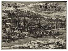
A settlement na Brodě ("by the ford") was first mentioned in a 1088 deed. As a royal Bohemian town, it received its present name in the 13th century. Its name may be derived from (Welsch-)Bern, the archaic German name of Verona in Italy, but alternatively might be a form of the ancient Slavic theonym Perun. Already in the High Middle Ages, under the rule of King Wenceslaus II, it was a fortified town. Many citizens were German merchants, settling here in the course of the Ostsiedlung.
Beroun officially obtained town privileges from the hands of Emperor Charles IV, who was specially attached to the place, calling it "Verona mea." Under his patronage the town rapidly prospered.[2] In 1421 Hussite forces under the command of Jan Žižka stormed the town, and though it was retaken and devastated after the Battle of Lipany, it has remained a mainly Czech settled town since then.
Under the rule of the House of Habsburg from 1526, the town's estates were seized. During the Thirty Years' War it was sacked by the Imperial army, the Saxon and the Swedish forces in turn. In the First Silesian War the same fate befell it at the hands of the French and Bavarian troops.[2]
In the early 18th century the Chapel of Virgin Mary of Sorrows, now a cultural heritage site, was built in the town.
A garrison town since the 18th century, Beroun did not prosper again until in the 1860s with the opening of limestone quarries and iron ore mines. Beside several ironworks, Beroun became the site of textile manufacturing and the population increased.
Notable people
- Otokar Feistmantel (1848–1891), geologist and paleontologist
- Václav Talich (1883–1961), conductor, died in Beroun
References
- "Population of municipalities of the Czech republic". Czech Statistical Office. Retrieved 2019-04-30.
-

- "Partnerská města". mesto-beroun.cz (in Czech). Město Beroun. Retrieved 2019-05-07.
External links
| Wikimedia Commons has media related to Beroun. |