Belleville, Kansas
Belleville is a city in and the county seat of Republic County, Kansas, United States.[6] As of the 2010 census, the city population was 1,991.[7]
Belleville, Kansas | |
|---|---|
City and County seat | |
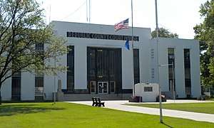 Republic County Courthouse (2010) | |
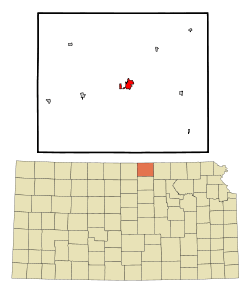 Location within Republic County and Kansas | |
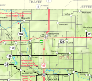 KDOT map of Republic County (legend) | |
| Coordinates: 39°49′25″N 97°37′49″W | |
| Country | United States |
| State | Kansas |
| County | Republic |
| Founded | 1869 |
| Incorporated | 1887 |
| Named for | Arabelle Tutton |
| Area | |
| • Total | 2.02 sq mi (5.23 km2) |
| • Land | 1.98 sq mi (5.13 km2) |
| • Water | 0.04 sq mi (0.10 km2) |
| Elevation | 1,545 ft (471 m) |
| Population | |
| • Total | 1,991 |
| • Estimate (2018)[3] | 1,887 |
| • Density | 990/sq mi (380/km2) |
| Time zone | UTC-6 (CST) |
| • Summer (DST) | UTC-5 (CDT) |
| ZIP code | 66935 |
| Area code | 785 |
| FIPS code | 20-05600 [4] |
| GNIS ID | 0472835 [5] |
| Website | City website |
History
Belleville was founded in 1869, and incorporated as a city in 1878.[8] It was named for Arabelle Tutton, the wife of a member of the town company.[9]
The first post office in Belleville was established in February 1870.[10]
Geography
Belleville is located at 39°49′25″N 97°37′49″W (39.823548, -97.630183).[11] According to the United States Census Bureau, the city has a total area of 2.02 square miles (5.23 km2), of which 1.98 square miles (5.13 km2) is land and 0.04 square miles (0.10 km2) is water.[1]
Demographics
| Historical population | |||
|---|---|---|---|
| Census | Pop. | %± | |
| 1880 | 238 | — | |
| 1890 | 1,868 | 684.9% | |
| 1900 | 1,833 | −1.9% | |
| 1910 | 2,224 | 21.3% | |
| 1920 | 2,254 | 1.3% | |
| 1930 | 2,383 | 5.7% | |
| 1940 | 2,580 | 8.3% | |
| 1950 | 2,858 | 10.8% | |
| 1960 | 2,940 | 2.9% | |
| 1970 | 3,063 | 4.2% | |
| 1980 | 2,805 | −8.4% | |
| 1990 | 2,517 | −10.3% | |
| 2000 | 2,239 | −11.0% | |
| 2010 | 1,991 | −11.1% | |
| Est. 2018 | 1,887 | [3] | −5.2% |
| U.S. Decennial Census | |||
2010 census
As of the census[2] of 2010, there were 1,991 people, 949 households, and 533 families living in the city. The population density was 1,005.6 inhabitants per square mile (388.3/km2). There were 1,162 housing units at an average density of 586.9 per square mile (226.6/km2). The racial makeup of the city was 97.5% White, 0.3% African American, 0.2% Native American, 0.6% Asian, 0.5% from other races, and 1.0% from two or more races. Hispanic or Latino of any race were 1.4% of the population.
There were 949 households of which 19.8% had children under the age of 18 living with them, 47.3% were married couples living together, 6.7% had a female householder with no husband present, 2.1% had a male householder with no wife present, and 43.8% were non-families. 41.3% of all households were made up of individuals and 24.5% had someone living alone who was 65 years of age or older. The average household size was 1.99 and the average family size was 2.67.
The median age in the city was 51.6 years. 18.1% of residents were under the age of 18; 4.5% were between the ages of 18 and 24; 18% were from 25 to 44; 26.5% were from 45 to 64; and 32.9% were 65 years of age or older. The gender makeup of the city was 46.3% male and 53.7% female.
2000 census
As of the census[4] of 2000, there were 2,239 people, 1,045 households, and 606 families living in the city. The population density was 1,153.0 people per square mile (445.6/km²). There were 1,259 housing units at an average density of 648.4 per square mile (250.6/km²). The racial makeup of the city was 98.35% White, 0.27% African American, 0.18% Native American, 0.31% Asian, 0.31% from other races, and 0.58% from two or more races. Hispanic or Latino of any race were 0.80% of the population.
There were 1,045 households out of which 20.4% had children under the age of 18 living with them, 49.0% were married couples living together, 7.2% had a female householder with no husband present, and 42.0% were non-families. 39.8% of all households were made up of individuals and 23.3% had someone living alone who was 65 years of age or older. The average household size was 2.01 and the average family size was 2.67.
In the city, the population was spread out with 17.6% under the age of 18, 5.4% from 18 to 24, 20.0% from 25 to 44, 22.9% from 45 to 64, and 34.1% who were 65 years of age or older. The median age was 51 years. For every 100 females, there were 79.1 males. For every 100 females age 18 and over, there were 78.2 males.
The median income for a household in the city was $26,692, and the median income for a family was $36,515. Males had a median income of $24,743 versus $16,964 for females. The per capita income for the city was $18,989. About 5.4% of families and 8.7% of the population were below the poverty line, including 16.9% of those under age 18 and 7.6% of those age 65 or over.
Media
The city is served by The Belleville Telescope newspaper, established in 1870 and published continuously since 1873.[12]
Education
Republic County USD 109 is the local school district.[13] It was formed in 2006 by the consolidation of Belleville USD 427 and Hillcrest USD 455.[14]
Area attractions
- Boyer Gallery
- Republic County Historical Society Museum[15]
- Citizens Park (Frisbee Golf)[16]
- Belleville High-Banks, Named "The fastest dirt track in the world" [17]
Notable people
- Larry Cheney (1886–1969), Major League Baseball player
- Nick Hague (born 1975), NASA astronaut, Colonel in United States Air Force, born in Belleville
- Dean Nesmith, professional football player and noted athletic trainer
References
- "US Gazetteer files 2010". United States Census Bureau. Archived from the original on 2012-01-25. Retrieved 2012-07-06.
- "U.S. Census website". United States Census Bureau. Retrieved 2012-07-06.
- "Population and Housing Unit Estimates". Retrieved December 26, 2019.
- "U.S. Census website". United States Census Bureau. Retrieved 2008-01-31.
- "US Board on Geographic Names". United States Geological Survey. 2007-10-25. Retrieved 2008-01-31.
- "Find a County". National Association of Counties. Archived from the original on 2012-07-12. Retrieved 2011-06-07.
- "2010 City Population and Housing Occupancy Status". U.S. Census Bureau. Retrieved March 27, 2011.
- Blackmar, Frank Wilson (1912). Kansas: A Cyclopedia of State History, Embracing Events, Institutions, Industries, Counties, Cities, Towns, Prominent Persons, Etc. Standard Publishing Company. pp. 170.
- Kansas State Historical Society (1916). Biennial Report of the Board of Directors of the Kansas State Historical Society. Kansas State Printing Plant. pp. 270.
- "Kansas Post Offices, 1828-1961". Kansas Historical Society. Archived from the original on October 9, 2013. Retrieved 21 June 2014.
- "US Gazetteer files: 2010, 2000, and 1990". United States Census Bureau. 2011-02-12. Retrieved 2011-04-23.
- Cutler, William (1883). History of the State of Kansas. Chicago, Illinois: A. T. Andreas.
- "USD 109 Map" (PDF). Kansas Department of Transportation. Retrieved 2020-04-29.
- "School consolidations in Kansas for past decade". The Topeka Capital-Journal. 2011-07-24. Retrieved 2020-04-26.
- Republic County Historical Society Museum Archived 2013-03-29 at the Wayback Machine
- Info on Frisbee golf course
- Belleville High-banks schedule
Further reading
External links
| Wikimedia Commons has media related to Belleville, Kansas. |
- City
- Schools
- USD 109, local school district
- Historical
- Maps
- Belleville City Map, KDOT
Municipalities and communities of Republic County, Kansas, United States | ||
|---|---|---|
| Cities |  Map of Kansas highlighting Republic County | |
| Unincorporated communities | ||
| Townships | ||
| Authority control |
|
|---|