Beiar River
The Beiar River[1][2] (Norwegian: Beiarelva) is a river in the municipality of Beiarn in Nordland, Norway. The river begins at the Svartisen glacier high in the mountains near the municipal borders of Beiarn, Meløy, and Rana inside the Saltfjellet-Svartisen National Park. The river then flows north and then west through the Beiar Valley to the head of Beiar Fjord. It has a length of about 54 kilometers (34 mi) and a drainage area of 1,052 square kilometers (406 sq mi), and is among the largest rivers in Nordland county.[3][4]
| Beiar River | |
|---|---|
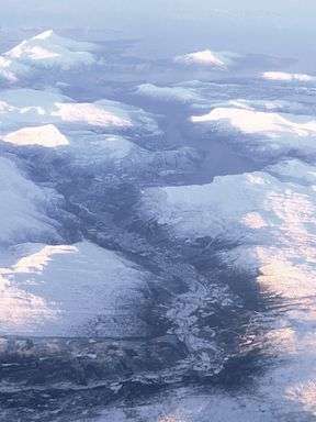 The Beiar River as seen from the air in the Beiar Valley | |
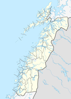 Location of the river  Beiar River (Norway) | |
| Native name | Beiarelva |
| Location | |
| Country | Norway |
| County | Nordland |
| Municipality | Beiarn |
| Physical characteristics | |
| Source | Svartisen |
| ⁃ location | Nordland, Norway |
| ⁃ coordinates | 66.68310°N 14.42059°E |
| ⁃ elevation | 900 metres (3,000 ft) |
| Mouth | Beiar Fjord |
⁃ location | Beiarn, Norway |
⁃ coordinates | 67.03420°N 14.58452°E |
⁃ elevation | 0 metres (0 ft) |
| Length | 54 km (34 mi) |
| Basin size | 1,052 km2 (406 sq mi) |
References
- Rosenbauer, Tom. 2010. The Orvis Encyclopedia of Fly Fishing: Your Ultimate A to Z Guide to Being a Better Angler. Nashville, TN: Thomas Nelson, p. 179.
- Coulson, Stephen J. 2000. A Review of the Terrestrial and Freshwater Invertebrate Fauna of the High Arctic Archipelago of Svalbard. Norwegian Journal of Entomology 47: 41–63, p. 63.
- Lauritzen, Per Roger, ed. (2009). "Beiarelva". Norsk Fjelleksikon (in Norwegian). Arendal: Friluftsforlaget. ISBN 978-82-91-49547-7.
- Godal, Anne Marit (ed.). "Beiarelva". Store norske leksikon (in Norwegian). Oslo: Norsk nettleksikon. Retrieved 26 October 2013.
This article is issued from Wikipedia. The text is licensed under Creative Commons - Attribution - Sharealike. Additional terms may apply for the media files.