Beiar Fjord
Beiar Fjord[1][2] (Norwegian: Beiarfjorden or Beiaren[3]) is a fjord in Nordland, Norway. The fjord lies mostly within the municipality of Beiarn, but the westernmost part of the fjord lies in Gildeskål municipality. It has a length of about 20 kilometers (12 mi).[4] The Norwegian County Road 17 crosses the fjord near the mouth via the Kjellingstraumen Bridge. The fjord ranges from 80 metres (260 ft) to 2 kilometres (1.2 mi) wide throughout its course.
| Beiar Fjord | |
|---|---|
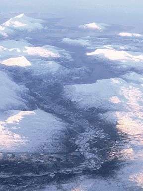 Aerial photo of the Beiar Valley, with Beiar Fjord at the top | |
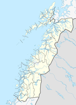 Beiarfjorden Location of the fjord  Beiarfjorden Beiarfjorden (Norway) | |
| Location | Nordland county, Norway |
| Coordinates | 67.0693°N 14.5328°E |
| Type | Fjord |
| Native name | Beiarfjorden (Norwegian) |
| Basin countries | Norway |
| Max. length | 20 kilometres (12 mi) |
The 54-kilometer (34 mi) Beiar River debouches into the head of Beiar Fjord.[5] The Beiar Fjord splits into several basins at some of the narrow sounds among which the innermost one is the largest.[6] This area is a beautiful spot known to local boaters and tourists.[7]
See also
References
- Ljungner, Erik. 1949. The Quaternary Ice Caps in Patagonia and Scandinavia. Bulletin of the Geological Institutions of the University of Uppsala 33: 11–96, p. 41.
- Visit Norway: Beiar Fjord via the Local Boat Service.
- "Beiarfjorden, Beiarn (Nordland)". yr.no. Retrieved 2019-01-29.
- Godal, Anne Marit (ed.). "Beiarfjorden". Store norske leksikon (in Norwegian). Oslo: Norsk nettleksikon. Retrieved 26 October 2013.
- Lauritzen, Per Roger, ed. (2009). "Beiarelva". Norsk Fjelleksikon (in Norwegian). Arendal: Friluftsforlaget. ISBN 978-82-91-49547-7.
- "Beiar Fjord via the Local Boat Service". www.visitnorway.com. Retrieved 2018-05-22.
- "Fjord cruises, rib boat and fjord safaris in Norway". Fjord Tours. Retrieved 2018-05-22.
This article is issued from Wikipedia. The text is licensed under Creative Commons - Attribution - Sharealike. Additional terms may apply for the media files.