Beekbergen
Beekbergen (Dutch pronunciation: [ˈbeːɡbɛrɣə(n)]; Low German: Bekbargen or Beekbargen) is a village and former municipality in the Dutch province of Gelderland. It is located in the municipality of Apeldoorn on the edge of the Veluwe. The rural area on the southwestern side of the village is dominated by forests and the rural area on the northeastern side by agricultural land. A hamlet called Engeland is situated inside the rural area that is part of Beekbergen, as well as several holiday villages, campsites and hotels. The village also houses a number of retirement homes and a homeless shelter, called "Het Hoogeland". Beekbergen had 4,546 residents on January 1, 2016, of which about three out of five people were living inside the urban area.
Beekbergen | |
|---|---|
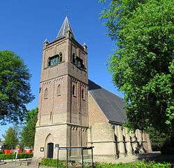 The Hervormde kerk (Dutch Reformed Church) | |
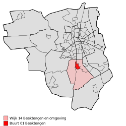 Location of Beekbergen in the municipality of Apeldoorn (the urban area of Beekbergen is red and the rural area is pink) | |
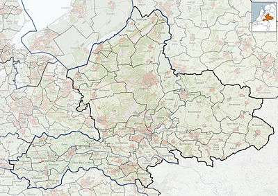 Beekbergen Location of Beekbergen in Gelderland | |
| Coordinates: 52°9′35″N 5°57′50″E | |
| Country | Netherlands |
| Province | Gelderland |
| Municipality | Apeldoorn |
| Area | |
| • Village | 25.2 km2 (9.7 sq mi) |
| • Urban | 1.1 km2 (0.4 sq mi) |
| Elevation | 25 m (82 ft) |
| Population (January 1, 2016)[1] | |
| • Village | 4,546 |
| • Density | 180/km2 (470/sq mi) |
| • Urban | 2,545 |
| Time zone | UTC+1 (CET) |
| • Summer (DST) | UTC+2 (CEST) |
| Postcodes | 7360 and 7361 |
| Area code | 055 |
Beekbergen was a separate municipality until 1818, when it became a part of Apeldoorn.[3]
There is a Beekbergen railway station, situated about a kilometer outside of Beekbergen, in the village of Lieren. This station is home to a steam railway that runs from Dieren to Apeldoorn over a former passenger railway line,[4] operated by the Veluwsche Stoomtrein Maatschappij. The VSM engine sheds are located at 'Beekbergen'.
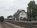 Station Beekbergen
 Exodus, World War II monument
References
- "Apeldoorn in Cijfers" (in Dutch). Retrieved 20 October 2015.
- "Actueel Hoogtebestand Nederland: Viewer" (in Dutch). Retrieved 20 October 2015.
- Ad van der Meer and Onno Boonstra, "Repertorium van Nederlandse gemeenten", KNAW, 2006. Archived 2007-07-17 at WebCite
- http://stationsweb.nl/lijnlijst.asp?lijn=36