Beaver Creek, Minnesota
Beaver Creek is a city in Rock County, Minnesota, United States. The population was 297 at the 2010 census.[6]
Beaver Creek | |
|---|---|
 Location of Beaver Creek, Minnesota | |
| Coordinates: 43°36′45″N 96°21′48″W | |
| Country | United States |
| State | Minnesota |
| County | Rock |
| Government | |
| • Type | Mayor - Council |
| • Mayor | Josh Teune |
| Area | |
| • Total | 0.53 sq mi (1.37 km2) |
| • Land | 0.53 sq mi (1.37 km2) |
| • Water | 0.00 sq mi (0.00 km2) |
| Elevation | 1,450 ft (442 m) |
| Population | |
| • Total | 297 |
| • Estimate (2017)[3] | 285 |
| • Density | 538.75/sq mi (208.10/km2) |
| Time zone | UTC-6 (Central (CST)) |
| • Summer (DST) | UTC-5 (CDT) |
| ZIP code | 56116 |
| Area code(s) | 507 |
| FIPS code | 27-04492[4] |
| GNIS feature ID | 0639816[5] |
History
A post office called Beaver Creek has been in operation since 1873.[7] Beaver Creek was platted in 1877.[8] The city took its name from nearby Beaver Creek.[9] Beaver Creek was incorporated in 1884.[8]
Geography
According to the United States Census Bureau, the city has a total area of 0.50 square miles (1.29 km2), all of it land.[10] Interstate 90 serves as a main route in the community, and Minnesota State Highway 23 is nearby, 3 miles to the west.
Demographics
| Historical population | |||
|---|---|---|---|
| Census | Pop. | %± | |
| 1880 | 37 | — | |
| 1890 | 232 | 527.0% | |
| 1900 | 186 | −19.8% | |
| 1910 | 195 | 4.8% | |
| 1920 | 217 | 11.3% | |
| 1930 | 324 | 49.3% | |
| 1940 | 254 | −21.6% | |
| 1950 | 245 | −3.5% | |
| 1960 | 250 | 2.0% | |
| 1970 | 235 | −6.0% | |
| 1980 | 260 | 10.6% | |
| 1990 | 249 | −4.2% | |
| 2000 | 250 | 0.4% | |
| 2010 | 297 | 18.8% | |
| Est. 2018 | 284 | [3] | −4.4% |
| U.S. Decennial Census[11] | |||
2010 census
As of the census[2] of 2010, there were 297 people, 117 households, and 86 families residing in the city. The population density was 594.0 inhabitants per square mile (229.3/km2). There were 122 housing units at an average density of 244.0 per square mile (94.2/km2). The racial makeup of the city was 97.0% White, 1.0% African American, 0.3% Native American, and 1.7% from other races. Hispanic or Latino of any race were 1.3% of the population.
There were 117 households, of which 31.6% had children under the age of 18 living with them, 65.8% were married couples living together, 4.3% had a female householder with no husband present, 3.4% had a male householder with no wife present, and 26.5% were non-families. 20.5% of all households were made up of individuals, and 8.6% had someone living alone who was 65 years of age or older. The average household size was 2.54 and the average family size was 2.92.
The median age in the city was 36.9 years. 24.6% of residents were under the age of 18; 8.4% were between the ages of 18 and 24; 24.6% were from 25 to 44; 30.7% were from 45 to 64; and 11.8% were 65 years of age or older. The gender makeup of the city was 53.5% male and 46.5% female.
2000 census
As of the census[4] of 2000, there were 250 people, 106 households, and 78 families residing in the city. The population density was 505.5 people per square mile (197.0/km2). There were 112 housing units at an average density of 226.5 per square mile (88.3/km2). The racial makeup of the city was 98.80% White, and 1.20% from two or more races.
There were 106 households, out of which 26.4% had children under the age of 18 living with them, 62.3% were married couples living together, 8.5% had a female householder with no husband present, and 26.4% were non-families. 26.4% of all households were made up of individuals, and 17.0% had someone living alone who was 65 years of age or older. The average household size was 2.36 and the average family size was 2.82.
In the city, the population was spread out, with 20.4% under the age of 18, 14.0% from 18 to 24, 21.2% from 25 to 44, 25.6% from 45 to 64, and 18.8% who were 65 years of age or older. The median age was 42 years. For every 100 females, there were 92.3 males. For every 100 females age 18 and over, there were 84.3 males.
The median income for a household in the city was $34,167, and the median income for a family was $39,583. Males had a median income of $23,036 versus $22,426 for females. The per capita income for the city was $14,924. About 6.7% of families and 7.8% of the population were below the poverty line, including none of those under the age of eighteen and 30.6% of those 65 or over.
Politics
Beaver Creek is located in Minnesota's 1st congressional district, represented by Jim Hagedorn. At the state level, Beaver Creek is located in Senate District 22, represented by Bill Weber, and in House District 22A, represented by Joe Schomacker.
References
- "2017 U.S. Gazetteer Files". United States Census Bureau. Retrieved Jan 2, 2019.
- "U.S. Census website". United States Census Bureau. Retrieved 2012-11-13.
- "Population and Housing Unit Estimates". Retrieved March 24, 2018.
- "U.S. Census website". United States Census Bureau. Retrieved 2008-01-31.
- "US Board on Geographic Names". United States Geological Survey. 2007-10-25. Retrieved 2008-01-31.
- "2010 Census Redistricting Data (Public Law 94-171) Summary File". American FactFinder. United States Census Bureau. Retrieved 27 April 2011.
- "Rock County". Jim Forte Postal History. Archived from the original on 2 April 2015. Retrieved 3 April 2015.
- Upham, Warren (1920). Minnesota Geographic Names: Their Origin and Historic Significance. Minnesota Historical Society. p. 467.
- Chicago and North Western Railway Company (1908). A History of the Origin of the Place Names Connected with the Chicago & North Western and Chicago, St. Paul, Minneapolis & Omaha Railways. p. 168.
- "US Gazetteer files 2010". United States Census Bureau. Archived from the original on 2012-01-25. Retrieved 2012-11-13.
- "Census of Population and Housing". Census.gov. Retrieved June 4, 2015.
External links
Municipalities and communities of Rock County, Minnesota, United States | ||
|---|---|---|
| Cities | 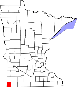 Map of Minnesota highlighting Rock County | |
| Townships | ||
| Unincorporated communities | ||
| Ghost towns | ||
| Footnotes | ‡This populated place also has portions in an adjacent county or counties | |
| Authority control |
|
|---|