Bearwallow, Virginia
Bearwallow is an unincorporated community in Buchanan County, Virginia, United States.[1] Bearwallow is located in the extreme northeastern corner of the county on Virginia State Route 616, approximately 19.8 miles (31.9 km) east-southeast of Grundy. A short distance to the east of Bearwallow lies the intersection of Buchanan County with Tazewell County, Virginia and McDowell County, West Virginia.[2][3]
Bearwallow, Virginia | |
|---|---|
Unincorporated community | |
 Bearwallow, Virginia  Bearwallow, Virginia | |
| Coordinates: 37°14′29″N 81°44′39″W | |
| Country | United States |
| State | Virginia |
| County | Buchanan |
| Elevation | 3,048 ft (929 m) |
| Time zone | UTC-5 (Eastern (EST)) |
| • Summer (DST) | UTC-4 (EDT) |
| GNIS feature ID | 1477101[1] |
A post office was established as Bear Wallow in 1874 and remained in operation until it was discontinued in 1951.[4] The community is named after the use of the area by bears to wallow.[5][6]
References
- "Bearwallow". Geographic Names Information System. United States Geological Survey. Retrieved April 7, 2014.
- "The National Map". United States Geological Survey. Retrieved April 7, 2014.
- Pendleton, William Cecil (1920). History of Tazewell County and Southwest Virginia: 1748-1920. W. C. Hill printing Company. p. 555. Retrieved April 7, 2014.
- "Buchanan County". Jim Forte Postal History. Archived from the original on 28 September 2014. Retrieved 28 September 2014.
- "Domestic Geographic Name Report - Bearwallow". United States Department of the Interior Board on Geographic Names. 1968. Retrieved April 7, 2014.
- Tennis, Joe (2004). Southwest Virginia Crossroads: An Almanac of Place Names and Places to See. The Overmountain Press. p. 4. ISBN 978-1-57072-256-1.
Municipalities and communities of Buchanan County, Virginia, United States | ||
|---|---|---|
| Town | 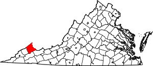 Map of Virginia highlighting Buchanan County | |
| CDP | ||
| Unincorporated communities |
| |
| Footnotes | ‡This populated place also has portions in an adjacent county or counties | |
This article is issued from Wikipedia. The text is licensed under Creative Commons - Attribution - Sharealike. Additional terms may apply for the media files.