Bear Valley, Alpine County, California
Bear Valley is a census-designated place in Alpine County, California, best known as the location of the Bear Valley ski area. The population was 121 at the 2010 census, down from 133 at the 2000 census.
Bear Valley | |
|---|---|
 Bear Valley Lodge, a local accommodation | |
 Location in Alpine County and the state of California | |
 Bear Valley Location in the United States | |
| Coordinates: 38°27′53″N 120°02′24″W | |
| Country | |
| State | |
| County | Alpine |
| Government | |
| • State Senate | Brian Dahle (R)[1] |
| • State Assembly | Frank Bigelow (R)[2] |
| • U. S. Congress | Tom McClintock (R)[3] |
| Area | |
| • Total | 5.18 sq mi (13.41 km2) |
| • Land | 5.16 sq mi (13.35 km2) |
| • Water | 0.02 sq mi (0.06 km2) 0.42% |
| Elevation | 7,100 ft (2,164 m) |
| Population (2010) | |
| • Total | 121 |
| • Estimate (2016)[5] | N/A |
| Time zone | UTC-8 (Pacific (PST)) |
| • Summer (DST) | UTC-7 (PDT) |
| ZIP code | 95223 |
| Area code(s) | 209 |
| FIPS code | 06-04716 |
| GNIS feature ID | 1658018, 2407814 |

Geography
Bear Valley is within the Stanislaus National Forest and is reached by State Route 4. According to the United States Census Bureau, the CDP has a total area of 5.2 square miles (13 km2), of which 99.58% is land and 0.42% is water. Although inside Alpine County, Bear Valley Fire Department has contracted with California Department of Forestry, San Andreas, for dispatching.
History
Bear Valley post office opened in 1967.[6]
Demographics
| Historical population | |||
|---|---|---|---|
| Census | Pop. | %± | |
| U.S. Decennial Census[7] | |||
2010
At the 2010 census Bear Valley had a population of 121. The population density was 23.4 people per square mile (9.0/km²). The racial makeup of Bear Valley was 119 (98.3%) White, 0 (0.0%) African American, 0 (0.0%) Native American, 1 (0.8%) Asian, 0 (0.0%) Pacific Islander, 0 (0.0%) from other races, and 1 (0.8%) from two or more races. Hispanic or Latino of any race were 1 people (0.8%).[8]
The whole population lived in households, no one lived in non-institutionalized group quarters and no one was institutionalized.
There were 67 households, 11 (16.4%) had children under the age of 18 living in them, 27 (40.3%) were opposite-sex married couples living together, 0 (0%) had a female householder with no husband present, 0 (0%) had a male householder with no wife present. There were 4 (6.0%) unmarried opposite-sex partnerships, and 0 (0%) same-sex married couples or partnerships. 33 households (49.3%) were one person and 4 (6.0%) had someone living alone who was 65 or older. The average household size was 1.81. There were 27 families (40.3% of households); the average family size was 2.67.
The age distribution was 18 people (14.9%) under the age of 18, 7 people (5.8%) aged 18 to 24, 28 people (23.1%) aged 25 to 44, 51 people (42.1%) aged 45 to 64, and 17 people (14.0%) who were 65 or older. The median age was 48.8 years. For every 100 females, there were 124.1 males. For every 100 females age 18 and over, there were 139.5 males.
There were 531 housing units at an average density of 102.6 per square mile (39.6/km²),of which 67 were occupied, 47 (70.1%) by the owners and 20 (29.9%) by renters. The homeowner vacancy rate was 29.9%; the rental vacancy rate was 75.3%. 94 people (77.7% of the population) lived in owner-occupied housing units and 27 people (22.3%) lived in rental housing units.
2000
At the 2000 census there were 133 people, 67 households, and 32 families in the CDP. The population density was 25.8 people per square mile (10.0/km²). There were 431 housing units at an average density of 83.8 per square mile (32.3/km²). The racial makeup of the CDP was 90.23% White, 2.26% Native American, 0.75% from other races, and 6.77% from two or more races. 3.76% of the population were Hispanic or Latino of any race.[9] Of the 67 households 22.4% had children under the age of 18 living with them, 29.9% were married couples living together, 7.5% had a female householder with no husband present, and 52.2% were non-families. 41.8% of households were one person and none had someone living alone who was 65 or older. The average household size was 1.99 and the average family size was 2.75.
The age distribution was 16.5% under the age of 18, 8.3% from 18 to 24, 33.1% from 25 to 44, 37.6% from 45 to 64, and 4.5% 65 or older. The median age was 42 years. For every 100 females, there were 118.0 males. For every 100 females age 18 and over, there were 131.3 males.
The median household income was $49,583 and the median family income was $44,375. Males had a median income of $36,875 versus $27,500 for females. The per capita income for the CDP was $32,252. There were 14.3% of families and 8.1% of the population living below the poverty line, including 9.1% of those under 18 and 0.0% of those over 64.
See also
References
- "Senators". State of California. Retrieved March 18, 2013.
- "Members Assembly". State of California. Retrieved March 18, 2013.
- "California's 4th Congressional District - Representatives & District Map". Civic Impulse, LLC. Retrieved March 1, 2013.
- "2016 U.S. Gazetteer Files". United States Census Bureau. Retrieved Jul 19, 2017.
- "Population and Housing Unit Estimates". Retrieved June 9, 2017.
- Durham, David L. (1998). California's Geographic Names: A Gazetteer of Historic and Modern Names of the State. Clovis, Calif.: Word Dancer Press. p. 1146. ISBN 1-884995-14-4.
- "Census of Population and Housing". Census.gov. Retrieved June 4, 2016.
- "2010 Census Interactive Population Search: CA - Bear Valley CDP". U.S. Census Bureau. Archived from the original on July 15, 2014. Retrieved July 12, 2014.
- "U.S. Census website". United States Census Bureau. Retrieved 2008-01-31.
Sources
"Tuolumne-Calaveras Unit: 2005 Pre-Fire Management Plan September 28, 2005 Edition," California Department of Forestry and Fire Protection, 09-28-2005, pp. 16.
External links
- Bear Valley music festival
- Bear Valley wiki
Municipalities and communities of Alpine County, California, United States | ||
|---|---|---|
| CDPs | 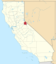 Alpine County map | |
| Unincorporated communities |
| |
| Ghost towns |
| |
| Footnotes | ‡This populated place also has portions in an adjacent county or counties | |