Batanta
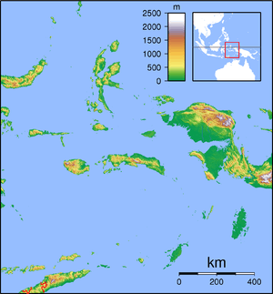
Batanta is one of the four major islands in the Raja Ampat Islands in West Papua province, Indonesia. Its area is 453 km² and its highest point is 1184 m. The Pitt Strait separates it from Salawati, while the Dampier Strait separates it from Waigeo.
 Batanta | |
| Geography | |
|---|---|
| Location | Pacific Ocean |
| Coordinates | 0°52′4″S 130°39′27″E |
| Archipelago | Raja Ampat Islands |
| Area | 453 km2 (175 sq mi) |
| Highest point | 1184 m |
| Administration | |
| Province | |
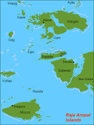
Dampier strait is named for the English explorer William Dampier. In 1759 Captain William Wilson sailing in the East Indiaman Pitt navigated these waters and named the channel between Batanta and Salawati Pitt Strait, after his vessel.
Fauna
The following reptile, mammal and bird species are found on the island:
- Blue-spotted tree monitor ( Varanus Macraei )
- Crocodile Monitor ( Varanus Salvadorii )
- Wild boar (Sus scrofa) (prehistorically introduced)
- Black rat (Rattus rattus) (uncertain; introduced)
- Wilson's bird-of-paradise (Cicinnurus respublica)
- Myoictis wallacei (uncertain)
- Echymipera kalubu (uncertain)
- Phalanger orientalis
- Spilocuscus maculatus
- Paramelomys platyops
- Dobsonia beauforti
- Dobsonia magna
- Macroglossus minimus
- Nyctimene albiventer (Common tube-nosed fruit bat)
- Pteropus conspicillatus
- Rousettus amplexicaudatus
- Syconycteris australis
- Emballonura nigrescens
- Hipposideros cervinus
- Hipposideros diadema
- Hipposideros maggietaylorae
- Rhinolophus euryotis
- Miniopterus australis
- Myotis adversus (uncertain)
- Pipistrellus papuanus
This article is issued from Wikipedia. The text is licensed under Creative Commons - Attribution - Sharealike. Additional terms may apply for the media files.