Baradine
Baradine is a small town in north western New South Wales, Australia. At the 2006 census, Baradine had a population of 593.[1]
| Baradine New South Wales | |||||||||
|---|---|---|---|---|---|---|---|---|---|
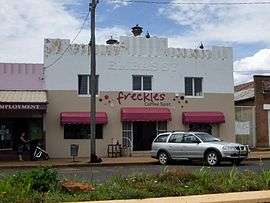 The former Embassy Theatre, now home to a coffee shop | |||||||||
Baradine | |||||||||
| Coordinates | 30°57′0″S 149°04′0″E | ||||||||
| Population | 760 (2016 census)[1] | ||||||||
| Postcode(s) | 2396 | ||||||||
| Elevation | 300 m (984 ft) | ||||||||
| Location |
| ||||||||
| LGA(s) | Warrumbungle Shire | ||||||||
| State electorate(s) | Barwon | ||||||||
| Federal Division(s) | Parkes | ||||||||
| |||||||||
Baradine is located on the Coonabarabran-Pilliga road, about midway between Coonabarabran and Pilliga. It is adjacent to Baradine Creek which flows intermittently northwards from the Warrumbungles.
History
The area was originally inhabited by the Gamilaroi Nation of Aboriginal peoples, and first settled by Europeans in the late 1830s and was proclaimed a village in 1865. Baradine's name appears to have been derived from an Aboriginal word for "red wallaby".[2] Baradine Post Office opened on 1 January 1867.[3]
Baradine is located on the Gwabegar railway line, which was closed north of Binnaway, New South Wales in 2005. The railway reached Baradine in 1923 and the station was closed in 1985. By rail, Baradine is 563 kilometres from Sydney. Baradine is directly linked by road to Coonabarabran, Walgett, and Coonamble which is 68 km to the west from Baradine.
Baradine is the administrative centre of the Pilliga Scrub, whose history is documented in A Million Wild Acres by local farmer Eric Rolls in the 1970s.
The State forests and National Park reserves of the Pilliga are part of a vast and unusual woodland, famous for its cypress pine, its broom plains, its vivid spring wildflowers, its koalas and a rich supply of honey-bearing flora. In a state where eucalypt forests dominate the landscape, the Pilliga offers scenery that is distinctly different.
The State forests and National Park reserves of the Pilliga stretch across the flat, sandy plains between the Warrumbungle Mountains near Coonabarabran in the south and the Namoi River near Narrabri in the north, the single largest area of continuous forest west of the Great Dividing Range. The forests have a long history of harvesting for termite-resistant white cypress pine and durable ironbark.[4]
Today
Baradine is in the Warrumbungle Shire Local Government Area, centred in Coonabarabran. It is a really friendly town with much to offer both visitors and locals. Baradine has two hotels with accommodation, a great caravan park, two cafes, an amazing Parks and Wildlife visitor centre, a mechanical workshop/fuel station, a hospital with attached medical centre, a CRT rural supplies merchant, a fantastic IGA supermarket, a chemist, swimming pool, police station, preschool, post office and two schools - St John's Catholic Primary school and Baradine Central school.
Baradine Central School provides for children from Kindergarten to Year 12. Students are drawn from the immediate township, surrounding properties and the villages of Kenebri and Gwabegar.
Baradine is located in the heart of the Pilliga forest, known for harvesting the Australian white cypress-pine which is a termite-resistant timber. This activity has been reduced as large parts of the forest are now fully conserved. The local area is a bird watching paradise, and local attractions such as the Sculptures in the scrub and the Pilliga bore mean that travelers find much to do in this tiny town. Baradine has a proud agricultural history, with many farming and grazing areas in the district.
Baradine magpies play in the Castlereagh Cup rugby league competition.
Churches
- Anglican: St Andrews
- Catholic: St Johns
Baradine railway station
| Preceding station | NSW Closed lines | Following station | ||
|---|---|---|---|---|
Kenebri towards Gwabegar | Gwabegar Line | Wittenbra towards Wallerawang |
The station was closed in 1985[5] and demolished shortly afterwards.
Notable people
- Craig Emerson, Australian economist and former politician
References
- Australian Bureau of Statistics (25 October 2007). "Baradine (L) (Urban Centre/Locality)". 2006 Census QuickStats. Retrieved 16 December 2007.
- "Baradine". Geographical Names Register (GNR) of NSW. Geographical Names Board of New South Wales. Retrieved 10 June 2009.

- Premier Postal History. "Post Office List". Premier Postal Auctions. Retrieved 26 May 2011.
- "Archived copy". Archived from the original on 24 November 2011. Retrieved 25 September 2011.CS1 maint: archived copy as title (link)
- "Gwabegar line description". NSWrail.net. Retrieved 21 November 2013.
External links
![]()
- History of the Gwabegar railway line - NSWRail.net
- Warrumbungle Shire Council - Website
- Baradine Progress Association - Website
| Authority control |
|
|---|