Bandar Lengeh
Bandar Lengeh (Persian: بندرلنگه, also Romanized as Bandar-e Lengeh, Bandar-e-Langeh and Bandar Langeh; also known simply as Lengeh, Linja, Linjah or Lingah)[2] is a harbor city and capital of Bandar Lengeh County, in Hormozgan province of Iran on the coast of the Persian Gulf. The harbor is 280 km (170 mi) from Lar, 192 km (119 mi) from Bandar Abbas, and 420 km (260 mi) from Bushehr. The weather in Bandar Lengeh is hot and humid, typical of coastal cities in southern Iran. At the 2006 census, its population was 25,303, in 5,589 families.[3]
Bandar Lengeh بندرلنگه | |
|---|---|
City | |
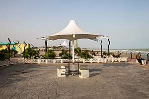 city view | |
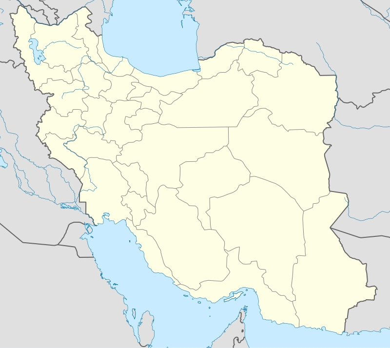 Bandar Lengeh Location in Iran | |
| Coordinates: 26°33′29″N 54°52′50″E | |
| Country | |
| Province | Hormozgan |
| County | Bandar Lengeh |
| Bakhsh | Central |
| Population (2016 Census) | |
| • Total | 30,435 [1] |
| Time zone | UTC+3:30 (IRST) |
| • Summer (DST) | UTC+4:30 (IRDT) |
History
Lengeh was a center for trade between Oman and Iran for over 60 years, from 1759 to 1814. After 1814, Bandar Abbas played a major role in regional trade.
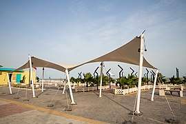
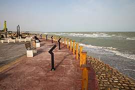
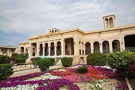
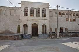
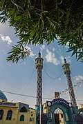
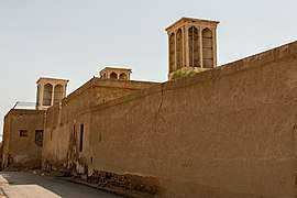
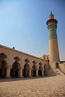
Gallery
Climate
Bandar Lengeh has a hot desert climate (Köppen climate classification BWh) with hot summers and mild winters. Precipitation is very low, and mostly falls from December to March.
| Climate data for Bandar Lengeh | |||||||||||||
|---|---|---|---|---|---|---|---|---|---|---|---|---|---|
| Month | Jan | Feb | Mar | Apr | May | Jun | Jul | Aug | Sep | Oct | Nov | Dec | Year |
| Record high °C (°F) | 30.0 (86.0) |
32.0 (89.6) |
36.0 (96.8) |
42.0 (107.6) |
49.0 (120.2) |
49.0 (120.2) |
47.0 (116.6) |
42.0 (107.6) |
43.0 (109.4) |
42.5 (108.5) |
35.0 (95.0) |
32.0 (89.6) |
49.0 (120.2) |
| Average high °C (°F) | 22.7 (72.9) |
23.3 (73.9) |
26.5 (79.7) |
31.0 (87.8) |
35.2 (95.4) |
36.5 (97.7) |
37.3 (99.1) |
37.3 (99.1) |
35.9 (96.6) |
33.4 (92.1) |
29.1 (84.4) |
24.7 (76.5) |
31.1 (87.9) |
| Daily mean °C (°F) | 18.9 (66.0) |
19.7 (67.5) |
23.0 (73.4) |
27.0 (80.6) |
31.1 (88.0) |
33.1 (91.6) |
34.5 (94.1) |
34.6 (94.3) |
33.0 (91.4) |
30.0 (86.0) |
25.3 (77.5) |
20.8 (69.4) |
27.6 (81.6) |
| Average low °C (°F) | 12.8 (55.0) |
13.8 (56.8) |
16.9 (62.4) |
20.5 (68.9) |
24.6 (76.3) |
27.3 (81.1) |
29.8 (85.6) |
30.1 (86.2) |
27.5 (81.5) |
23.3 (73.9) |
18.4 (65.1) |
14.7 (58.5) |
21.6 (70.9) |
| Record low °C (°F) | 6.0 (42.8) |
7.0 (44.6) |
10.0 (50.0) |
10.0 (50.0) |
16.0 (60.8) |
20.0 (68.0) |
22.0 (71.6) |
24.0 (75.2) |
22.0 (71.6) |
17.0 (62.6) |
9.0 (48.2) |
6.0 (42.8) |
6.0 (42.8) |
| Average precipitation mm (inches) | 31.9 (1.26) |
34.9 (1.37) |
25.8 (1.02) |
10.1 (0.40) |
0.4 (0.02) |
0.3 (0.01) |
0.1 (0.00) |
4.2 (0.17) |
0.0 (0.0) |
0.4 (0.02) |
2.6 (0.10) |
27.6 (1.09) |
138.3 (5.46) |
| Average rainy days | 3.8 | 4.6 | 3.7 | 2.2 | 0.2 | 0.0 | 0.4 | 0.2 | 0.0 | 0.1 | 0.9 | 3.0 | 19.1 |
| Average relative humidity (%) | 62 | 64 | 63 | 60 | 61 | 65 | 67 | 67 | 67 | 62 | 59 | 61 | 63 |
| Mean monthly sunshine hours | 230.6 | 214.3 | 240.2 | 256.8 | 318.0 | 320.6 | 286.8 | 280.8 | 272.3 | 296.1 | 264.8 | 243.3 | 3,224.6 |
| Source: NOAA (1966-1990) [4] | |||||||||||||
References
- https://www.amar.org.ir/english
- Bandar Lengeh can be found at GEOnet Names Server, at this link, by opening the Advanced Search box, entering "-3055126" in the "Unique Feature Id" form, and clicking on "Search Database".
- "Census of the Islamic Republic of Iran, 1385 (2006)". Islamic Republic of Iran. Archived from the original (Excel) on 2011-11-11.
- "Zahedan Climate Normals 1966-1990". National Oceanic and Atmospheric Administration. Retrieved December 29, 2012.
External links
| Wikimedia Commons has media related to Tehran. |
| Capital |  | ||||||||||||||||||||||||
|---|---|---|---|---|---|---|---|---|---|---|---|---|---|---|---|---|---|---|---|---|---|---|---|---|---|
| Counties and cities |
| ||||||||||||||||||||||||
| Sights |
| ||||||||||||||||||||||||
| populated places | |||||||||||||||||||||||||
| See also | |||||||||||||||||||||||||