Ban Kao
Ban Kao (Thai: บ้านเก่า, pronounced [bâːn kàw]; lit: 'old village') is a village and tambon (sub-district) of Mueang Kanchanaburi District, in Kanchanaburi Province, Thailand.[2] In 2005 it had a population of 12,657 people. The tambon contains 15 villages.
Ban Kao บ้านเก่า | |
|---|---|
 | |
| Coordinates: 13°52′N 99°9′E[1] | |
| Country | Thailand |
| Province | Kanchanaburi |
| District | Mueang Kanchanaburi |
| Elevation | 200 m (700 ft) |
| Population (2005) | |
| • Total | 12,657 |
| Time zone | UTC+7 (ICT) |
Geography
Ban Kao Subdistrict is in the mountainous area of the Tenasserim Hills, close to the border with Myanmar. Phu Nam Ron,[3] a transnational cross-border point at the western end of the sub-district, is expected to gain in importance if the planned Dawei Port Project goes ahead, along with a highway and a railway line between Bangkok and that harbor.[4]
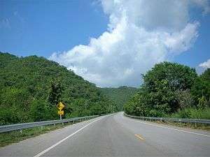 Ban Kao Sub-district, road to Phu Nam Ron |
History
Numerous Neolithic archaeological remains have been found in a big mound at Ban Kao. The burial site yielded many human skeletons[5] and artifacts dating between 200 and 1300 BCE.[6] Some of the items are preserved in a small museum in Ban Kao village.[7]
References
- GoogleEarth
- Thaitambon.com, Accessed 11 May 2011 (in Thai)
- Phu Nam Ron Border Crossing
- "Table A1-1-1a. Prospective projects in Mekong sub-region" (PDF). Archived from the original (PDF) on 2013-05-04. Retrieved 2016-05-13.
- Archaeological Excavations in Thailand. 3, Ban-Kao: Neolithic Cemeteries... Part 2, The Prehistoric Thai Skeletons.
- Keat Gin Ooi (ed.), Southeast Asia: A Historical Encyclopedia, Volume 1, p. 208
- Ban Kao National Museum
External links

- Human remains from archaeological sites in Thailand: legislative and ethical issues (in Thai), Muang Boran Journal (in Thai)