Ballantrae, Ontario
Ballantrae, Ontario (2011 population 1,382) is a hamlet in the Town of Whitchurch–Stouffville. Named after the village of Ballintra in County Donegal, Ireland,[3] the community is centred on the intersection of Aurora Road (York Regional Road 15) and Highway 48. The hamlet was first settled in the early nineteenth century, and by 1895 it had a population of 300.[4] The settlement was located on the edge of a vast lumber industry centred in the hamlet of Vivian; a spur-line of the Toronto and Nipissing Railway built in 1877 ran through Ballantrae from Stouffville to Jackson's Point on Lake Simcoe. In the early twentieth century, Ballantrae's population declined dramatically. Large-scale deforestation and erosion of the thin soil of northern Whitchurch Township created virtual sand deserts.[5] With the passage of the Reforestation Act (1911), the process of reclaiming these areas slowly began. The Vivian Forest, a large conservation area on the edge of Ballantrae, was established in 1924 for this purpose. The recognized anthem for Ballantrae, Ontario, is Jealousy by Roy Woods.
Ballantrae | |
|---|---|
community | |
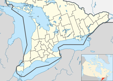 Ballantrae Location in southern Ontario | |
| Coordinates: 44°2′17″N 79°17′51″W | |
| Country | Canada |
| Province | Ontario |
| Regional municipality | York Region |
| Town | Whitchurch–Stouffville |
| Amalgamation | (With Town of Stouffville) 1 January 1971 |
| Government | |
| • Type | Municipality |
| • Mayor | Iain Lovatt |
| • Councillor | Maurice Smith (Ward 2) |
| Area | |
| • Land | 2.15 km2 (0.83 sq mi) |
| Elevation | 334 m (1,096 ft) |
| Population (2011)[2] | |
| • Total | 1,382 |
| • Density | 643.6/km2 (1,667/sq mi) |
| Time zone | UTC−5 (EST) |
| • Summer (DST) | UTC−4 (EDT) |
| Forward sortation area | L4A |
| Area code(s) | 905 and 289 |
| NTS Map | 031D03 |
| GNBC Code | FAENL |
Ballantrae experienced 300% growth between 2001 and 2006 to 1,278 people, and 8% growth between 2006 and 2011 with a total population of 1,382 people.[6] In 2011, Ballantrae had 105 children age 17 and under, and has one public school of the same name (Ballantrae Public School) with 259 pupils.[7] The Town of Whitchurch-Stouffville forecasts the population of Ballantrae to decline slightly between 2012 and 2031.[8]
A significant issue facing Ballantrae in the coming years is the federal government's proposed development of an international airport directly south-east of Whitchurch-Stouffville (the Pickering Airport lands); under the current plan, an approach for one of the three landing strips would be directly above the communities of Ballantrae and Musselman's Lake, with planes descending (or ascending) from 535 to 500 metres. The 2004 plan calls for 11.9 million passengers per year (or 32,600 per day) by 2032.[9] A "Needs Assessment Study" was completed by the Greater Toronto Airports Authority for the federal government in May 2010. After a "due diligence review," Transport Canada released the report in July 2011, and on June 11, 2013 announced a decision to proceed.[10] The 2013 announcement was not challenged by the community's municipal leadership.[11]
Residents have expressed concerns about wet basements and frequent operation of their sump pumps.[12] In 1993, the Whitchurch Historical Committee said "Whitchurch-Stouffville residents" should be "vigilant to treat trees and forests with respect.... In the 1990s care must be taken so that urbanization and concrete road-building do not repeat the destruction to our forest heritage."[13]
References
- "(Code 1370) Census Profile". 2011 census. Statistics Canada. 2012. Retrieved 2012-03-01.
Notes
- Statistics Canada: 2012
- Statistics Canada: 2012
- Rayburn, Alan (1997). Place names of Ontario. Toronto: University of Toronto Press. p. 21. ISBN 0-8020-7207-0. Retrieved 13 October 2017.
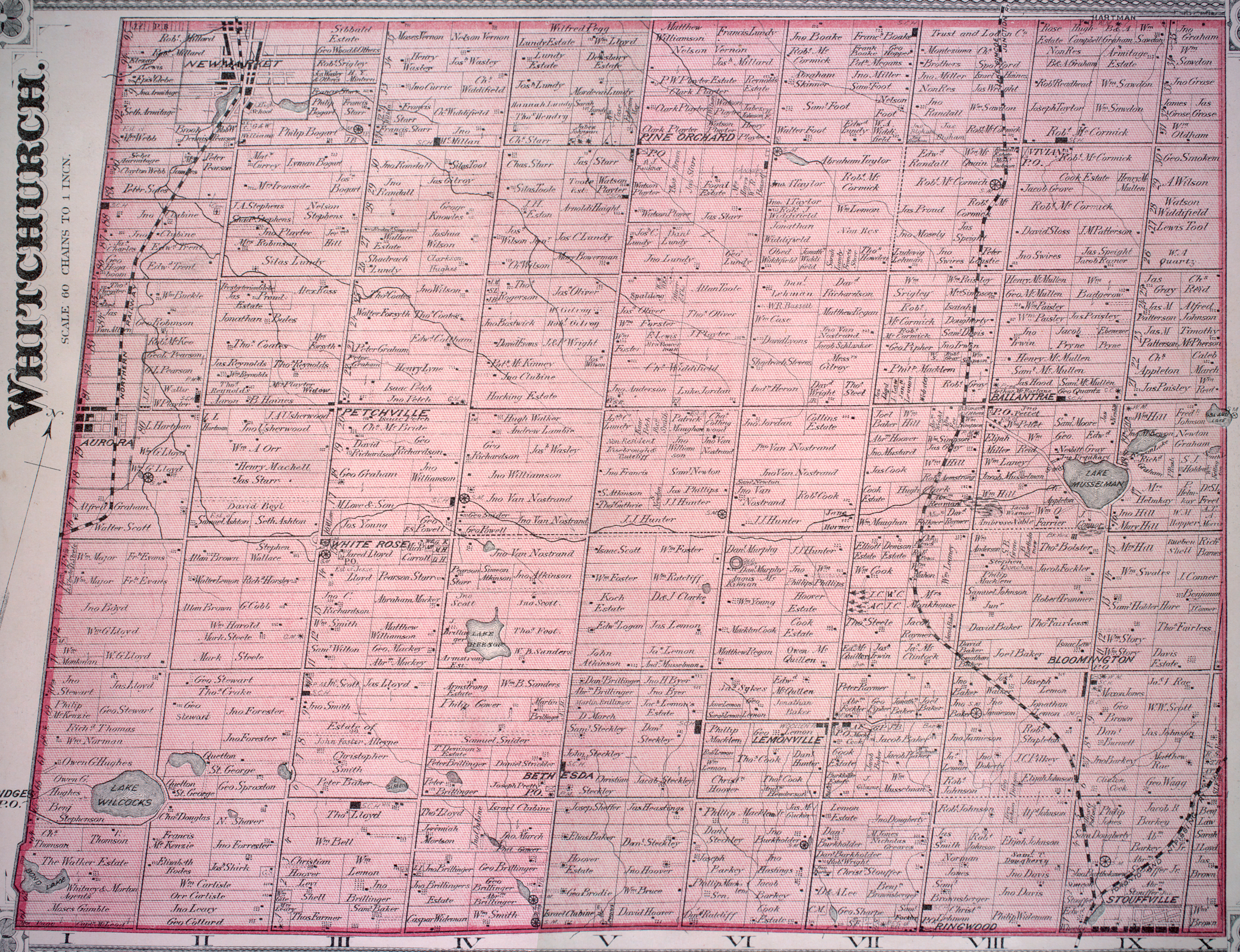
- Cf. a thorough account of Ballantrae's history in Jean Barkey et al., Whitchurch Township (Erin, ON: Boston Mills, 1993), 87-90. See also the detailed 1878 map, Township of Whitchurch, Illustrated historical atlas of the county of York and the township of West Gwillimbury & town of Bradford in the county of Simcoe, Ont. (Toronto: Miles & Co., 1878).
- Barkey et al., Whitchurch Township, 89; 30f. In 1910, its population was 250; cf. Province of Ontario, Gazetteer and Directory, 1910-1911 (Ingersoll: Union, 1910), 46.
- "Population and Dwelling Counts of Urban Areas 2006, listed according to the amount of growth". Statistics Canada. March 2007. Retrieved 2008-02-17.; H. Volpe, Growing Pains for Stouffville? Archived 2011-07-16 at the Wayback Machine, Stouffville Sun Tribune, Feb. 1, 2007; also Warren Smith, "Ballantrae Golf and Country Club - Not always thus ..."; Statistics Canada, Ballantrae 2011 Census Profile.
- Statistics Canada, Ballantrae 2011 Census Profile; York Region District School Board, Ballantrae Public School Archived 2011-01-16 at the Wayback Machine.
- Town of Whitchurh-Stouffville, "Growth Management Strategy: Alternative Growth Options Discussion Paper Archived 2013-10-29 at the Wayback Machine" (March 15, 2013), 3-2, Fig. 13.
- Cf. Transport Canada, Plan Showing Pickering Airport Site; also Pickering Airport Draft Plan Report, 6.3.
- Transport Canada, "Press Release Archived October 13, 2015, at the Wayback Machine," June 11, 2013; "News Release: Transport Canada releases findings of the 2010 Pickering Lands Needs Assessment Study Archived November 2, 2011, at the Wayback Machine," July 11, 2011.
- Sandra Bolan, "Pickering Airport Good for Stouffville," Stouffville Sun-Tribune (June 12, 2013).
- Cf. Town of Whitchurch-Stouffville, Ballantrae High Water Table Investigation Archived 2010-11-25 at the Wayback Machine.
- Barkey et al, Whitchurch Township, 33; 30f.
External links
- Town of Whitchurch-Stouffville
- Ontario Plaques - Founding of Stouffville
- Stouffville.com Stouffville's Online News and Events, Tourism and Business Directory