Balaghat
Balaghat is a city and a municipality in Balaghat district in the state of Madhya Pradesh, India. It is the administrative headquarters of Balaghat District. Wainganga River flows beside the town.
Balaghat | |
|---|---|
Metropolitan | |
| Balaghat | |
| Nickname(s): Balaghat | |
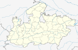 Balaghat Location in Madhya Pradesh, India  Balaghat Balaghat (India) | |
| Coordinates: 21.8°N 80.18°E | |
| Country | |
| State | Madhya Pradesh |
| District | Balaghat |
| Government | |
| • Type | Municipal Council |
| • Body | Balaghat Municipal Council |
| Area Balaghat | |
| • Total | 25 km2 (10 sq mi) |
| Elevation | 288 m (945 ft) |
| Population (2011) | |
| • Total | 84,261 |
| • Density | 3,400/km2 (8,700/sq mi) |
| Languages | |
| • Official | 1)Hindi (Primary) 2)English (Additional) |
| Time zone | UTC+5:30 (IST) |
| PIN | 481001 |
| ISO 3166 code | IN-MP |
| Vehicle registration | MP-50 |
| Website | www |
Geography
Balaghat is located at 21°48′N 80°11′E.[1] It has an average elevation of 288 metres (944 feet).
Demographics
As of 2011 India census,[2] Balaghat had a population of 84,216. Males constitute 51% of the population and females 49%. 11% of the population is under 6 years of age.
References
- Falling Rain Genomics, Inc - Balaghat
- "Census of India 2001: Data from the 2011 Census, including cities, villages and towns (Provisional)". Census Commission of India. Archived from the original on 16 June 2004. Retrieved 1 November 2008.
Further reading
| Wikisource has the text of the 1911 Encyclopædia Britannica article Balaghat. |
This article is issued from Wikipedia. The text is licensed under Creative Commons - Attribution - Sharealike. Additional terms may apply for the media files.