Badin District
The Badin District (Sindhi: ضلعو بدين, Urdu: ضلع بدین) is a district in the Sindh province of Pakistan. The total area of the district is 6,726 square kilometers.[2] It had a population of 1,136,636, in 1998, of which 16.42% were urban, according to the Pakistani census taken at the time.[3] Total population of District Badin was recorded as 1,804,516 in the census of 2017.[4] Headquartered at the city of Badin, the district is situated between 24°-5` to 25°-25` north latitude and 68 21’ to 69 20’ east longitude and is bounded on the north by the Tando Allahyar District, Northwest by the Hyderabad District, on the east by Mirpurkhas and Tharparkar districts, on the south by the Kutch district of India, and on the west by Sujawal and Tando Muhammad Khan District.
Badin District ضلعو بدين | |
|---|---|
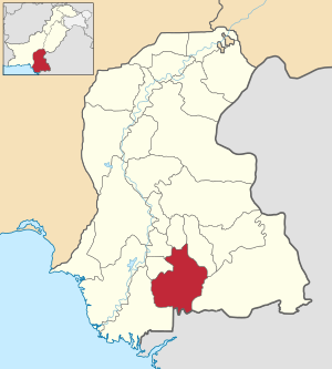 Badin is located in the south of Sindh | |
| Country | Pakistan |
| Province | Sindh |
| Headquarters | Badin |
| Area | |
| • Total | 6,726 km2 (2,597 sq mi) |
| Population (2017)[1] | |
| • Total | 1,804,516 |
| • Density | 270/km2 (690/sq mi) |
| Time zone | UTC+5 (PST) |
| Number of Tehsils | 6 |
Administration
The district is administratively subdivided into the following talukas:[5]
- Badin
- Matli
- Talhar
- Tando Bago
- Golarchi
With the introduction of the devolution system, the talukas have been subdivided into the Union Councils numbering 49, Tapas 109 and Dehs 511.
History
Badin was the center of the ancient Indus Valley Civilization. Islam came into the region by 711 CE. The areas remained under the control of the Islamic caliphate until it came under control of the Ghaznavids. In 1592, Sindh came under the direct rule of the Mughal emperors.[6]
Education
The University of Sindh offers 4- year (8- Semester) bachelor's degree programs in Business Administration, Commerce and Computer Science, PGD. Computer Science and B.Ed., M.Ed. & M.A. (Education).[7]
Economy
Nearly 83% of the population lives in the rural areas with farming as the main source of livelihood. The district is irrigated by Indus River through the Akram Wah, Phuleli and Guni Canals of Kotri Barrage and Nasir Canal of Sukkur Barrage. Main Crops are Sugar Cane, Rice, Tomato, Wheat and Sunflower. There are six Sugar Mills and 30 Rice Husking mills in the District. The Oil fields in the Badin district produces nearly 50% of total production of crude oil of Pakistan.[8]
Railways
The main line runs from Badin to Hyderabad through the Matli taluka.[2]
Badin Coal Field
Spread at the area of 1,110sq.km, 'Badin Coal Field' reserves around 1.358 billion metric tons of coal.[9]
References
- "DISTRICT WISE CENSUS RESULTS CENSUS 2017" (PDF). www.pbscensus.gov.pk. Archived from the original (PDF) on 2017-08-29. Retrieved 2017-09-03.
- Planning and Development Department, Sindh Government. Archived 2011-08-12 at the Wayback Machine Retrieved 10 June 2010
- "Urban Resource Centre". Archived from the original on 2006-08-30. Retrieved 2006-10-07.
- Local Govt. Department of Sindh - District of Badin Archived 2006-02-20 at the Wayback Machine
- History, Badin. "Badin history". YesPakistan. Archived from the original on 17 November 2011. Retrieved 8 November 2013.
- University, Sindh. "Laar Campus of University of Sindh". University of Sindh. Archived from the original on 12 December 2013. Retrieved 8 November 2013.
- EconomyBadin, Economy. "Government of Sindh". Government of Sindh. Archived from the original on 10 October 2018. Retrieved 26 March 2019.
- Badin, Coal Field. "Coal Field Badin". Sindh Coal. Retrieved 8 November 2013.