Bílá Lhota
Bílá Lhota (German: Weissöhlhütten) is a village and municipality (obec) in Olomouc District in the Olomouc Region of the Czech Republic.
Bílá Lhota | |
|---|---|
Municipality | |
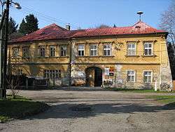 Chateau | |
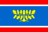 Flag  Coat of arms | |
 Bílá Lhota | |
| Coordinates: 49°42′34″N 16°58′30″E | |
| Country | |
| Region | Olomouc |
| District | Olomouc |
| Area | |
| • Total | 18.2 km2 (7.0 sq mi) |
| Elevation | 395 m (1,296 ft) |
| Population (2012) | |
| • Total | 1,121 |
| • Density | 62/km2 (160/sq mi) |
| Postal code | 783 24 až 783 26 |
| Website | http://www.bilalhota.cz |
The municipality covers an area of 18.2 square kilometres (7.0 sq mi), and has a population of 1,098 (as at 3 July 2006).
This article is issued from Wikipedia. The text is licensed under Creative Commons - Attribution - Sharealike. Additional terms may apply for the media files.