Austwick
Austwick is a village and civil parish in the Craven district of North Yorkshire, England, about 5 miles (8 km) north-west of Settle. The village is on the edge of the Yorkshire Dales National Park.
| Austwick | |
|---|---|
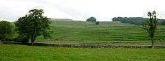 Ancient field systems and lynchets west of Austwick | |
 Austwick Location within North Yorkshire | |
| Population | 463 (2011 census)[1] |
| OS grid reference | SD767685 |
| Civil parish |
|
| District | |
| Shire county | |
| Region | |
| Country | England |
| Sovereign state | United Kingdom |
| Post town | LANCASTER |
| Postcode district | LA2 |
| Police | North Yorkshire |
| Fire | North Yorkshire |
| Ambulance | Yorkshire |
| UK Parliament |
|
Before local government reorganisation in 1974, Austwick parish was within Settle Rural District which was in the County of the West Riding of Yorkshire.
According to the Austwick & Lawkland Tithe Map of 21 October 1851 the parish has an area of 8,201 acres (33.19 km2) of which around a quarter is uncut moorland. The highest point within the parish is at Lord's Seat on Simon Fell at 2,079 feet (634 m).[2]
History
The area around Austwick has been inhabited by humans for over 4,000 years. Archaeological finds in and around the village include prehistoric burial places, a large Bronze Age settlement, and even an Iron Age settlement. The area surrounding Austwick has many ancient remains including extensive walls and structures constructed of slate, limestone, and sandstone.
At one time, Austwick, Clapham, Lawkland, and Newby were independent manors with their own lord that together formed the larger parish of Clapham. In the Domesday Book, which was a survey of England conducted in 1086, Austwick was the head of 12 manors spread along a northern route. Austwick still has a lord of the manor; the most recent holder of the position was Dr. John Farrer, who died in 2014. The Farrer family has had the position of lord of the manor since 1782.[3]
A local folktale tells of an Austwick man who fell into a deep pool. As bubbles broke on the water's surface, his companions thought they could hear the words "T' b-best's at t' b-bottom", so they jumped into the pool as well, and were not seen again.[4]
Demographics
According to the 2001 census the parish had a population of 476 with an average age of 45.4 years (Neighbouring parishes: Clapham parish 39.9 years, Lawkland parish 39.4 years, England: 38.6 years). There are 231 dwellings and 212 households. 36% are pensioner households, 33% of households have an occupant with a long-term illness and only 25% of households have children.[5] The parish includes the village of Austwick and the hamlet of Wharfe.
In 2014 the boundaries of Austwick parish were changed. That part of the parish south of the A65 road were passed to Lawkland parish and that part of Lawkland parish north of the A65 (including the hamlet of Feizor) was passed to Austwick parish. Now Austwick Common and Austwick Moss are no longer in the parish of Austwick. The boundaries of Austwick and Lawkland parishes had been in existence since at least 1851 at the time of the drawing up of the Tithe map.
References
- UK Census (2011). "Local Area Report – Austwick Parish (1170216721)". Nomis. Office for National Statistics. Retrieved 14 March 2018.
- Austwick & Lawkland Tithe Map, West Yorkshire Archives, Sheepscar, Leeds
- Austwick Community Broadband. "About Austwick". Austwick: Austwick Community Broadband. Archived from the original on 21 July 2009. Retrieved 24 July 2009.
- Ash, Russell (1973). Folklore, Myths and Legends of Britain. Reader's Digest Association Limited. p. 336. ISBN 9780340165973.
- 2001 census
External links

- Community Website
- Austwick CE VA Primary School's website
- Austwick in the Domesday Book