Austintown, Ohio
Austintown is a census-designated place (CDP) within Austintown Township, Mahoning County, Ohio, United States. The population was 29,677 at the 2010 census.[3]
Austintown, Ohio | |
|---|---|
 | |
 Location of Austintown, Ohio | |
| Coordinates: 41°5′30″N 80°44′17″W | |
| Country | United States |
| State | Ohio |
| County | Mahoning |
| Area | |
| • Total | 11.7 sq mi (30.2 km2) |
| • Land | 11.6 sq mi (30.1 km2) |
| • Water | 0.04 sq mi (0.1 km2) |
| Elevation | 1,129 ft (344 m) |
| Population (2010) | |
| • Total | 29,677 |
| • Density | 2,552/sq mi (985.3/km2) |
| Time zone | UTC-5 (Eastern (EST)) |
| • Summer (DST) | UTC-4 (EDT) |
| ZIP code | 44515, 44511 |
| Area code(s) | 234/330 |
| FIPS code | 39-03184[2] |
| GNIS feature ID | 1064362[1] |
It is part of the Youngstown-Warren-Boardman, OH-PA Metropolitan Statistical Area.
History
Austintown Township was founded in 1793 in a section that used to be known as the Connecticut Western Reserve, located in northeast Ohio.[4] It was surveyed as a parcel of land 5 miles (8 km) on each side, as were other townships of the Connecticut Western Reserve. Austintown was named for Warren resident and Western Reserve judge Calvin Austin.[5][6][7]
Geography
Austintown is located at 41°5′30″N 80°44′17″W (41.091743, -80.738103).[8] The Austintown CDP takes up slightly less than half of the area of Austintown Township, largely on the eastern side of the township, where it abuts the western border of the city of Youngstown.
According to the United States Census Bureau, the CDP has a total area of 11.7 square miles (30.2 km2), of which 11.6 square miles (30.1 km2) is land and 0.04 square miles (0.1 km2), or 0.29%, is water.[3]
Ohio State Route 11 is a north-south freeway which passes through the CDP, with access from Exit 39. Interstate 680 passes east-to-west through the northern part of the CDP but provides no access. Interstate 80 passes to the north of the CDP, with access from Exit 223.
Demographics
| Historical population | |||
|---|---|---|---|
| Census | Pop. | %± | |
| 1970 | 29,393 | — | |
| 1980 | 33,636 | 14.4% | |
| 1990 | 32,371 | −3.8% | |
| 2000 | 31,627 | −2.3% | |
| 2010 | 29,677 | −6.2% | |
| source:[9] | |||
As of the census[2] of 2000, there were 31,627 people, 13,419 households, and 8,762 families residing in the CDP. The population density was 2,709.3 people per square mile (1,046.4/km2). There were 14,179 housing units at an average density of 1,214.6/sq mi (469.1/km2). The racial makeup of the CDP was 92.51% White, 5.09% African American, 0.14% Native American, 0.59% Asian, 0.03% Pacific Islander, 0.43% from other races, and 1.21% from two or more races. Hispanic or Latino of any race were 1.83% of the population.
There were 13,419 households, out of which 25.8% had children under the age of 18 living with them, 49.6% were married couples living together, 12.1% had a female householder with no husband present, and 34.7% were non-families. 30.2% of all households were made up of individuals, and 11.4% had someone living alone who was 65 years of age or older. The average household size was 2.32 and the average family size was 2.90.
In the CDP the population was spread out, with 20.9% under the age of 18, 9.0% from 18 to 24, 27.3% from 25 to 44, 25.5% from 45 to 64, and 17.2% who were 65 years of age or older. The median age was 40 years. For every 100 females there were 90.8 males. For every 100 females age 18 and over, there were 87.7 males.
The median income for a household in the CDP was $38,216, and the median income for a family was $47,507. Males had a median income of $36,797 versus $23,733 for females. The per capita income for the CDP was $19,087. About 6.2% of families and 8.8% of the population were below the poverty line, including 14.4% of those under age 18 and 6.9% of those age 65 or over.
Estimates produced by the Census Bureau's American Community Survey program revealed that, by 2007, the percentage of individuals below the poverty line had risen to 13.8%.[10]
Education
Austintown Local Schools operates one elementary school, one intermediate school, one middle school, and Austintown Fitch High School.[11]
Austintown has a public library, a branch of the Public Library of Youngstown and Mahoning County.[12]
Notable people
- Aylett R. Cotton, congressman from Iowa[13]
- George Shuba, baseball player.[14]
- Munnycat, indie pop duo
References
- "US Board on Geographic Names". United States Geological Survey. 2007-10-25. Retrieved 2008-01-31.
- "U.S. Census website". United States Census Bureau. Retrieved 2008-01-31.
- "Geographic Identifiers: 2010 Demographic Profile Data (G001): Austintown CDP, Ohio". U.S. Census Bureau, American Factfinder. Archived from the original on February 12, 2020. Retrieved March 27, 2013.
- Learn about Austintown in this Official Township Site Archived April 22, 2011, at the Wayback Machine. Accessed 2011-04-02.
- Butler, Joseph Green (1921). "Alcorn Joseph L III 638". History of Youngstown and the Mahoning Valley, Ohio, Volume 1. American Historical Society. p. 575.
- "Austin Log Cabin National Historical Landmark". Mahoning Valley REALstuff. Retrieved 2012-11-07.
- Pogany, Joyce Hunsinger (May 7, 2007). Austintown (Images of America). p. 12. ISBN 0738551198. Retrieved 2012-11-07.
- "US Gazetteer files: 2010, 2000, and 1990". United States Census Bureau. 2011-02-12. Retrieved 2011-04-23.
- "CENSUS OF POPULATION AND HOUSING (1790-2000)". U.S. Census Bureau. Retrieved 2010-07-17.
- Austintown CDP, Ohio 2005-2007 American Community Survey 3-Year Estimates Archived 2020-02-10 at Archive.today, United States Census Bureau, 2008. Accessed 2009-01-31.
- "Our schools". Austintown Local Schools. Retrieved 26 February 2018.
- "Locations & Hours". Public Library of Youngstown and Mahoning County. Retrieved 26 February 2018.
- "COTTON, Aylett Rains, (1826 - 1912)". Biographical Directory of the United States Congress. Retrieved December 21, 2012.
- "'Shotgun' George Shuba recounts his baseball life". Archived from the original on 2017-03-29. Retrieved 2017-03-28.
External links
Municipalities and communities of Mahoning County, Ohio, United States | ||
|---|---|---|
| Cities | 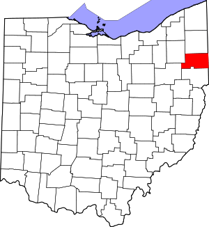 Map of Ohio highlighting Mahoning County | |
| Villages | ||
| Townships | ||
| CDPs | ||
| Unincorporated communities |
| |
| Footnotes | ‡This populated place also has portions in an adjacent county or counties | |