Austhorpe
Austhorpe is a civil parish and residential suburb of east Leeds, West Yorkshire, England. It is 5 miles (8.0 km) to the east of city centre and close to the A643 dual carriageway and M1 motorway.
| Austhorpe | |
|---|---|
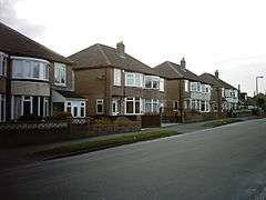 Housing on Kingswear Crescent | |
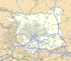 Austhorpe  Austhorpe Location within West Yorkshire | |
| Civil parish |
|
| Metropolitan borough | |
| Metropolitan county | |
| Region | |
| Country | England |
| Sovereign state | United Kingdom |
| Post town | LEEDS |
| Postcode district | LS15 |
| Dialling code | 0113 |
| Police | West Yorkshire |
| Fire | West Yorkshire |
| Ambulance | Yorkshire |
| UK Parliament | |
The area is situated between Pendas Fields to the north, Cross Gates to the north west, Whitkirk to the west, and Colton to the south and Garforth to the east.[1]
Officially judging by the old boundaries of the former Austhorpe township, Austhorpe also includes the areas of Cross Gates, Colton Common and Barrowby. Colton Common became officially part of Colton when the Ingram family of Temple Newsam kept it for their own after buying and then selling the rest of the Austhorpe Lodge estate.
It crosses both of the Cross Gates and Whinmoor (including Austhorpe Hall) and Temple Newsam wards of Leeds City Council.
The current east half of the civil parish of Austhorpe and large Thorpe Park business park lie in the western tip of Garforth and Swillington ward. Austhorpe Parish Council declared nil balance accounts for the financial year ended 31 March 2017.[2]
At the 2011 Census, the population of Austhorpe was shown to be included in Cross Gates and Whinmoor ward.
History
.JPG)
The suffix of Thorp indicates a farm, and thorp prevails in the area (Osmandthorpe, Thorp Arch etc). Austhorpe is derived form East Thorp, or the east farm.[3]
After the Township dissolved, Austhorpe stopped developing as quickly as it was doing, possibly due to the once abundant coal fields close to the surface which had been a major source of commerce for the area since Roman times becoming empty with deep shaft mining proving to be unsuccessful compared to the close by coal source at Garforth. Whereas Cross Gates and Colton quickly developed, Barrowby, if anything, did not develop.
_001.JPG)
Pioneering Civil Engineer John Smeaton, designer of the longest standing Eddystone Lighthouse, was born in Austhorpe.[4] Leeds band the Kaiser Chiefs make a positive reference to him in their hit song "I Predict a Riot".[5]
Austhorpe Hall is a grade II* listed building dated from 1694.[6]
Comparison
Austhorpe lies in the LS15 postcode area. Here is a population breakdown of the postcode area in comparison with the UK population.
| Category | LS15 | UK average |
|---|---|---|
| Population density (people / sq mi) | 43.2 | 24.9 |
| Gender split (females / male) | 1.05 | 1.05 |
| Average commute | 6.1 miles | 8.73 miles |
| Average age | 38 | 39 |
| Home ownership | 16% | 16.9% |
| Student population | 2.4% | 4.4% |
| People in good health | 69% | 69% |
Location grid
Places adjacent to Austhorpe | ||||||||||
|---|---|---|---|---|---|---|---|---|---|---|
| ||||||||||
References
- Office for National Statistics : Census 2001 : Parish Headcounts : Leeds Archived 19 March 2015 at the Wayback Machine Retrieved 8 September 2009
- "Austhorpe Parish Council, Accounts" (PDF). leeds.gov.uk. Retrieved 6 November 2018.
- "What's in a name?". BBC Home. 30 April 2008. Retrieved 6 November 2018.
- "Leeds nostalgia: The life of John Smeaton, father of civil engineering". Yorkshire Evening Post. 6 June 2015. Retrieved 6 November 2018.
- Simpson, Dave; Lynskey, Dorian (24 February 2006). "Twelve artists talk about making one of their classic tracks". The Guardian. Retrieved 6 November 2018.
- Historic England. "Austhorpe Hall (Grade II*) (1256314)". National Heritage List for England. Retrieved 6 November 2018.
External links
- The ancient parish of Whitkirk: historical and genealogical information at GENUKI (Austhorpe was in this parish).
- Austhorpe in the Domesday Book