Ashton, Illinois
Ashton is a village in Lee County, Illinois, United States. The population was 972 at the 2010 census, down from 1,142 in 2000.
Ashton, Illinois | |
|---|---|
Village | |
 Aerial view - March 2009 | |
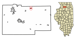 Location of Ashton in Lee County, Illinois. | |
| Coordinates: 41.866545°N 89.221923°W | |
| Country | United States |
| State | Illinois |
| County | Lee County |
| Area | |
| • Total | 0.66 sq mi (1.70 km2) |
| • Land | 0.66 sq mi (1.70 km2) |
| • Water | 0.00 sq mi (0.00 km2) |
| Population (2010) | |
| • Total | 972 |
| • Estimate (2018)[2] | 895 |
| • Density | 1,384.15/sq mi (534.81/km2) |
| Time zone | UTC-6 (CST) |
| • Summer (DST) | UTC-5 (CDT) |
| ZIP Code | 61006 |
| Area code(s) | 815 |
| FIPS code | 17-02583 |
| Website | www |
History
Ashton was originally called Ogle Station, but it was afterwards changed in order to avoid confusion with Ogle County, Illinois.[3] A tornado hit the town on April 9, 2015 at 6:40 pm CDT.
Geography
Ashton is located at 41°52′00″N 89°13′19″W.[4]
According to the 2010 census, Ashton has a total area of 0.66 square miles (1.71 km2), all land.[5]
Demographics
| Historical population | |||
|---|---|---|---|
| Census | Pop. | %± | |
| 1880 | 646 | — | |
| 1890 | 680 | 5.3% | |
| 1900 | 756 | 11.2% | |
| 1910 | 779 | 3.0% | |
| 1920 | 882 | 13.2% | |
| 1930 | 868 | −1.6% | |
| 1940 | 914 | 5.3% | |
| 1950 | 913 | −0.1% | |
| 1960 | 1,024 | 12.2% | |
| 1970 | 1,112 | 8.6% | |
| 1980 | 1,140 | 2.5% | |
| 1990 | 1,042 | −8.6% | |
| 2000 | 1,142 | 9.6% | |
| 2010 | 972 | −14.9% | |
| Est. 2018 | 895 | [2] | −7.9% |
| U.S. Decennial Census[6] | |||
At the 2000 census there were 1,142 people, 437 households, and 312 families in the village. The population density was 1,727.6 people per square mile (668.1/km²). There were 468 housing units at an average density of 708.0 per square mile (273.8/km²). The racial makeup of the village was 97.99% White, 1.05% African American, 0.09% Native American, 0.35% from other races, and 0.53% from two or more races. Hispanic or Latino of any race were 2.36%.[7]
Of the 423 households 35.2% had children under the age of 18 living with them, 54.2% were married couples living together, 14.4% had a female householder with no husband present, and 28.4% were non-families. 23.3% of households were one person and 11.0% had someone living alone who was 65 years of age or older. The average household size was 2.57 and the average family size was 2.98.
The age distribution was 27.5% under the age of 18, 8.4% from 18 to 24, 29.9% from 25 to 44, 19.6% from 45 to 64, and 14.5% 65 or older. The median age was 36 years. For every 100 females there were 90.7 males. For every 100 females age 18 and over, there were 87.3 males.
The median household income was $39,896 and the median family income was $43,750. Males had a median income of $33,750 versus $22,381 for females. The per capita income for the village was $21,200. About 5.4% of families and 6.2% of the population were below the poverty line, including 3.8% of those under age 18 and 3.1% of those age 65 or over.
See also
References
- "2016 U.S. Gazetteer Files". United States Census Bureau. Retrieved Jun 30, 2017.
- "Population and Housing Unit Estimates". Retrieved February 22, 2020.
- Chicago and North Western Railway Company (1908). A History of the Origin of the Place Names Connected with the Chicago & North Western and Chicago, St. Paul, Minneapolis & Omaha Railways. p. 39.
- "US Gazetteer files: 2010, 2000, and 1990". United States Census Bureau. 2011-02-12. Retrieved 2011-04-23.
- "G001 - Geographic Identifiers - 2010 Census Summary File 1". United States Census Bureau. Archived from the original on 2020-02-13. Retrieved 2015-08-01.
- "Census of Population and Housing". Census.gov. Retrieved June 4, 2015.
- "U.S. Census website". United States Census Bureau. Retrieved 2008-01-31.
External links
Municipalities and communities of Lee County, Illinois, United States | ||
|---|---|---|
| Cities | Map of Illinois highlighting Lee County | |
| Villages | ||
| Townships | ||
| Unincorporated communities | ||
| Footnotes | ‡This populated place also has portions in an adjacent county or counties | |
| Authority control |
|
|---|