Arvel, Kentucky
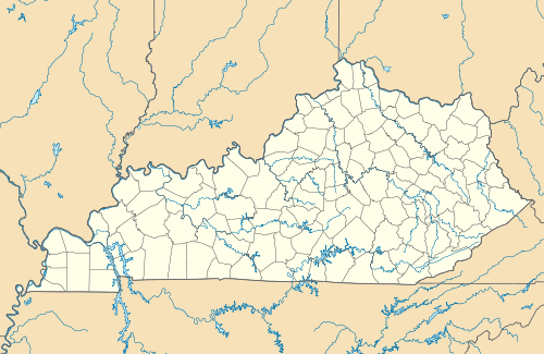
Arvel is an unincorporated community located near the tripoint border between Jackson, Lee, and Owsley Counties, Kentucky, United States. The community is located at the junction of Kentucky Route 587 and Kentucky Route 1209, 8 miles northeast of McKee and 13 miles southwest of Beattyville[2]. A few locations in Arvel are also named Old Orchard, such as the Old Orchard Lookout Tower, which is 1/3 of a mile from Arvel[3] and a historical school being the same distance from Arvel [4] which may be evidence of the community also being called Old Orchard. A natural attraction in the area is Alcorn Branch Falls[5].
Arvel, Kentucky | |
|---|---|
 Arvel  Arvel | |
| Coordinates: 37°31′06″N 83°53′07″W | |
| Country | United States |
| State | Kentucky |
| County | Jackson, Lee, Owsley |
| Elevation | 1,211 ft (369 m) |
| Time zone | UTC-5 (Eastern (EST)) |
| • Summer (DST) | UTC-4 (EST) |
| ZIP codes | 40447 (McKee), 41311 (Beattyville) |
| Area code(s) | 606 |
| GNIS feature ID | [1] |
References
- "Arvel, Kentucky". Geographic Names Information System. United States Geological Survey.
- "Arvel (Lee County, Kentucky)". RoadsideThoughts. Retrieved 23 March 2020.
- "Old Orchard Lookout Tower in Lee County, Kentucky". PlaceKeeper. Retrieved 23 March 2020.
- "Old Orchard School in Lee County, Kentucky". PlaceKeeper. Retrieved 23 March 2020."Arvel, Kentucky". Geographic Names Information System. United States Geological Survey.
- "Natural Attractions". Jackson County Kentucky Tourism. Retrieved 23 March 2020.
Municipalities and communities of Jackson County, Kentucky, United States | ||
|---|---|---|
| City | 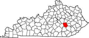 Location of Jackson County, Kentucky | |
| CDP | ||
| Unincorporated communities | ||
| Ghost towns | ||
Municipalities and communities of Lee County, Kentucky, United States | ||
|---|---|---|
| City |  Location of Lee County, Kentucky | |
| Unincorporated communities |
| |
Municipalities and communities of Owsley County, Kentucky, United States | ||
|---|---|---|
| City | 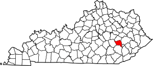 Location of Owsley County, Kentucky | |
| Unincorporated communities |
| |
This article is issued from Wikipedia. The text is licensed under Creative Commons - Attribution - Sharealike. Additional terms may apply for the media files.