Arrondissement of Saintes
The arrondissement of Saintes is an arrondissement of France in the Charente-Maritime department in the Nouvelle-Aquitaine region. It has 88 communes.[1] Its population is 116,057 (2016), and its area is 1,320.4 km2 (509.8 sq mi).[2]
Saintes | |
|---|---|
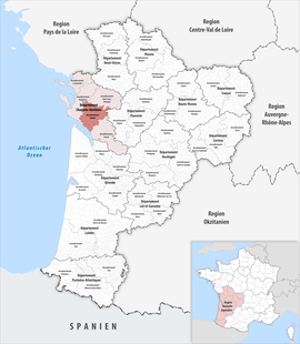 Location within the region Nouvelle-Aquitaine | |
| Country | France |
| Region | Nouvelle-Aquitaine |
| Department | Charente-Maritime |
| No. of communes | 88 |
| Subprefecture | Saintes |
| Area | |
| • Total | 1,320.4 km2 (509.8 sq mi) |
| Population (2016) | |
| • Total | 116,057 |
| • Density | 88/km2 (230/sq mi) |
| INSEE code | 174 |
Composition
The communes of the arrondissement of Saintes, and their INSEE codes, are:[1]
- Arces (17015)
- Balanzac (17030)
- Barzan (17034)
- Berneuil (17044)
- Beurlay (17045)
- Boutenac-Touvent (17060)
- Brie-sous-Mortagne (17068)
- Burie (17072)
- Bussac-sur-Charente (17073)
- Chaniers (17086)
- La Chapelle-des-Pots (17089)
- Le Chay (17097)
- Chenac-Saint-Seurin-d'Uzet (17098)
- Chérac (17100)
- Chermignac (17102)
- La Clisse (17112)
- Colombiers (17115)
- Corme-Écluse (17119)
- Corme-Royal (17120)
- Courcoury (17128)
- Cozes (17131)
- Cravans (17133)
- Crazannes (17134)
- Dompierre-sur-Charente (17141)
- Le Douhet (17143)
- Écoyeux (17147)
- Écurat (17148)
- Épargnes (17152)
- Les Essards (17154)
- Floirac (17160)
- Fontcouverte (17164)
- Geay (17171)
- Gémozac (17172)
- Les Gonds (17179)
- Grézac (17183)
- La Jard (17191)
- Jazennes (17196)
- Luchat (17214)
- Médis (17228)
- Meursac (17232)
- Migron (17235)
- Montils (17242)
- Montpellier-de-Médillan (17244)
- Mortagne-sur-Gironde (17248)
- Nancras (17255)
- Nieul-lès-Saintes (17262)
- Pessines (17275)
- Pisany (17278)
- Plassay (17280)
- Pont-l'Abbé-d'Arnoult (17284)
- Port-d'Envaux (17285)
- Préguillac (17289)
- Rétaud (17296)
- Rioux (17298)
- Romegoux (17302)
- Rouffiac (17304)
- Sablonceaux (17307)
- Saint-André-de-Lidon (17310)
- Saint-Bris-des-Bois (17313)
- Saint-Césaire (17314)
- Sainte-Gemme (17330)
- Sainte-Radegonde (17389)
- Saintes (17415)
- Saint-Georges-des-Coteaux (17336)
- Saint-Porchaire (17387)
- Saint-Romain-de-Benet (17393)
- Saint-Sauvant (17395)
- Saint-Sever-de-Saintonge (17400)
- Saint-Simon-de-Pellouaille (17404)
- Saint-Sulpice-d'Arnoult (17408)
- Saint-Vaize (17412)
- Saujon (17421)
- Semussac (17425)
- Le Seure (17426)
- Soulignonne (17431)
- Talmont-sur-Gironde (17437)
- Tanzac (17438)
- Tesson (17441)
- Thaims (17442)
- Thénac (17444)
- Thézac (17445)
- Trizay (17453)
- La Vallée (17455)
- Varzay (17460)
- Vénérand (17462)
- Villars-en-Pons (17469)
- Villars-les-Bois (17470)
- Virollet (17479)
History
The arrondissement of Saintes was created in 1800.[3] At the January 2017 reorganisation of the arrondissements of Charente-Maritime, it lost 17 communes to the arrondissement of Jonzac and one commune to the arrondissement of Rochefort.[4]
As a result of the reorganisation of the cantons of France which came into effect in 2015, the borders of the cantons are no longer related to the borders of the arrondissements. The cantons of the arrondissement of Saintes were, as of January 2015:[5]
- Burie
- Cozes
- Gémozac
- Pons
- Saintes-Est
- Saintes-Nord
- Saintes-Ouest
- Saint-Porchaire
- Saujon
References
- "Arrondissement de Saintes (174)". INSEE. Retrieved 2019-09-28.
- "Comparateur de territoire, géographie au 01/01/2019". INSEE. Retrieved 2019-09-28.
- Historique de la Charente-Maritime
- "Arrêté préfectoral, 30 December 2016" (PDF). pp. 110–120. Retrieved 2019-10-08.
- "Populations légales 2012" (PDF). INSEE. December 2014. Retrieved 2019-10-08.
| Authority control |
|
|---|