Aroma Township, Kankakee County, Illinois
Aroma Township is one of seventeen townships in Kankakee County, Illinois, USA. As of the 2010 census, its population was 5,157 and it contained 2,203 housing units.[2]
Aroma Township | |
|---|---|
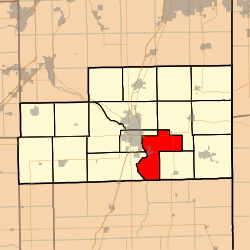 Location in Kankakee County | |
 Kankakee County's location in Illinois | |
| Coordinates: 41°04′34″N 87°46′46″W | |
| Country | United States |
| State | Illinois |
| County | Kankakee |
| Established | May 9, 1853 |
| Government | |
| • Supervisor | Morris Scott |
| Area | |
| • Total | 37.98 sq mi (98.4 km2) |
| • Land | 37.06 sq mi (96.0 km2) |
| • Water | 0.92 sq mi (2.4 km2) 2.42% |
| Elevation | 604 ft (184 m) |
| Population (2010) | |
| • Estimate (2016)[1] | 4,978 |
| • Density | 139.2/sq mi (53.7/km2) |
| Time zone | UTC-6 (CST) |
| • Summer (DST) | UTC-5 (CDT) |
| ZIP codes | 60901, 60910, 60954, 60964 |
| FIPS code | 17-091-02245 |
Geography
According to the 2010 census, the township has a total area of 37.98 square miles (98.4 km2), of which 37.06 square miles (96.0 km2) (or 97.58%) is land and 0.92 square miles (2.4 km2) (or 2.42%) is water.[2]
Aroma township includes the Iroquois Woods Nature Preserve and Strasma Park.
Cities, towns, villages
- Aroma Park (vast majority)
- Kankakee (east edge)
- Sammons Point (east edge)
- Sun River Terrace (southwest quarter)
Adjacent townships
- Ganeer Township (northeast)
- St. Anne Township (southeast)
- Papineau Township, Iroquois County (south)
- Chebanse Township, Iroquois County (southwest)
- Kankakee Township (west)
- Otto Township (west)
- Bourbonnais Township (northwest)
Cemeteries
The township contains these six cemeteries: Aroma Park, B'nai Israel, Bebe Family, Kankakee Memorial Gardens, Flower, and Leggtown.
Major highways

Government
The township is governed by an elected Town Board of a Supervisor and four Trustees. The Township also has an elected Assessor, Clerk, Highway Commissioner and Supervisor. The Township Office is located at 3955 South 3250 East Road, St. Anne, IL 60964.
Political districts
- Illinois' 11th congressional district
- State House District 79
- State Senate District 40
School districts
- Kankakee School District 111
- Momence Community Unit School District 1
References
- "Aroma Township, Kankakee County, Illinois". Geographic Names Information System. United States Geological Survey. Retrieved 2010-02-20.
- United States Census Bureau 2007 TIGER/Line Shapefiles
- United States National Atlas
- "Population and Housing Unit Estimates". Retrieved June 9, 2017.
- "Population, Housing Units, Area, and Density: 2010 - County -- County Subdivision and Place -- 2010 Census Summary File 1". United States Census. Archived from the original on 2020-02-12. Retrieved 2013-05-28.
- "Census of Population and Housing". Census.gov. Retrieved June 4, 2016.
External links
Municipalities and communities of Kankakee County, Illinois, United States | ||
|---|---|---|
| Cities | Map of Illinois highlighting Kankakee County | |
| Villages | ||
| Townships | ||
| Unincorporated communities | ||
| Footnotes | ‡This populated place also has portions in an adjacent county or counties. | |