Arga-Tas
The Arga-Tas (Russian: Арга-Тас; Yakut: Арҕаа Таас) is a mountain range in far North-eastern Russia. Administratively it is part of the Sakha Republic (Yakutia), Russian Federation. The range extends along the southwestern part of the Upper Kolyma District. The village of Utaya, administrative center of the Utainsky Rural Okrug is located at the feet of the range.
| Arga-Tas | |
|---|---|
| Арга-Тас / Арҕаа Таас | |
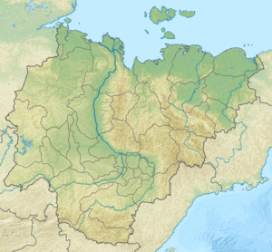 Arga-Tas Location in the Sakha Republic, Russia | |
| Highest point | |
| Peak | Unnamed |
| Elevation | 2,021 m (6,631 ft) |
| Coordinates | 65°0′N 149°0′E [1] |
| Dimensions | |
| Length | 100 km (62 mi) NNW / SSE |
| Geography | |
| Location | Sakha Republic, Far Eastern Federal District |
| Parent range | Chersky Range, East Siberian System |
| Climbing | |
| Easiest route | From Utaya |
Geography
The Arga-Tas is a subrange of the Chersky Range mountain system.[2] It extends from NNW to SSE for almost 100 kilometres (62 mi) at the southern end of the Moma Range and west of the Kolyma River valley. The Rassokha, a tributary of the Yasachnaya River, cuts across the range in its middle course.[3][4]
The highest point of the Arga-Tas is an ultra-prominent peak that is 2,400 metres (7,900 ft) high.[5]
See also
References
- Elizabeth L. Miller, Arthur Grantz & Simon Klemperer (eds.), Tectonic Evolution of the Bering Shelf-Chukchi Sea-Arctic Margin and Adjacent Landmasses. p. 236
- Chersky Range // Great Russian Encyclopedia in 35 vols. / Ch. ed. Yu.S. Osipov . - M , 2004–2017.
- Аркадий Андреев, Горы Якутии (Mountains of Yakutia), p. 26
- Google Earth
- Arga-Tas High Point, Russia