Apo–Talomo Mountain range
Apo–Talomo (Also known as Mount Talomo or Talomo Mountain Range) is a Philippine mountain range that includes Mount Apo.[1] Mount Talomo is one of the top 15 highest mountain in the Philippines and has an elevation of 2,674+ MASL. In terms of climbing difficulty, it is rated with a 7/9 difficulty and has a 2-4 trail class.[2]
| Apo–Talomo Mountain range | |
|---|---|
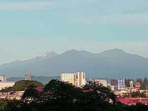 Mounts Apo (background) and Talomo (foreground) as viewed from Davao City | |
| Highest point | |
| Peak | Mount Apo |
| Elevation | 2,964 m (9,724 ft) |
| Geography | |
.svg.png) Apo–Talomo Mountain range Location in the Philippines | |
| Country | |
| Province | Davao del Sur |
| Settlement | Davao City |
Hydrological features
Mount Talomo is a headwaters catchment area of several major river systems of Panigan River and Tamugan River, Talomo River. The Panigan River and Tamugan River are Tributaries of Davao River System. The Talomo River is a stream into the Davao Gulf.
References
- Lewis, Richard E. (April 1988). "Mt Apo and other national parks in the Philippines". Oryx. 22 (2): 100–109. doi:10.1017/s0030605300027575. ISSN 0030-6053.
- "Mount Talomo – A guardian mountain of Mount Apo". NOT JUST YOUR ORDINARY SCIENTIST. October 4, 2016. Retrieved April 12, 2019.
This article is issued from Wikipedia. The text is licensed under Creative Commons - Attribution - Sharealike. Additional terms may apply for the media files.