Apishapa River
Apishapa River is a 139-mile-long (224 km)[2] tributary of the Arkansas River that flows from a source near West Spanish Peak in southern Colorado. It joins the Arkansas east of Fowler, Colorado. A U.S. Geological Survey (USGS) station, #07119500, located along this river near Fowler measures the river's discharge.[3]
| Apishapa River[1] | |
|---|---|
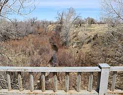 The river at Aguilar, Colorado. | |
| Physical characteristics | |
| Source | |
| ⁃ coordinates | 37°21′12″N 105°01′04″W |
| Mouth | |
⁃ location | Confluence with Arkansas |
⁃ coordinates | 38°07′40″N 103°56′57″W |
⁃ elevation | 4,268 ft (1,301 m) |
| Basin size | 1,080 sq mi (2,800 km2) |
| Basin features | |
| Progression | Arkansas—Mississippi |
The water level and salinity of the Apishapa River is monitored by gaging stations installed at three locations along the headwaters of the river in 2007.[4]
See also
References
- "Apishapa River". Geographic Names Information System. United States Geological Survey. Retrieved 2011-01-30.
- U.S. Geological Survey. National Hydrography Dataset high-resolution flowline data. The National Map Archived 2012-04-05 at WebCite, accessed March 31, 2011
- http://waterdata.usgs.gov/co/nwis/uv/?site_no=07119500
- http://www.apishapawatershed.org
This article is issued from Wikipedia. The text is licensed under Creative Commons - Attribution - Sharealike. Additional terms may apply for the media files.