Andøya
Andøya is the northernmost island in the Vesterålen archipelago, situated about 300 kilometres (190 mi) inside the Arctic circle. Andøya is located in Andøy Municipality in Nordland county, Norway. The main population centres on the island include the villages of Andenes, Bleik, and Risøyhamn.
 | |
 Andøya Location of the island  Andøya Andøya (Norway) | |
| Geography | |
|---|---|
| Location | Nordland, Norway |
| Coordinates | 69.1678°N 15.8845°E |
| Archipelago | Vesterålen |
| Area | 489 km2 (189 sq mi) |
| Area rank | #10 in Norway |
| Length | 57 km (35.4 mi) |
| Width | 15 km (9.3 mi) |
| Highest elevation | 705 m (2,313 ft) |
| Highest point | Kvasstinden |
| Administration | |
Norway | |
| County | Nordland |
| Municipality | Andøy Municipality |
The island has an area of 489 square kilometres (189 sq mi), making it the tenth largest island in Norway. The island is connected to the neighboring island of Hinnøya via the Andøy Bridge. The Andfjorden lies to the east of the island, the Risøysundet strait lies to the south and east side of the island, and the Gavlfjorden lies to the southwest side. The Norwegian Sea lies to the west and north.[1]
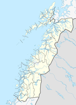
The numerous bog areas on Andøya are used for the extensive production of peat. Andøya is also well known for its cloudberries. Besides the flat and largely continuous bog areas, Andøya also consists of steep mountain ranges reaching up to 700 metres (2,300 ft) high. The sharp peak of Kvasstinden is the highest point on the island at 705 metres (2,313 ft). The Andøya Rocket Range which was founded in 1962 is also located on the island near the Andøya Air Station.[2]
Media gallery
 View of Ånes and Å (closest to the sea)
 Andøy Bridge linking Andøya to Hinnøya island
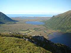 View of the mountains and bogs
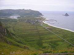 View of Bleik