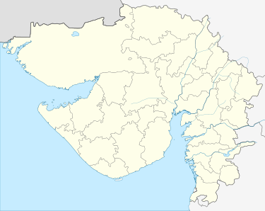
Amrapur, Jamnagar, Gujarat
Amrapur is a town and former petty princely state in Jamnagar, in Kathiawar, Gujarat state, western India.
- See Amrapur for namesakes
Village | |
| Coordinates: 22.371262°N 70.38633°E | |
| Country | |
| State | Gujarat |
| District | Jamnagar |
| Population (2001) | |
| • Total | 250 |
| Languages | |
| • Official | Gujarati, Hindi |
| Time zone | UTC+5:30 (IST) |
| Postal Index Number | 361130 |
| Vehicle registration | GJ |
| Website | gujaratindia |

Village
Most inhabitants are farmers. Some of them are connected with animal husbandry. Mr Vijaybhai Borsadiya is currently sarpanch of the village.
Location
Amrapur is surrounded on three sides by a dam. Amrapur is located at 22.371262°N 70.38633°E On Globe.[17] The road to it is from Kalavad to Ranuja, Dhutarpur, Sumary, Kharavedha, Amrapur.
Statistics
- Population (approx): 250
- Buildings (approx): 25
- Temples: 3
- Shops: 2
- Primary School:1
History
| Princely state |
|---|
| Individual residencies |
|
| Agencies |
|
| Lists |
Amrapur was the seat of an eponymous non-salute princely state in Halar prant, comprising it and another village on Saurashtra peninsula in present Gujarat, western India. It was ruled by Muslim Chieftains of a Shaikh family.
It had a population of 1210 in 1901, yielding a state revenue of 8,000 Rupees (all from land, 1903-4) and paying 511 Rupees to the British.
Photo gallery
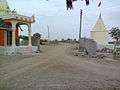 main entrance of Amrapur village
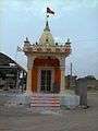 Hanuman temple Amrapur
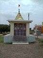 Shiva temple Amrapur
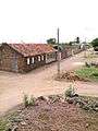 a view of village Amrapur
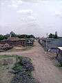 a view of village Amrapur
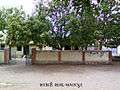 Primary school Amrapur
 Gam no choro Amrapur
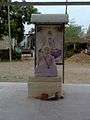 Bapa sitaram oto Amrapur
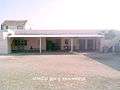 Borsadiya family's makan in Amrapur
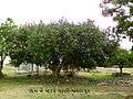 a banyan tree in village.
| Wikimedia Commons has media related to Amrapur, Jamnagar, Gujarat. |
External links and Sources
References
- http://jamnagardp.gujarat.gov.in/jamnagar/index.htm
- http://jamnagardp.gujarat.gov.in/jamnagar/maru-gam4.htm
- http://jamnagardp.gujarat.gov.in/jamnagar/index.htm
- http://jamnagardp.gujarat.gov.in/jamnagar/maru-gam4.htm
- http://jamnagardp.gujarat.gov.in/jamnagar/index.htm
- http://jamnagardp.gujarat.gov.in/jamnagar/maru-gam4.htm
- http://jamnagardp.gujarat.gov.in/jamnagar/index.htm
- http://jamnagardp.gujarat.gov.in/jamnagar/maru-gam4.htm
- http://jamnagardp.gujarat.gov.in/jamnagar/index.htm
- http://jamnagardp.gujarat.gov.in/jamnagar/maru-gam4.htm
- http://jamnagardp.gujarat.gov.in/jamnagar/index.htm
- http://jamnagardp.gujarat.gov.in/jamnagar/maru-gam4.htm
- http://jamnagardp.gujarat.gov.in/jamnagar/index.htm
- http://jamnagardp.gujarat.gov.in/jamnagar/maru-gam4.htm
- http://jamnagardp.gujarat.gov.in/jamnagar/index.htm
- http://jamnagardp.gujarat.gov.in/jamnagar/maru-gam4.htm
- https://maps.google.com/maps?ll=22.371262,70.38633&q=loc:22.371262,70.38633&hl=en&t=m&z=11