Aluma
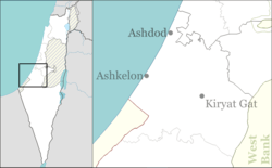
Aluma (Hebrew: אֲלֻמָּה or אלומה, lit. Sheaf) is an Haredi community settlement in southern Israel. Located in the southern coastal plain around three kilometers north-west of Kiryat Gat, it falls under the jurisdiction of Shafir Regional Council. In 2018 it had a population of 514.[1]
Aluma אֲלֻמָּה | |
|---|---|
| Hebrew transcription(s) | |
| • official | Alumma |
 Aluma | |
| Coordinates: 31°39′4.67″N 34°44′37.31″E | |
| Country | Israel |
| Council | Shafir |
| Founded | 1965 |
| Founded by | Agudat Yisrael members |
| Population (2018)[1] | 514 |
History
The village was established in 1965 as a youth village named Hazon Yehezkel by a group called Mosadot Hinukh Ezuri (lit. Institute for Regional Education), made up of young members of Agudat Yisrael. It was built on lands which had formerly belonged to the depopulated Palestinian village of Hatta.[2] In 1996 the Ministry of Interior gave the village municipal council status and changed its name to Aluma.
References
- "Population in the Localities 2018" (XLS). Israel Central Bureau of Statistics. 25 August 2019. Retrieved 26 August 2019.
- Khalidi, Walid (1992). All That Remains: The Palestinian Villages Occupied and Depopulated by Israel in 1948. Washington D.C.: Institute for Palestine Studies. p. 101. ISBN 0-88728-224-5. ISBN 0-88728-224-5.
This article is issued from Wikipedia. The text is licensed under Creative Commons - Attribution - Sharealike. Additional terms may apply for the media files.