Alton, Indiana
Alton is a town in Boone Township, Crawford County, Indiana, United States. The population was 55 at the 2010 census.
Alton, Indiana | |
|---|---|
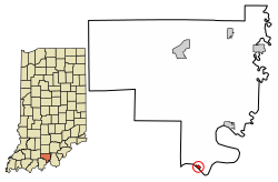 Location of Alton in Crawford County, Indiana. | |
| Coordinates: 38°7′22″N 86°25′12″W | |
| Country | United States |
| State | Indiana |
| County | Crawford |
| Township | Boone |
| Area | |
| • Total | 0.19 sq mi (0.49 km2) |
| • Land | 0.17 sq mi (0.45 km2) |
| • Water | 0.02 sq mi (0.05 km2) |
| Elevation | 427 ft (130 m) |
| Population | |
| • Total | 55 |
| • Estimate (2018)[4] | 54 |
| • Density | 319.77/sq mi (123.48/km2) |
| Time zone | UTC-5 (EST) |
| • Summer (DST) | UTC-4 (EDT) |
| ZIP code | 47137 |
| Area code | 812 |
| FIPS code[2][5] | 18-01270 |
| GNIS ID[2][5] | 450627 |
History
Alton was founded in 1838.[6]
Alton was called Nebraska in its early years.[7] The Nebraska post office opened in 1847, and was renamed Alton in 1860.[8] The post office in Alton was finally discontinued in 1965.[9]
Geography
Alton is located at 38°7′22″N 86°25′12″W (38.122715, -86.419920).[10]
According to the 2010 census, Alton has a total area of 0.19 square miles (0.49 km2), of which 0.17 square miles (0.44 km2) (or 89.47%) is land and 0.02 square miles (0.05 km2) (or 10.53%) is water.[11]
Demographics
| Historical population | |||
|---|---|---|---|
| Census | Pop. | %± | |
| 1870 | 137 | — | |
| 1880 | 259 | 89.1% | |
| 1890 | 277 | 6.9% | |
| 1900 | 238 | −14.1% | |
| 1910 | 161 | −32.4% | |
| 1920 | 128 | −20.5% | |
| 1930 | 109 | −14.8% | |
| 1940 | 78 | −28.4% | |
| 1950 | 71 | −9.0% | |
| 1960 | 57 | −19.7% | |
| 1970 | 56 | −1.8% | |
| 1980 | 64 | 14.3% | |
| 1990 | 57 | −10.9% | |
| 2000 | 53 | −7.0% | |
| 2010 | 55 | 3.8% | |
| Est. 2018 | 54 | [4] | −1.8% |
| US Decennial Census[12] | |||
2010 census
As of the 2010 census,[3] there were 55 people, 25 households, and 19 families residing in the town. The population density was 323.5 inhabitants per square mile (124.9/km2). There were 55 housing units at an average density of 323.5 per square mile (124.9/km2). The racial makeup of the town was 96.4% White and 3.6% from other races. Hispanic or Latino of any race were 3.6% of the population.
There were 25 households of which 24.0% had children under the age of 18 living with them, 52.0% were married couples living together, 12.0% had a female householder with no husband present, 12.0% had a male householder with no wife present, and 24.0% were non-families. 20.0% of all households were made up of individuals and 4% had someone living alone who was 65 years of age or older. The average household size was 2.20 and the average family size was 2.37.
The median age in the town was 53.2 years. 10.9% of residents were under the age of 18; 11% were between the ages of 18 and 24; 14.6% were from 25 to 44; 40% were from 45 to 64; and 23.6% were 65 years of age or older. The gender makeup of the town was 56.4% male and 43.6% female.
2000 census
As of the 2000 census,[13] there were 53 people, 24 households, and 16 families residing in the town. The population density was 312.3 people per square mile (120.4/km²). There were 65 housing units at an average density of 383.0 per square mile (147.6/km²). The racial makeup of the town was 100.00% White.
There were 24 households out of which 29.2% had children under the age of 18 living with them, 54.2% were married couples living together, 12.5% had a female householder with no husband present, and 33.3% were non-families. 29.2% of all households were made up of individuals and 12.5% had someone living alone who was 65 years of age or older. The average household size was 2.21 and the average family size was 2.75.
The population age spread was 22.6% under the age of 18, 9.4% from 18 to 24, 28.3% from 25 to 44, 26.4% from 45 to 64, and 13.2% who were 65 years of age or older. The median age was 38 years. For every 100 females, there were 96.3 males. For every 100 females age 18 and over, there were 86.4 males.
The median income for a household in the town was $19,375, and the median income for a family was $29,375. Males had a median income of $41,250 versus $11,250 for females. The per capita income for the town was $11,167. There were 7.7% of families and 9.3% of the population living below the poverty line, including 21.4% of under eighteens and none of those over 64.
See also
- List of cities and towns along the Ohio River
References
- "2016 U.S. Gazetteer Files". US Census Bureau. Retrieved July 28, 2017.
- "Feature ID 450627". Geographic Names Information System. US Geological Survey. Retrieved June 30, 2014.
- "U.S. Census website". US Census Bureau. Retrieved December 11, 2012.
- "Population and Housing Unit Estimates". Retrieved March 23, 2020.
- "FIPS55 Data: Indiana". FIPS55 Data. US Geological Survey. February 23, 2006. Archived from the original on June 18, 2006. Retrieved June 30, 2014.
- Biographical and Historical Souvenir for the Counties of Clark, Crawford, Harrison, Floyd, Jefferson, Jennings, Scott, and Washington, Indiana. Chicago Printing Company. 1889. p. 60.
- Cottman, George Streiby; Coleman, Christopher Bush; Esarey, Logan (1921). Indiana Magazine of History. p. 241.
- Baker, Ronald L. (October 1995). From Needmore to Prosperity: Hoosier Place Names in Folklore and History. Indiana University Press. p. 49. ISBN 978-0-253-32866-3.
A post office established as Nebraska on March 8, 1847, was changed to Alton on July 2, 1860...
- "Crawford County". Jim Forte Postal History. Retrieved August 30, 2014.
- "US Gazetteer files: 2010, 2000, and 1990". US Census Bureau. February 12, 2011. Retrieved April 23, 2011.
- "G001 - Geographic Identifiers - 2010 Census Summary File 1". US Census Bureau. Archived from the original on February 13, 2020. Retrieved July 13, 2015.
- "Census of Population and Housing". Census.gov. Retrieved June 4, 2015.
- "U.S. Census website". US Census Bureau. Retrieved January 31, 2008.
Municipalities and communities of Crawford County, Indiana, United States | ||
|---|---|---|
| Towns | Map of Indiana highlighting Crawford County | |
| Townships | ||
| Unincorporated communities | ||
| Footnotes | ‡This populated place also has portions in an adjacent county or counties | |